
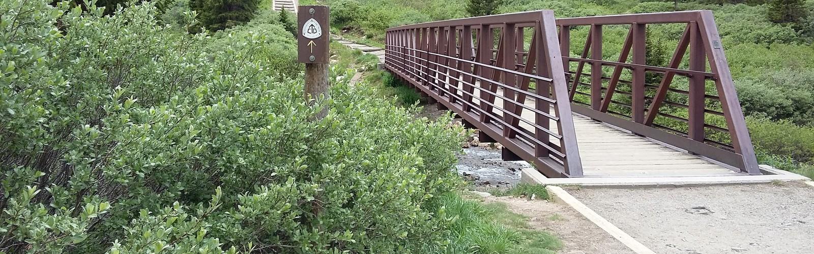

Ready to explore Grays Peak Trail? Here's everything you need to know before you go!
Discover the trail
Oh no! We don't have any photos 😢
This trail hasn't been captured yet. Be the first to share your adventure!Trail description
Grays Peak Trail is one of Colorado's most iconic high-alpine routes, drawing hikers who want to stand on top of a true fourteener with a summit that sits right on the Continental Divide. The trail is straightforward by fourteener standards, which makes it a popular first high-altitude summit for people stepping into serious mountain hiking — but don't let that fool you. The elevation, the exposure, and the terrain demand real preparation and solid decision-making, especially when afternoon weather rolls in fast.
The Terrain
The trail follows a well-worn path up a broad valley before climbing steadily toward the ridge. Early on, you're moving through open tundra and past a creek drainage, with the massive bulk of Grays Peak visible ahead the entire time. The route gains elevation consistently — there's no flat section where you get to catch your breath for long. As you push higher, the trail becomes rockier and the vegetation thins out completely, leaving you on loose talus and scree as you approach the upper ridge.
The final push to the summit is steep and exposed. The trail switchbacks up the south face, and the footing requires attention — loose rock and uneven surfaces mean you need to watch your step, especially on the descent when tired legs make mistakes more likely. The summit itself is a broad, rocky plateau with views in every direction that are genuinely hard to describe without sounding like you're overselling it.
What Makes This Trail Stand Out
Grays Peak sits directly on the Continental Divide, which means you're standing on the spine of North America at the top. On a clear day, the panoramic views stretch across an enormous swath of the Rockies. What also sets this trail apart is the option to tag Torreys Peak on the same outing — the two summits are connected by a ridge, and many hikers do both in a single push. The connecting ridge between Grays and Torreys is one of the more accessible fourteener combos in the state, and it's a natural extension if you've got the legs and the time.
Wildlife is a real part of the experience here. Mountain goats are commonly spotted on and around the upper slopes, and pikas and marmots are almost guaranteed sightings in the talus fields. The open tundra environment means you're often hiking with wide sightlines, so you'll spot animals well before you're close to them.
Altitude and Acclimatization
This is where Grays Peak Trail separates itself from most hikes in the Colorado Springs region and across the Front Range. The trailhead itself sits at high elevation, and the summit pushes well above 14,000 feet. If you're coming from lower elevations — especially from sea level — acclimatization is not optional, it's essential. Spending at least one or two nights at altitude before attempting the summit makes a significant difference in how your body handles the thin air.
Symptoms of altitude sickness — headache, nausea, dizziness, fatigue — can hit anyone regardless of fitness level. If you feel them coming on during the climb, the right call is always to descend. There's no shame in turning around, and the mountain will be there next time.
Weather and Timing
Alpine weather on a fourteener is serious business. Afternoon thunderstorms are a consistent pattern during summer months, and lightning above treeline is genuinely dangerous. The standard advice — and it's worth following — is to be on the summit and heading back down before noon. That means an early start, often before sunrise, especially during peak season when the trailhead parking fills up fast.
Starting in the dark with a headlamp is completely normal here and actually gives you some of the best moments of the hike — watching the sunrise from the upper slopes with the valley still in shadow below is something that sticks with you.
Practical Information
- Trailhead access: The trailhead is reached via a dirt road that can be rough depending on conditions. A high-clearance vehicle is helpful, though passenger cars with good clearance have made it. Check road conditions before heading out.
- Parking: The trailhead parking area fills early on weekends and during peak summer season. Arriving before dawn is the most reliable way to secure a spot.
- Dogs: Dogs are permitted on the trail. Keep them under control, especially around wildlife and other hikers on narrow sections.
- Leave No Trace: The fragile alpine tundra ecosystem is easily damaged. Stay on the established trail, especially in the lower sections where vegetation is present. Don't cut switchbacks.
- Gear: Layers are non-negotiable. Even on warm summer mornings, the upper mountain can be cold and windy. Rain gear, sun protection, plenty of water, and snacks are standard kit for this kind of outing.
- Cell service: Expect limited to no cell service in the valley and at the trailhead. Download offline maps before you go.
Who This Trail Is For
Grays Peak Trail is often described as one of the more approachable fourteeners in Colorado, and that's accurate in terms of technical difficulty — there's no scrambling or route-finding required on the standard route. But "approachable" doesn't mean easy. The sustained elevation gain, the altitude, and the exposure to weather make this a trail that rewards hikers who come prepared and take the conditions seriously.
If you've done solid hiking at lower elevations and you're ready to step up to high-alpine terrain, this is a legitimate and rewarding place to do it. If you're already comfortable on fourteeners and want to knock out two summits in one day, the Grays-Torreys combination is one of the best options in the state for exactly that.
Either way, give yourself a full day, start early, and pay attention to the sky — that's the formula that makes a Grays Peak outing one you'll want to repeat.
The Essential Hiking Checklist
Everything you need for your next hike. Bilingual, printable, 1 page.
Get your free hiking checklistRecommended gear for this trail
As an Amazon Associate I earn from qualifying purchases.


Ready to go?
Everything you need to know before you goWhen?
How much?
As an Amazon Associate I earn from qualifying purchases.
Affiliate links — LGPO may earn a commission at no extra cost to you.
- Hiking shoes Essential
- → Salomon Elixir Tour Mid WP · 203.38 $
- Layered clothing Essential
- Rain jacket Essential
- Trekking poles
- → Black Diamond Trail Ergo Cork · 69.99 $
- Headlamp
- → Petzl Actik Core 625 · 103.95 $
FAQ - Frequently asked questions
Everything you need to knowSimilar hikes nearby
Discover other trails you might enjoy

Saint Vrain Mountain, Colorado
Denver and Cities of the Rockies
Grays Peak, Colorado
Denver and Cities of the Rockies

Fern Lake Trail
Denver and Cities of the Rockies
Cache La Poudre River
Denver and Cities of the Rockies
Guanella Pass Scenic Byway
Denver and Cities of the Rockies
Mount Evans Scenic Byway
Denver and Cities of the Rockies
Hiking near Regina
4 trails to explore ~1202 km away
We work hard to provide the most up-to-date and error-free data possible. If something seems incorrect, let us know! Your contribution helps the whole community.
Hikers' opinions
Be the first to review!
No hiker has shared their experience yet. Share your impressions and help other hikers!