
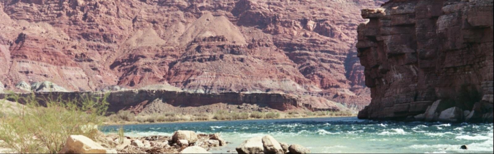
Ready to explore Colorado River (Lees Ferry)? Here's everything you need to know before you go!
Discover the trail
2
community photos
Trail description
The Colorado River (Spanish: Río Colorado) is one of the principal rivers of the Southwestern United States and northern Mexico (the other being the Rio Grande). The 1,450-mile (2,330 km) Colorado River drains an expansive, arid watershed that encompasses parts of seven U.S. and two Mexican states. Starting in the central Rocky Mountains in the U.S., the river flows generally southwest across the Colorado Plateau and through the Grand Canyon before reaching Lake Mead on the Arizona–Nevada border, where it turns south toward the international border. After entering Mexico, the Colorado approaches the mostly dry Colorado River Delta at the tip of the Gulf of California between Baja California and Sonora.
Home to 11 U.S. National Parks, which include dramatic canyons and whitewater rapids, the Colorado River system is also a vital source of water for agriculture and urban areas in much of the southwestern desert lands of North America. The river and its tributaries are controlled by an extensive system of dams, reservoirs, and aqueducts, which in most years divert its entire flow to furnish irrigation and municipal water supply for almost 40 million people both inside and outside the watershed. The Colorado's large flow and steep gradient are used for generating hydroelectric power, and its major dams regulate peaking power demands in much of the Intermountain West. This intensive consumption has dried up the lower 100 miles (160 km) of the river, such that it has reached the sea only a few times since the 1960s.
Beginning with small bands of nomadic hunter-gatherers, Native Americans have inhabited the Colorado River basin for at least 8,000 years. Between 2,000 and 1,000 years ago, the river and its tributaries fostered large agricultural civilizations, which may have been some of the most sophisticated indigenous cultures in North America. These societies are believed to have collapsed because of a combination of severe drought and poor land use practices. Most native peoples that inhabit the basin today are descended from other groups that settled in the region beginning about 1,000 years ago. Europeans first entered the Colorado Basin in the 16th century, when explorers from Spain began mapping and claiming the area, which later became part of Mexico upon its independence in 1821. Early contact between foreigners and natives was generally limited to the fur trade in the headwaters and sporadic trade interactions along the lower river.
After the greater Colorado River basin became part of the U.S. in 1846, the bulk of the river's course was still largely the subject of myths and speculation. Several expeditions charted the Colorado in the mid-19th century, one of which, led by John Wesley Powell in 1869, was the first to run the rapids of the Grand Canyon. American explorers collected valuable information that would later be used to develop the river for navigation and water supply. Large-scale settlement of the lower basin began in the mid- to late-19th century, with steamboats providing transportation from the Gulf of California to landings along the Colorado River that linked to wagon roads into the interior of New Mexico Territory. Lesser numbers settled in the upper basin, which was the scene of major gold strikes in the 1860s and 1870s.
Major engineering of the river basin began around the start of the 20th century, with many guidelines established in a series of domestic and international treaties known as the "Law of the River". The U.S. federal government was the main driving force behind the construction of hydraulic engineering projects in the river system, although many state and local water agencies were also involved. Most of the major dams in the river basin were built between 1910 and 1970, and the system keystone, Hoover Dam, was completed in 1935. The Colorado is now considered among the most controlled and litigated rivers in the world, with every drop of its water fully allocated.
The damming and diversion of the Colorado River system have been opposed by the environmental movement in the American Southwest because of the detrimental effect on the ecology and natural beauty of the river and its tributaries. During the construction of Glen Canyon Dam, environmental organizations vowed to block any further development of the river, and a number of later dam and aqueduct proposals were defeated by citizen opposition. As demands for Colorado River water continue to rise, the level of human development and control of the river continues to generate controversy.
Free
1 page
The Essential Hiking Checklist
Everything you need for your next hike. Bilingual, printable, 1 page.
Get your free hiking checklistRecommended gear for this trail
As an Amazon Associate I earn from qualifying purchases.
LGPO Pick

Salomon
Elixir Tour Mid WP
Waterproof mid-height boot ideal for rocky terrain
203.38 $


Affiliate links — LGPO may earn a commission at no extra cost to you.
Ready to go?
Everything you need to know before you goWhen?
Opening hours
No information
Weather (next days)
Loading
What to bring?
As an Amazon Associate I earn from qualifying purchases.
Affiliate links — LGPO may earn a commission at no extra cost to you.
General hiking tips, to adapt to your outing.
Gear
- Hiking shoes Essential
- → Salomon Elixir Tour Mid WP · 203.38 $
- Layered clothing Essential
- Rain jacket Essential
- Trekking poles
- → Black Diamond Trail Ergo Cork · 69.99 $
- Headlamp
- → Petzl Actik Core 625 · 103.95 $
Water & food
Tip: bring water
Plan for at least 2 L per person on an outing of 2 hours or more.
Good to know
In an emergency
Emergency
911
GPS coordinates
36.8591, 36.8591
FAQ - Frequently asked questions
Everything you need to knowColorado River (Lees Ferry) is rated moderate.
The elevation gain of Colorado River (Lees Ferry) is 600 m.
The summit of Colorado River (Lees Ferry) is at 2,300 m.
Allow about 2h30 for Colorado River (Lees Ferry) (7.1 km).
Didn't find your answer?
Outings near Colorado River (Lees Ferry)
Discover other trails you might enjoy

Red River of Logan County Prices Mill to Tennessee State Line
22.8 km away
47.6 KM
Advanced
Gateway to the Narrows Trail
55.6 km away
9.8 KM
3h30
427 m
Intermediate
Don Edwards San Francisco Bay National Wildlife Refuge Newark Slough Trail
98.7 km away
8 KM
2.5 hours
War Eagle Trail
The Ozarks · 100.4 km away
1.6 KM
30 min
59 m
Beginner
Center Hill Lake & Cedars of Lebanon Cookeville to Long Hunter State Park
128.4 km away
11.1 KM
3h15
304 m
Intermediate
Top 10 best hiking in United States
Our ranking based on hiker reviews
Hiking near Sydney
25 trails to explore ~7650 km away
Did you spot an error?
We work hard to provide the most up-to-date and error-free data possible. If something seems incorrect, let us know! Your contribution helps the whole community.
Hikers' opinions
Be the first to review!
No hiker has shared their experience yet. Share your impressions and help other hikers!