
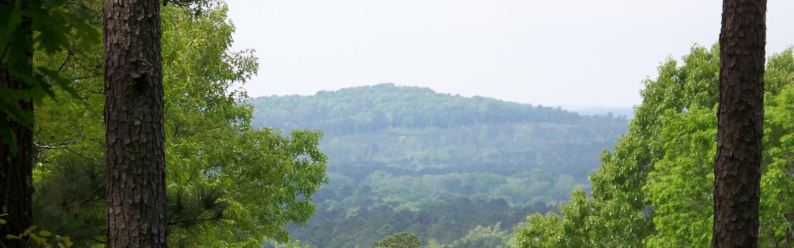

Ready to explore Driskill Mountain, Louisiana? Here's everything you need to know before you go!
Discover the trail
Oh no! We don't have any photos 😢
This trail hasn't been captured yet. Be the first to share your adventure!Trail description
Driskill Mountain sits at the top of Louisiana's topographic map — literally. As the highest natural point in the state, it holds a special place for peak baggers and curious hikers alike. Don't expect dramatic cliffs or sweeping alpine views, though. This is Louisiana, and Driskill plays by Louisiana's rules: gentle forested slopes, quiet woodland trails, and a summit that sneaks up on you through the pines. That understated character is exactly what makes it worth the trip.
The Highest Point in Louisiana
Driskill Mountain is the highest point in Louisiana, making it a must-visit for anyone working through the state highpoints list. It's located in Bienville Parish in the northern part of the state, tucked into a landscape of rolling hills and mixed pine-hardwood forest that feels a world away from the bayous and flat coastal plains most people associate with Louisiana.
The summit itself is marked and accessible, and the hike to reach it is genuinely pleasant — not just a checkbox. The trail winds through a quiet forest with a canopy of loblolly pine, shortleaf pine, and hardwoods. It's the kind of walk where you actually slow down and notice things: the texture of the bark, the way light filters through the canopy, the occasional rustle in the underbrush.
What the Trail Is Like
The trail to Driskill Mountain is well-maintained and clearly marked. The terrain is hilly by Louisiana standards, with enough elevation change to give your legs something to do without ever feeling strenuous. The path is mostly dirt and packed earth, with some rooty sections that keep you paying attention underfoot.
The forest here is dense and shady, which makes this a surprisingly comfortable hike even on warmer days. You're walking through a mature woodland the whole way, so there's consistent tree cover overhead. The trail has a natural, unhurried feel — it's not a manicured park path, but it's not rough bushwhacking either. It sits comfortably in between.
The summit area is marked with a benchmark and signage. It's a wooded high point rather than an open peak, so the "view" is more about the feeling of being at the top of Louisiana than any panoramic vista. For highpoint enthusiasts, that's part of the charm.
Flora and Wildlife
The forest around Driskill Mountain is a mix of pine and hardwood species typical of the upland areas of northern Louisiana. Loblolly and shortleaf pines dominate in places, while oaks, hickories, and other hardwoods fill in the understory and create a layered canopy. In spring, the forest floor comes alive with wildflowers and ferns.
Wildlife is present but tends to stay out of sight. White-tailed deer, wild turkey, and various songbirds are common in this part of Bienville Parish. Woodpeckers are particularly active in the older trees. If you move quietly and take your time, you're likely to spot more than you'd expect.
Access and Parking
Driskill Mountain is located on private land that has historically been accessible to hikers through the goodwill of the landowners. Access arrangements can change, so it's worth checking current conditions before you make the drive. The trailhead is reached via rural roads in Bienville Parish, and the area is remote enough that you'll want to confirm your route before heading out.
Parking is limited and informal near the trailhead. There are no developed facilities — no restrooms, no visitor center, no fee station. This is a no-frills, back-to-basics hiking experience. Come prepared with everything you need, including water, snacks, and a fully charged phone with your route saved offline.
Who This Hike Is For
Driskill Mountain works well for a wide range of hikers. The terrain is accessible enough for families with older kids and anyone looking for a relaxed day in the woods. At the same time, it has genuine appeal for experienced hikers who are working through the state highpoints — Louisiana's entry on that list is one of the more approachable ones, but it's no less satisfying to stand at the top.
It's also a great option for hikers who want to experience a side of Louisiana that doesn't get much attention. The northern hill country is genuinely different from the rest of the state, and Driskill sits right in the heart of it.
Tips Before You Go
- Confirm access: The trail crosses private land, so verify that access is still permitted before your visit. Local hiking groups and the Louisiana chapter of the Sierra Club can be good sources for current information.
- No facilities on site: Bring everything you need — water, snacks, a first aid kit, and sun protection for the drive and any open sections.
- Wear appropriate footwear: The trail has rooty and uneven sections. Sturdy trail shoes or light hiking boots are a better choice than casual sneakers.
- Download your maps offline: Cell service in rural Bienville Parish can be unreliable. Have your navigation sorted before you lose signal.
- Tick awareness: Like most wooded areas in Louisiana, ticks are present. Do a thorough check after your hike and tuck your pants into your socks on the trail.
- Best seasons: Fall and winter offer the most comfortable temperatures for hiking in this part of Louisiana. Spring can be beautiful but comes with more insects and the possibility of muddy trails after rain.
Why It Stands Out
Louisiana doesn't have mountains in the traditional sense, and Driskill Mountain is honest about that. What it offers instead is a quiet, forested highpoint experience that rewards the hikers who seek it out. The drive through the rural backroads of Bienville Parish, the shaded woodland trail, and the satisfaction of standing at the highest point in the state — it all adds up to something genuinely memorable, even if it doesn't look dramatic in photos.
For anyone building out their Louisiana hiking list or chasing state highpoints across the country, Driskill Mountain is a destination that delivers exactly what it promises: a peaceful walk through the Louisiana hill country to the top of the state.
The Essential Hiking Checklist
Everything you need for your next hike. Bilingual, printable, 1 page.
Get your free hiking checklistRecommended gear for this trail
As an Amazon Associate I earn from qualifying purchases.


Ready to go?
Everything you need to know before you goWhen?
How much?
As an Amazon Associate I earn from qualifying purchases.
Affiliate links — LGPO may earn a commission at no extra cost to you.
- Hiking shoes Essential
- → Salomon Elixir Tour Mid WP · 203.38 $
- Layered clothing Essential
- Rain jacket Essential
- Trekking poles
- → Black Diamond Trail Ergo Cork · 69.99 $
- Headlamp
- → Petzl Actik Core 625 · 103.95 $
FAQ - Frequently asked questions
Everything you need to knowHiking near Pittsburgh
0 trails to explore ~1457 km away
We work hard to provide the most up-to-date and error-free data possible. If something seems incorrect, let us know! Your contribution helps the whole community.
Hikers' opinions
Be the first to review!
No hiker has shared their experience yet. Share your impressions and help other hikers!