

Ready to explore Mount Kineo, Maine? Here's everything you need to know before you go!
Discover the trail

Trail description
Description
Mount Kineo rises sharply from the waters of Moosehead Lake in northern Maine, forming one of the most distinctive geological landmarks in the entire region. The mountain sits on a 1,150-acre peninsula that juts out from the eastern shore into Maine's largest lake, with rhyolite cliffs dropping roughly 700 feet straight to the water below. The surrounding landscape is pure northern Maine wilderness — thousands of acres of unbroken forest stretching toward the Canadian border in every direction.
The trail system covers 6.9 kilometers with 545 meters of elevation gain, rated moderate and typically completed in around 2 hours and 45 minutes. That combination of distance and vertical makes for a genuinely satisfying day hike — enough of a workout to feel earned, without being a sufferfest. What sets this mountain apart from other Maine peaks isn't just the views, though those are exceptional. It's the layering of geological rarity, deep Indigenous history, and the logistical quirk of getting here in the first place.
Getting There: The Boat Factor
Mount Kineo's peninsula location means you can't simply drive to the trailhead. Most hikers access the mountain by boat from the Rockwood area on Moosehead Lake's western shore. A seasonal ferry service operates from Rockwood, making the crossing straightforward for those without their own watercraft. If you're bringing a kayak or canoe, the crossing is manageable in calm conditions, but Moosehead Lake is a large body of water and can kick up quickly — check conditions before paddling across.
This water crossing is part of what keeps Mount Kineo feeling genuinely remote. It filters out casual visitors and adds a small adventure before you even set foot on the trail. Plan your timing around ferry schedules if you're relying on that service, and factor in some buffer in case weather delays your return crossing.
The Geology Underfoot
Mount Kineo contains one of the largest rhyolite formations in the world. This volcanic rock gives the cliffs their sharp, dramatic profile and creates terrain unlike anything else in Maine. Rhyolite fractures with clean, conchoidal breaks — similar to flint — which made it extraordinarily valuable to Indigenous peoples across a vast region. As you climb, you'll notice the rock's fine-grained texture and the way it catches light differently from the granite and schist common elsewhere in New England.
The mountain's geology isn't purely volcanic. Slate and sandstone layers appear throughout the lower sections, reflecting a more complex history of sedimentary and metamorphic processes. This variety translates directly into varied hiking terrain: softer, rooted paths through the forested lower sections give way to more technical scrambling across exposed rhyolite faces as you approach the summit. Nothing here requires ropes or technical gear, but you'll want to pay attention to your footing, especially on wet rock. Rhyolite can be slippery when damp, and the cliff edges are real.
The Trail Experience
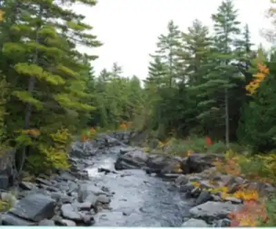
The hike begins in classic northern Maine mixed forest — white pine, maple, birch — with a canopy that keeps things cool and shaded in the lower sections. The trail is well-marked throughout, though the character of the terrain shifts noticeably as you gain elevation. The forest thins and the trees become more wind-stunted as you approach the exposed upper sections. The final push to the summit involves some hands-on scrambling across rhyolite faces, which most hikers find more fun than intimidating.
Weather on the exposed cliff sections can change fast, even when the forest below feels calm. The lake creates its own microclimate, and fog or wind can roll in with little warning. Bring an extra layer regardless of how warm it feels at the trailhead. The temperature difference between the sheltered forest and the open summit is often significant.
Views from the Top
The summit and cliff-top viewpoints deliver some of the most expansive lake views in Maine. Moosehead Lake covers roughly 75,000 acres, and from the top of Kineo you can see across a huge portion of it — water, islands, and forested shoreline in every direction. On clear days, the distant peaks of the Longfellow Mountains are visible to the west. There's no development cluttering the view. What you're looking at is genuine northern Maine wilderness, and it reads that way.
Indigenous History
The rhyolite at Mount Kineo wasn't just geologically interesting — it was one of the most important toolstone sources in pre-Columbian northeastern North America. Indigenous peoples traveled significant distances to quarry here, and artifacts made from Kineo rhyolite have been found throughout New England and well beyond, pointing to extensive trade networks centered on this mountain. The well-worn paths that generations of people made to reach this quarry site predate any modern trail by centuries. Walking here carries that weight, and it's worth sitting with that history rather than just passing through it.
Wildlife
The peninsula and surrounding lake environment support a solid cross-section of northern Maine wildlife. Moose are a genuine presence here, particularly near the water's edge and in any marshy areas on the peninsula. White-tailed deer are common along the trail, especially in early morning and evening. Black bears inhabit the area — standard food storage practices apply. On the lake, common loons are a near-constant presence, and the cliff faces attract raptors. Boreal forest bird species are well represented throughout the wooded sections of the trail.
Seasons and Timing
The practical hiking window runs from late spring through early fall, with the exact start of the season depending on ice-out conditions on Moosehead Lake, which affect boat access. Summer is the most reliable time for access and weather. Fall brings exceptional foliage given the elevation and the lake backdrop, but weather can deteriorate quickly and you'll want to keep a close eye on forecasts, particularly if you're relying on a water crossing to get back.
Recommended gear for this trail


Ready to go?
Everything you need to know before you goStarting Point
To access the hiking trails, you can start from the parking area at Rockwood Public Landing. From there, take a ferry or water taxi across Moosehead Lake to reach the trailheads on the peninsula. The address for Rockwood Public Landing is 352 Moosehead Lake Road, Rockwood, ME 04478.
When?
How much?
- Hiking shoes Essential
- → Salomon Elixir Tour Mid WP · 203.38 $
- Layered clothing Essential
- Rain jacket Essential
- Trekking poles
- → Black Diamond Trail Ergo Cork · 69.99 $
- Headlamp
- → Petzl Actik Core 625 · 103.95 $
FAQ - Frequently asked questions
Everything you need to knowThe Essential Hiking Checklist
Everything you need for your next hike. Bilingual, printable, 1 page.
Download the free checklistSimilar hikes nearby
Discover other trails you might enjoy

Chimney Peak, Maine
Maine Highlands

Katahdin
Maine Highlands
Little Spencer Mountain
Maine Highlands
barnard mountain
Maine Highlands
Pleasant Pond Mountain
Maine Highlands
Katahdin Lake
Maine Highlands
Hiking near Bangor
0 trails to explore ~125 km away
We work hard to provide the most up-to-date and error-free data possible. If something seems incorrect, let us know! Your contribution helps the whole community.
Hikers' opinions