

Ready to explore Snow Mountain, Maine? Here's everything you need to know before you go!
Discover the trail
Trail description
Description
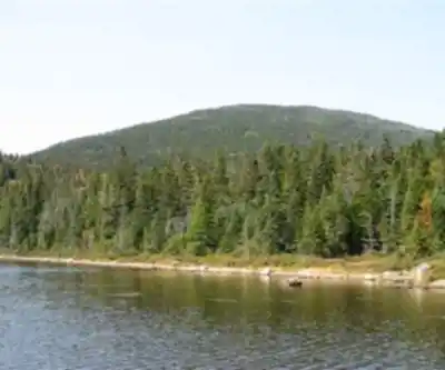
Snow Mountain is a remote and rewarding summit hike in the Chain of Ponds region of Western Maine. Located just 5 miles (8 km) from the Canada-US border in Franklin County, this 1207-meter (3960-foot) peak is a significant undertaking that rewards effort with excellent views extending into Quebec and across the surrounding wilderness.
The Trail
At 11.3 kilometers with 701 meters of elevation gain, Snow Mountain is a genuine full-day expedition. The route is primarily via ATV paths and an abandoned fire tower trail, which are generally well-defined thanks to active ATV use in the region, but the paths can be confusing in places. Expect a steady, sustained climb rather than dramatic elevation spikes, which helps distribute the effort across the hike.
The estimated 5-hour time accounts for a moderate pace with occasional stops. Faster hikers may complete it sooner; slower parties or those with photography breaks should add buffer time. This is solidly in the Difficult category due to distance, elevation gain, and remote location.
What to Expect on the Way Up
The terrain is classic remote Maine north woods—mixed forest, rocky footing, and increasing exposure as you gain elevation. The trail transitions through forested slopes before opening at higher elevations where views begin to emerge. The summit features a historic fire tower (abandoned) that provides remarkable panoramic views of the surrounding area, including views into Canada to the north.
Footing is uneven throughout, with rocky sections requiring careful foot placement. Sturdy hiking boots with excellent grip are essential. Trekking poles are highly recommended for both ascent and especially for descent on the rougher sections.
Critical Planning Considerations
- Distance: 11.3 km (7 miles)
- Elevation gain: 701 m (2300 feet)
- Summit elevation: 1207 m (3960 feet)
- Difficulty: Difficult
- Estimated time: 5 hours
- Location: Chain of Ponds area, Franklin County, Maine, near Maine/Quebec border
- Cell service: Poor—download offline maps before departing
- Terrain: ATV paths and abandoned tower trail; paths are defined but can be confusing
This is a remote hike in rugged terrain. Bring substantial water (2-3 liters), high-calorie snacks, and a full lunch. Start early to ensure adequate daylight for the full 5+ hour commitment. Downloading offline maps is strongly recommended due to poor cell coverage. Inform someone of your hiking plans and expected return time.
Who This Hike Is For
Snow Mountain is for experienced hikers comfortable with full-day commitments, uneven terrain, and remote wilderness. This is not an easy or beginner-friendly hike. It suits hikers seeking genuine remote summit experiences, those pursuing Maine's 4000-footer alternatives (Snow Mountain at 3960 feet falls just shy), peakbaggers, and experienced backpackers comfortable with navigation challenges. The fire tower views and border location add unique character.
Recommended gear for this trail


Ready to go?
Everything you need to know before you goStarting Point
The trails at the snow mountain, maine in Maine can be accessed from the parking lot on the east side of the mountain.
When?
How much?
- Hiking shoes Essential
- → Salomon Elixir Tour Mid WP · 203.38 $
- Layered clothing Essential
- Rain jacket Essential
- Trekking poles
- → Black Diamond Trail Ergo Cork · 69.99 $
- Headlamp
- → Petzl Actik Core 625 · 103.95 $
FAQ - Frequently asked questions
Everything you need to knowThe Essential Hiking Checklist
Everything you need for your next hike. Bilingual, printable, 1 page.
Download the free checklistSimilar hikes nearby
Discover other trails you might enjoy

Long Mountain
Western Mountains
Pleasant Mountain
Western Mountains
Witt's End Trail
Western Mountains
Tumbledown Mountain
Western Mountains
Royce Mt. Trailhead
Western Mountains
Bald Pate Mountain
Western Mountains
Hiking near Sherbrooke
53 trails to explore ~94 km away
We work hard to provide the most up-to-date and error-free data possible. If something seems incorrect, let us know! Your contribution helps the whole community.
Hikers' opinions