

Ready to explore Boardman River? Here's everything you need to know before you go!
Discover the trail
Oh no! We don't have any photos 😢
This trail hasn't been captured yet. Be the first to share your adventure!Trail description
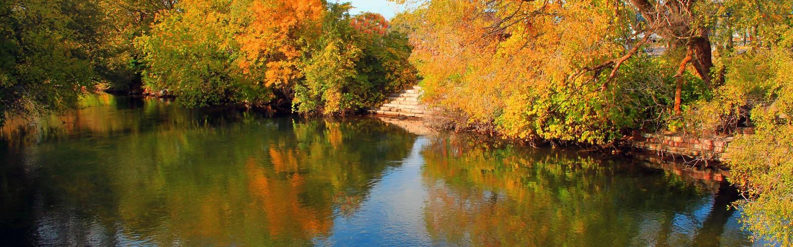
The Boardman River corridor in central Michigan is one of those places that earns its reputation quietly. No dramatic overlooks, no summit payoff — just a cold, clear river winding through a mix of hardwood forest, wetlands, and restored floodplain that keeps pulling you forward. If you're looking for a trail experience that's more about immersion than conquest, this one delivers.
The River Itself
The Boardman River is a designated Natural River under Michigan law, which means it's been protected from development and kept in a relatively natural state. The water runs remarkably clear for a lowland river, fed by groundwater and spring-fed tributaries throughout its watershed. You'll notice the color — almost tea-tinted in spots from tannins, but genuinely clean. It's a well-known trout stream, and on calm mornings you'll often see anglers working the current from the banks or wading in.
The river has also been the subject of a major dam removal and restoration project in recent years. Several dams that had altered the Boardman's flow and blocked fish passage for decades were removed, allowing the river to reclaim its natural channel. Walking along the corridor today, you're seeing a river in active recovery — and in many stretches, that recovery is visibly well underway.
What the Trail Is Like
The trail follows the river through a landscape that shifts as you move along it. Sections run close to the water's edge, where you get the sound of the current and occasional glimpses of fish holding in the shallows. Other stretches pull back into the forest, moving through stands of maple, beech, and hemlock that create a noticeably cooler microclimate even on warm days.
The terrain is generally gentle. There are no significant climbs here — the path stays close to the river's elevation, with only minor undulations as it navigates around wetland pockets and stream crossings. That makes it accessible to a wide range of hikers, including those who want a longer, relaxed outing without technical challenge.
Footing varies. Some sections are well-maintained natural surface trail, firm and easy to follow. Others can get soft after rain, particularly near the floodplain areas where the ground stays moist. Waterproof footwear is a reasonable call if there's been recent precipitation.
Wildlife and Natural Features
The Boardman corridor is genuinely good wildlife habitat. The combination of moving water, adjacent wetlands, and mature forest creates the kind of edge diversity that supports a wide range of species. Kingfishers are a regular sighting along the river — you'll often hear the rattling call before you see the bird. Great blue herons work the shallows. Wood ducks use the quieter backwater areas.
The dam removal work has also brought back migratory fish species that were previously blocked from reaching their historic spawning grounds. The ecological story here is an active one, not just a static nature walk.
In the forest sections, look for the understory plants that signal a healthy northern Michigan woodland — trillium in spring, ferns throughout the growing season, and the occasional patch of wild ginger along shadier slopes. The hemlock stands in particular have a distinctive feel: darker, quieter, with a thick duff underfoot that muffles sound.
Practical Information
- Difficulty: The trail is suitable for most fitness levels. The flat-to-rolling terrain means even beginners or families with older kids can handle it comfortably.
- Footwear: Trail runners or light hiking boots work well in dry conditions. Go waterproof if rain has fallen recently, especially for the floodplain sections.
- Dogs: Check current regulations at the trailhead — rules can vary depending on which section of the corridor you're accessing and who manages that land.
- Seasonality: The trail is accessible across multiple seasons. Spring brings high water and wildflowers. Summer offers shade and wildlife activity. Fall color in the hardwood sections is strong. Winter access depends on snow conditions and whether the access roads are maintained.
- Bugs: Like most river corridors in Michigan, mosquitoes and black flies can be significant in late spring and early summer. Plan accordingly — long sleeves and insect repellent are worth it.
Getting There and Access
The Boardman River corridor has multiple access points rather than a single main trailhead. This is worth knowing before you go — it means you can choose your entry point based on what section of the river you want to explore, and it also means the trail works well as a point-to-point with a vehicle shuttle if you want to cover more ground without retracing your steps.
Parking availability varies by access point. Some spots have small dedicated lots; others rely on roadside pulloffs. Checking current conditions and access details before heading out is a good habit here, particularly since the restoration work along the corridor has occasionally shifted which areas are open and how they're accessed.
Why It's Worth the Trip
What sets the Boardman River trail apart from a lot of central Michigan hiking is the combination of ecological significance and genuine trail quality. You're not just walking next to a river — you're walking next to a river that's actively being restored to health, in a landscape that shows what the region looked like before widespread development altered its waterways. The trail itself is quiet, well-suited to a pace that lets you actually notice things, and long enough to feel like a real outing rather than a quick loop.
It's the kind of place that rewards repeat visits across seasons, because the river and the forest around it are genuinely dynamic — what you see in April is a different experience from what you find in October.
The Essential Hiking Checklist
Everything you need for your next hike. Bilingual, printable, 1 page.
Get your free hiking checklistRecommended gear for this trail
As an Amazon Associate I earn from qualifying purchases.


Ready to go?
Everything you need to know before you goWhen?
How much?
As an Amazon Associate I earn from qualifying purchases.
Affiliate links — LGPO may earn a commission at no extra cost to you.
- Hiking shoes Essential
- → Salomon Elixir Tour Mid WP · 203.38 $
- Layered clothing Essential
- Rain jacket Essential
- Trekking poles
- → Black Diamond Trail Ergo Cork · 69.99 $
- Headlamp
- → Petzl Actik Core 625 · 103.95 $
FAQ - Frequently asked questions
Everything you need to knowHiking near Kitchener
142 trails to explore ~427 km away
We work hard to provide the most up-to-date and error-free data possible. If something seems incorrect, let us know! Your contribution helps the whole community.
Hikers' opinions
Be the first to review!
No hiker has shared their experience yet. Share your impressions and help other hikers!