

Ready to explore Nemadji State Forest? Here's everything you need to know before you go!
Discover the trail
Oh no! We don't have any photos 😢
This trail hasn't been captured yet. Be the first to share your adventure!Trail description
Nemadji State Forest is one of those places that doesn't try to impress you — it just does. Located in Pine County in east-central Minnesota, this working forest covers a wide stretch of rolling terrain shaped by glacial activity, river systems, and decades of careful land management. It's not a destination with a single marquee trail or a famous overlook. Instead, it rewards the kind of hiker who's happy to slow down, get a little muddy, and explore on their own terms.
The Landscape
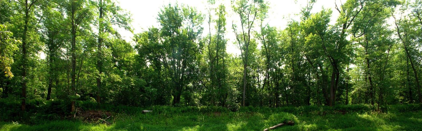
The forest takes its name from the Nemadji River, which drains much of the area and gives the land its character. The terrain here is largely low-lying and wet in places, with upland ridges breaking the pattern just enough to keep things interesting. You'll move through a mix of aspen and birch stands, conifer plantations, and boggy lowlands — the kind of mosaic that's typical of northeastern Minnesota's transition zone between the boreal north and the mixed forests further south. The southern portions feature gently rolling upland terrain, while the northeast transitions into steep stream valleys.
The soils in this part of the state are heavy clay, left behind by glacial Lake Duluth. That means trails can get soft and slick after rain, and spring conditions can be genuinely challenging. Come prepared with waterproof footwear if you're visiting outside of the dry summer months.
What to Expect on the Trail
Nemadji State Forest isn't a manicured park experience. Trails here are generally low-key and lightly developed, which is part of the appeal. You're more likely to share the forest with grouse hunters, ATV riders, and snowmobilers than with crowds of day hikers. The multi-use nature of the land is worth keeping in mind — especially during fall hunting seasons, when blaze orange is a smart addition to your kit.
The forest road network is extensive, and many hikers use forest roads and two-track paths to piece together their own routes. If you're the type who likes a clearly marked loop with a trailhead kiosk and a picnic table at the end, this might not be your spot. But if you're comfortable with a map and compass — or a downloaded offline GPS track — Nemadji opens up considerably. Trail connections to the Matthew Lourey State Trail and the Gandy Dancer Trail offer additional riding and hiking opportunities.
Wildlife and Nature
This is solid wildlife country. White-tailed deer are common throughout the forest, and black bear sightings are not unusual. The wetland areas and river corridors attract a good variety of waterfowl and wading birds, and the dense cover supports populations of ruffed grouse and woodcock — which is a big part of why this forest draws hunters from across the region every fall. Eagles are also present in the forest.
Birders will find the forest productive, particularly during spring migration when warblers move through the mixed stands in numbers. The boggy areas are worth checking for species that prefer wet, shrubby habitat.
Seasonal Considerations
Each season brings a genuinely different experience here. Summer offers the most accessible conditions, with drier trails and long daylight hours. Fall is arguably the most popular time — the aspen and birch turn quickly and the colors can be striking, plus the hunting seasons bring a lot of activity to the area. Winter opens up the forest to snowmobiling and cross-country skiing on groomed trails. Spring is the trickiest season: snowmelt combined with that heavy clay soil can make many trails nearly impassable, and biting insects arrive early.
Practical Information
Nemadji State Forest is managed by the Minnesota Department of Natural Resources. As a state forest — rather than a state park — the rules and infrastructure are different from what you might expect. Dispersed camping is generally permitted in Minnesota state forests, following DNR guidelines, which makes this a good option for backpackers looking for a low-cost overnight without a reservation system.
- Access: The forest is accessible via a network of county roads and forest roads. Road conditions vary, and some routes require a high-clearance vehicle, particularly in wet conditions.
- Fees: There is no day-use fee to enter Nemadji State Forest.
- Dogs: Dogs are permitted in Minnesota state forests. Keep them under control, especially during hunting seasons.
- Motorized use: ATVs and snowmobiles are permitted on designated routes with approximately 100 miles of trail dedicated to ATV, OHM, and snowmobile riding. Expect to encounter motorized users, particularly on forest roads.
- Hunting: Hunting is permitted in state forests in Minnesota. During deer and grouse seasons, wear blaze orange and be aware of your surroundings.
- Maps: Download a DNR state forest map before you go. Cell service in the forest is unreliable, and having an offline map is strongly recommended.
Who This Forest Is For
Nemadji State Forest is a good fit for self-sufficient hikers, hunters, anglers, and anyone who wants to spend time in a large, relatively wild landscape without the structure of a developed park. It's also a reasonable choice for mountain bikers and horseback riders looking for space to roam on forest roads and two-track trails. If you're coming from the Twin Cities or Duluth looking for a quick, well-signed day hike, there are more convenient options — but if you want to get genuinely off the beaten path in east-central Minnesota, Nemadji delivers exactly that.
The Essential Hiking Checklist
Everything you need for your next hike. Bilingual, printable, 1 page.
Get your free hiking checklistRecommended gear for this trail
As an Amazon Associate I earn from qualifying purchases.


Ready to go?
Everything you need to know before you goWhen?
How much?
As an Amazon Associate I earn from qualifying purchases.
Affiliate links — LGPO may earn a commission at no extra cost to you.
- Hiking shoes Essential
- → Salomon Elixir Tour Mid WP · 203.38 $
- Layered clothing Essential
- Rain jacket Essential
- Trekking poles
- → Black Diamond Trail Ergo Cork · 69.99 $
- Headlamp
- → Petzl Actik Core 625 · 103.95 $
FAQ - Frequently asked questions
Everything you need to knowHiking near Winnipeg
17 trails to explore ~532 km away
We work hard to provide the most up-to-date and error-free data possible. If something seems incorrect, let us know! Your contribution helps the whole community.
Hikers' opinions
Be the first to review!
No hiker has shared their experience yet. Share your impressions and help other hikers!