

Ready to explore Taum Sauk Mountain, Missouri? Here's everything you need to know before you go!
Discover the trail


Trail description
Taum Sauk Mountain sits at the top of Missouri — literally. This is the highest point in the state, and reaching it is one of those hikes that feels genuinely rewarding without demanding technical skill or elite fitness. Located in the St. Francois Mountains in the southeastern part of the state, Taum Sauk Mountain State Park draws hikers who want to stand on Missouri's rooftop and experience some of the most rugged, ancient terrain the Midwest has to offer.
The Terrain
The landscape here is shaped by some of the oldest exposed rock in North America. The St. Francois Mountains are remnants of a billion-year-old volcanic system, and you feel that age underfoot — the trail crosses exposed igneous rock, moves through dense oak and pine forest, and winds past features that look nothing like the rolling farmland most people associate with Missouri. The ground is rocky and uneven in places, with roots crossing the path and loose stone on steeper sections. It's not technical, but it keeps you paying attention.
The forest canopy is thick in summer, offering shade through most of the route. In fall, the hardwoods turn and the views open up considerably. The understory is dense with ferns and mosses in the wetter sections, and the whole area has a quiet, remote feel that's rare this close to populated parts of the state.
The High Point
The summit marker at Taum Sauk Mountain is a modest but satisfying destination. There's a small clearing with a stone marker identifying this as Missouri's highest point. It's not a dramatic alpine peak — the elevation gain is gradual and the summit itself is forested — but standing there knowing you're at the top of the state carries its own quiet satisfaction. The marker is well-maintained and easy to find.
For hikers working through highpointing lists, this is a straightforward and accessible entry. For everyone else, it's simply a good hike in a beautiful corner of Missouri that most people from the northern and western parts of the state have never visited.
Mina Sauk Falls
The trail to Taum Sauk Mountain connects to Mina Sauk Falls, which is the tallest waterfall in Missouri. The falls drop over a series of volcanic rhyolite ledges, and after significant rainfall they're genuinely impressive. Even in drier conditions, the rock formations around the falls are worth seeing on their own. This section of trail is one of the most visually distinctive stretches in the entire park, and it's a strong reason to extend your hike rather than turning back at the summit marker.
The path near the falls can be slippery when wet, so tread carefully if you're visiting after rain. The rock is smooth and the drop-offs are real — this isn't a place to rush.
What to Expect on the Trail
The main loop through the park takes you through varied terrain without being monotonous. You'll move between open rocky outcrops and closed forest, cross small drainages, and pass through areas where the trail narrows and requires a bit more focus. The footing is the main challenge — not the elevation or the distance, but the constant variation in surface underfoot.
Trail signage is clear and the path is well-worn. Getting lost is unlikely, but carrying a map is still a reasonable habit here given the remoteness of the area. Cell service is limited in the park.
Practical Information
- Location: Taum Sauk Mountain State Park is in Reynolds County in southeastern Missouri, in the heart of the St. Francois Mountains.
- Access: The park is reached via Highway CC off Highway 21. The roads leading in are paved but narrow in sections — drive accordingly.
- Parking: There is a parking area at the trailhead near the summit. A second access point is available near the Taum Sauk section of the Ozark Trail.
- Fees: Missouri State Parks do not charge a general entry fee. Some facilities within the park may have associated costs.
- Dogs: Dogs are welcome on trails in Missouri State Parks and must be kept on a leash no longer than ten feet.
- Camping: The park has a primitive walk-in campground available for those who want to spend a night out. Reservations are handled through the Missouri State Parks system.
- Restrooms: Vault toilets are available at the main trailhead parking area.
Best Times to Visit
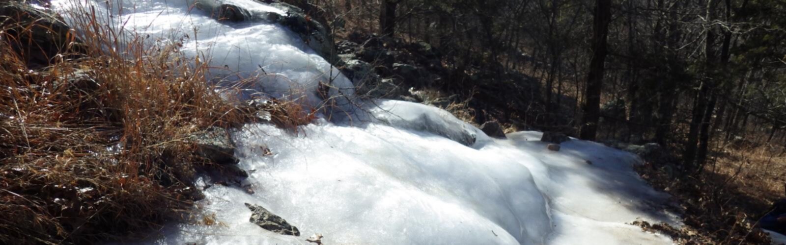
Spring and fall are the strongest seasons here. Spring brings wildflowers and higher water at Mina Sauk Falls. Fall delivers the best foliage in the St. Francois Mountains, and the cooler temperatures make the rocky terrain more comfortable underfoot. Summer is doable but can be hot and humid — start early if you're visiting between June and August. Winter visits are possible and the park stays open, though ice on the exposed rock sections near the falls requires extra caution.
Who This Hike Is For
Taum Sauk Mountain works well for a wide range of hikers. The terrain is accessible enough for families with older kids who are comfortable on uneven ground. It's a natural fit for highpointers checking off state summits. And for anyone based in Missouri who wants to see a genuinely wild and geologically fascinating corner of the state, this park delivers something that feels far removed from the typical Midwest outdoor experience.
The combination of the state highpoint, the tallest waterfall in Missouri, and billion-year-old volcanic rock in a single loop makes Taum Sauk Mountain State Park one of the most distinctive hiking destinations in the region.
The Essential Hiking Checklist
Everything you need for your next hike. Bilingual, printable, 1 page.
Get your free hiking checklistRecommended gear for this trail
As an Amazon Associate I earn from qualifying purchases.


Ready to go?
Everything you need to know before you goWhen?
How much?
As an Amazon Associate I earn from qualifying purchases.
Affiliate links — LGPO may earn a commission at no extra cost to you.
- Hiking shoes Essential
- → Salomon Elixir Tour Mid WP · 203.38 $
- Layered clothing Essential
- Rain jacket Essential
- Trekking poles
- → Black Diamond Trail Ergo Cork · 69.99 $
- Headlamp
- → Petzl Actik Core 625 · 103.95 $
FAQ - Frequently asked questions
Everything you need to knowHiking near Pittsburgh
0 trails to explore ~982 km away
We work hard to provide the most up-to-date and error-free data possible. If something seems incorrect, let us know! Your contribution helps the whole community.
Hikers' opinions
Be the first to review!
No hiker has shared their experience yet. Share your impressions and help other hikers!