
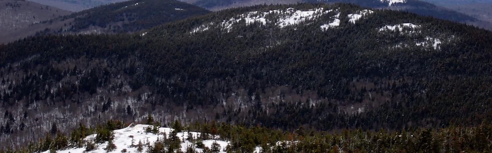

Ready to explore Cardigan Mountain State Park? Here's everything you need to know before you go!
Discover the trail


Trail description
Cardigan Mountain State Park is one of central New Hampshire's most satisfying hiking destinations, and it earns that reputation honestly. Spread across 5,000 acres in the Dartmouth-Lake Sunapee region, the park centers on Mount Cardigan's striking bald summit — a broad expanse of exposed granite that sets this mountain apart from most peaks in the area. On a clear day, the views stretch northeast to Mount Washington and the Presidential Range, and west across the Connecticut River valley to Vermont's Green Mountains.
What makes Cardigan genuinely special is that open summit. Most mountains at this elevation are tree-covered at the top, which limits what you actually see. Here, the bedrock takes over well before the true summit, giving you an almost alpine feel without the commitment of a high-alpine objective. It's a rare combination: moderate effort, big payoff.
The Hike
The West Ridge Trail is the go-to route for most visitors, and for good reason. The round trip covers about 4.8 km with 704 meters of elevation gain — numbers that put it firmly in moderate territory, though the climb is consistent enough that you'll feel it. Plan for roughly 3.5 hours round trip at a comfortable pace, with time to take in the summit.
The trail starts in mixed hardwood forest, where the path is well-defined and the grade is manageable. As you gain elevation, the hardwoods give way to conifers, the air cools, and the terrain starts to demand more attention. The upper section involves scrambling over granite slabs and following cairns across open rock — nothing technical, but you do need to watch your footing, especially if the rock is wet. Trekking poles are useful on the descent.
The summit area itself is worth lingering on. The exposed bedrock creates a wide-open platform with 360-degree sightlines, and on a good day the views are genuinely impressive. The Presidential Range to the northeast, Vermont's mountains to the west — it's the kind of panorama that makes the climb feel worthwhile even before you've caught your breath.
Beyond the West Ridge Trail, the park's trail network offers additional routes that wind through diverse forest ecosystems and connect with broader regional trail systems, including links to the Appalachian Trail Conservancy's network. This connectivity opens up options for longer loops and multi-day adventures for those who want more than a single summit push.
Wildlife and Natural Character
The park's 5,000 acres support a solid mix of wildlife. White-tailed deer are a common sight, especially in the early morning and at dusk. Red foxes move through the area, and the forest is active with bird life year-round — woodpeckers are frequently heard working through the trees, and hawks often ride thermals above the open summit. The diversity of habitat, from dense hardwood stands to rocky subalpine zones, means the wildlife picture shifts depending on where you are on the mountain.
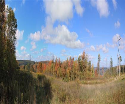
Seasonally, the park transforms in ways that make it worth visiting more than once. Fall foliage on the lower slopes — maples, birches, oaks — is vivid and well worth timing a trip around. Spring brings wildflowers and fresh growth to the forest floor. Summer offers full canopy cover on the lower trails and warm, open conditions on the summit. Winter is doable but demands preparation: the granite slabs ice over, and microspikes or crampons are often necessary for safe travel on the upper section.
Facilities and Practical Details
The park includes picnic areas where you can take a break and eat without rushing back to the car. These are well-positioned and work well for families or groups planning a full day out. Camping options exist in the surrounding area, making it feasible to base yourself nearby for multi-day exploration of the region. Local streams also offer fishing access, which adds another reason to spend more than a few hours here.
Before You Go
A few things worth knowing before you head out:
- Water: The exposed summit gets warm and sunny, and the climb is sustained. Bring more than you think you need.
- Footwear: Sturdy hiking boots with good traction are the right call here. The granite slabs on the upper section can be slippery, and ankle support matters on the rocky descent.
- Layers: The summit is consistently cooler and windier than the trailhead, even on warm days. Pack a wind layer regardless of the forecast.
- Winter conditions: Ice on the upper granite is a real hazard. Microspikes are strongly recommended from late fall through early spring.
- Leave No Trace: The park operates under LNT principles. Pack out everything you bring in, stay on marked trails, and give wildlife plenty of space. The summit's exposed rock ecosystem is fragile and slow to recover from damage.
Cardigan Mountain State Park delivers a genuinely rewarding experience — a real climb, real views, and a summit environment that feels distinct from anything else in the Dartmouth-Lake Sunapee region.
The Essential Hiking Checklist
Everything you need for your next hike. Bilingual, printable, 1 page.
Get your free hiking checklistRecommended gear for this trail
As an Amazon Associate I earn from qualifying purchases.


Ready to go?
Everything you need to know before you goStarting Point
The trails at the cardigan mountain state park in New Hampshire can be accessed from the park's main entrance.
When?
How much?
As an Amazon Associate I earn from qualifying purchases.
Affiliate links — LGPO may earn a commission at no extra cost to you.
- Hiking shoes Essential
- → Salomon Elixir Tour Mid WP · 203.38 $
- Layered clothing Essential
- Rain jacket Essential
- Trekking poles
- → Black Diamond Trail Ergo Cork · 69.99 $
- Headlamp
- → Petzl Actik Core 625 · 103.95 $
FAQ - Frequently asked questions
Everything you need to knowSimilar hikes nearby
Discover other trails you might enjoy
Mt Moosilauke
Dartmouth-Lake Sunapee
AMC Cardigan Lodge
Dartmouth-Lake Sunapee

Moose Mountain Shelter
Dartmouth-Lake Sunapee
Welton Falls
Dartmouth-Lake Sunapee
Big Sugarloaf Mountain
Dartmouth-Lake Sunapee
Forest Lake State Park
Dartmouth-Lake Sunapee
Hiking near Concord
0 trails to explore ~58 km away
We work hard to provide the most up-to-date and error-free data possible. If something seems incorrect, let us know! Your contribution helps the whole community.
Hikers' opinions
Be the first to review!
No hiker has shared their experience yet. Share your impressions and help other hikers!