

Ready to explore Wittenberg Mountain, New York? Here's everything you need to know before you go!
Discover the trail

Trail description
Description
Wittenberg Mountain is one of the more rewarding hikes in the Catskills. At just under 10 kilometers round trip with 610 meters of elevation gain, it's a solid day out — not a casual stroll, but well within reach for hikers with a reasonable fitness base. The estimated 6.5 hours gives you enough time to move at a comfortable pace, take in the views, and not feel rushed on the descent.
The Trail
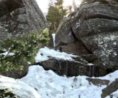
The route up Wittenberg Mountain follows the Burroughs Range Trail, a classic Catskills path that winds through dense hardwood and conifer forest before breaking out near the summit. The climb is steady rather than brutal — you gain elevation consistently, with a few steeper pitches in the upper section where the trail tightens and the footing gets rockier. Trekking poles are worth bringing if you have them, especially for the descent.
The trail is well-marked with the standard Catskill trail blazes, and the path itself is well-established. That said, some sections can be muddy after rain, and the upper reaches tend to hold moisture longer due to the tree cover and cooler temperatures at elevation.
The Summit
The summit of Wittenberg Mountain sits at 3,780 feet (1,152 meters) and delivers one of the best open views in the Catskills. From the top, you get a wide panorama looking south and west across the Catskill range — on a clear day, the Ashokan Reservoir is visible below, and the layered ridgelines stretch out in every direction. It's the kind of view that makes the climb feel worth every step.
The summit area itself is rocky and open, which is relatively uncommon in the Catskills where many high points are wooded. That openness is a big part of what makes Wittenberg stand out — you actually get to sit down, eat your lunch, and look at something.
The Burroughs Range Connection
Wittenberg is part of the Burroughs Range, which also includes Cornell Mountain and Slide Mountain — the highest peak in the Catskills. Many hikers combine Wittenberg with Cornell and Slide in a single long day, a traverse known as the Burroughs Range Traverse. That's a significantly longer and more demanding undertaking, typically requiring a car shuttle or a very long loop. If you're just doing Wittenberg on its own, the out-and-back from the Woodland Valley trailhead is the standard approach.
Getting There
The main trailhead for Wittenberg Mountain is at Woodland Valley Campground, located off Woodland Valley Road near Phoenicia, New York. The campground is managed by the New York State Department of Environmental Conservation (DEC). There is a parking area at the trailhead — arrive early on weekends, especially in fall, as it fills up quickly. The road into Woodland Valley is narrow in sections, so be prepared for that if you're driving a larger vehicle.
Practical Info
- Distance: 9.7 km round trip
- Elevation gain: 610 m
- Difficulty: Moderate
- Estimated time: 6 hours 30 minutes
- Trailhead: Woodland Valley Campground, near Phoenicia, NY
- Trail: Burroughs Range Trail
- Managed by: New York State DEC
When to Go
Late spring through early fall is the prime window for Wittenberg. The Catskills are known for spectacular fall foliage, and Wittenberg's open summit makes it a particularly good spot to catch the color — typically peak in early to mid-October in this part of New York. Summer hiking is excellent here as well, with the forest providing shade on the climb. Winter ascents are possible but require microspikes or crampons; the upper trail can be icy and the summit exposed to wind.
What to Bring
Bring more water than you think you need — there are no reliable water sources along the trail that you'd want to count on without a filter. Layers are smart even in summer, since the summit can be noticeably cooler and windier than the trailhead. Sturdy footwear with ankle support is recommended given the rocky terrain in the upper section.
Wittenberg Mountain earns its reputation as one of the Catskills' standout hikes — the combination of a manageable but genuine challenge, dense forest trail, and a genuinely open summit view puts it in a different category from many peaks in the region.
Recommended gear for this trail


Ready to go?
Everything you need to know before you goStarting Point
To access the hiking trails, you can start at the Woodland Valley Campground, which serves as a trailhead. The address is 1319 Woodland Valley Rd, Phoenicia, NY 12464. Another option is the trailhead located at the end of Moon Haw Road in Shandaken, NY. Both locations provide parking facilities for hikers.
When?
How much?
- Hiking shoes Essential
- → Salomon Elixir Tour Mid WP · 203.38 $
- Layered clothing Essential
- Rain jacket Essential
- Trekking poles
- → Black Diamond Trail Ergo Cork · 69.99 $
- Headlamp
- → Petzl Actik Core 625 · 103.95 $
FAQ - Frequently asked questions
Everything you need to knowThe Essential Hiking Checklist
Everything you need for your next hike. Bilingual, printable, 1 page.
Download the free checklistSimilar hikes nearby
Discover other trails you might enjoy

Old Mill Falls
Catskills
Catskill Scenic Trail
Catskills
Cliff Lake
Catskills
Plattekill Falls
Catskills
Ashokan Reservoir
Catskills
Devil's Path Trail
Catskills
Hiking near Poughkeepsie
0 trails to explore ~49 km away
We work hard to provide the most up-to-date and error-free data possible. If something seems incorrect, let us know! Your contribution helps the whole community.
Hikers' opinions