
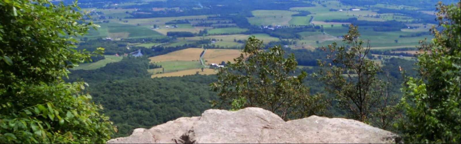

Ready to explore Rockhouse Mountain, New York? Here's everything you need to know before you go!
Discover the trail
Oh no! We don't have any photos 😢
This trail hasn't been captured yet. Be the first to share your adventure!Trail description
Rockhouse Mountain sits in the heart of New York's Hudson Valley, offering a 6-kilometer round trip that punches above its weight in terms of scenery. With 391 meters of elevation gain and an estimated 2.5 hours on trail, it's rated easy — making it a solid choice for hikers who want a genuine climb without committing to a full-day sufferfest.
Trail Experience and Terrain
The trail starts in dense forest, where the canopy does a good job of filtering light and keeping things cool on warmer days. As you gain elevation, the forest floor transitions from soft duff to rockier ground, and you start to see the outcroppings that give Rockhouse Mountain its name. These rocky features aren't just scenic — they break up the rhythm of the climb and give you natural spots to pause, catch your breath, and take in partial views before the summit opens up.
The path is well-marked throughout, so navigation isn't something you'll need to stress about. Footing requires a bit more attention on the rockier upper sections, but nothing that demands technical skills or specialized gear. Sturdy trail runners or hiking boots with decent grip will handle it comfortably.
Summit Views
The payoff at the top is a panoramic look across the Hudson Valley — rolling forested ridges, layered hillsides, and on a clear day, the Hudson River catching light in the distance. It's the kind of view that reminds you why people have been drawn to this region for generations. The summit is an obvious spot to sit down, eat something, and take your time before heading back down.
Wildlife and Seasonal Highlights
White-tailed deer are a common sight along the trail, especially if you're out early in the morning or in the late afternoon. Red foxes live in the area too, though they tend to stay out of sight — slow down and stay quiet and you improve your odds. The bird life is varied, with songbirds throughout the forest and raptors working the thermals near the summit. Binoculars are worth tossing in your pack.
Seasonally, fall is the standout. The Hudson Valley's foliage is legitimately spectacular, and Rockhouse Mountain puts you at a great elevation to watch the hillsides turn. Spring brings wildflowers and fresh green growth. Summer means full shade on the climb, which is welcome when temperatures climb. Winter hiking is quieter and the bare trees open up views that are hidden the rest of the year — just make sure your footwear handles icy or snowy conditions.
Nearby Trails and Connections
Rockhouse Mountain works well as a standalone hike, but it also sits within reach of a broader trail network. Harriman State Park nearby expands your options significantly — the Arden-Surebridge Trail mixes rocky scrambles with forest walking, and the Red Cross Trail connects to additional viewpoints and varied terrain. For those interested in longer routes, the Beech Trail in the Southfields area of Orange County links up with the Long Path, a long-distance trail that runs from the New York City area north into the Catskills. That connection makes it easy to build out a multi-day itinerary if you're looking to explore more of the region.
Planning Your Visit
At 2.5 hours, this hike fits comfortably into a half-day outing, leaving plenty of time to explore the surrounding area. The Hudson Valley has no shortage of small towns with good food — farm-to-table spots are common here, and a post-hike meal in one of the nearby communities is an easy way to round out the day.
Pack water and snacks regardless of the season — the climb is steady and the summit can be windier and cooler than the trailhead. Layering is smart even on mild days. Check conditions before you go, particularly in shoulder seasons when weather in the valley and on the summit can differ more than you'd expect.
Stay on marked trails to protect the vegetation and keep erosion in check, and pack out everything you bring in. The trail's condition and the wildlife that uses it depend on hikers doing their part.
The Essential Hiking Checklist
Everything you need for your next hike. Bilingual, printable, 1 page.
Get your free hiking checklistRecommended gear for this trail
As an Amazon Associate I earn from qualifying purchases.


Ready to go?
Everything you need to know before you goStarting Point
To access the hiking trails, you can start at one of the following trailheads:
Trailhead on Route 9W: Park at the designated parking area located along Route 9W. The parking lot is easily accessible from the main road and provides direct access to the trails.
Trailhead on Mountain Road: Another option is to begin your hike from the parking area on Mountain Road. This location offers a convenient starting point for exploring the trails.
Both trailheads are well-marked and provide ample parking for visitors.
When?
How much?
As an Amazon Associate I earn from qualifying purchases.
Affiliate links — LGPO may earn a commission at no extra cost to you.
- Hiking shoes Essential
- → Salomon Elixir Tour Mid WP · 203.38 $
- Layered clothing Essential
- Rain jacket Essential
- Trekking poles
- → Black Diamond Trail Ergo Cork · 69.99 $
- Headlamp
- → Petzl Actik Core 625 · 103.95 $
FAQ - Frequently asked questions
Everything you need to knowSimilar hikes nearby
Discover other trails you might enjoy

West Mountain
Hudson Valley

Witches Hole
Hudson Valley
Appalachian Trail
Hudson Valley
Little Dam Lake
Hudson Valley
Raven's Rock
Hudson Valley
Sterling Forest Fire Tower
Hudson Valley
Hiking near Poughkeepsie
0 trails to explore ~53 km away
We work hard to provide the most up-to-date and error-free data possible. If something seems incorrect, let us know! Your contribution helps the whole community.
Hikers' opinions
Be the first to review!
No hiker has shared their experience yet. Share your impressions and help other hikers!