

Ready to explore South County Trailway? Here's everything you need to know before you go!
Discover the trail
Trail description
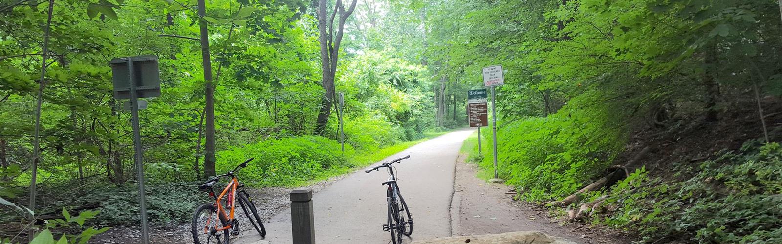
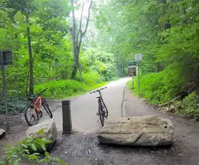
The South County Trailway is a paved multi-use trail running through the heart of Westchester County in New York's Hudson Valley. Built on a former rail corridor, it connects a string of communities along a smooth, mostly flat path that's welcoming to walkers, joggers, cyclists, and anyone looking to get outside without dealing with steep climbs or rugged terrain. It's the kind of trail that earns its place in a regular rotation — easy to access, easy to enjoy, and genuinely useful as both a recreational route and a practical connector between neighborhoods.
The Trail Itself
The South County Trailway follows the old Putnam Division rail bed, which gives it that characteristic rail-trail feel: gentle grades, wide open sightlines, and a consistent surface underfoot. The pavement is well-maintained and wide enough that foot traffic and cyclists can share the space without it feeling crowded on most days. The corridor passes through a mix of wooded stretches, open areas, and suburban edges, so the scenery shifts as you move along it.
Because it's a former rail line, the trail is essentially linear — you pick a starting point, head in one direction, and turn around when you're ready. There are multiple access points along the route, which makes it flexible. You can do a short out-and-back from a single trailhead, or park at one end and arrange a shuttle to cover the full length.
What to Expect on the Ground
The surface is paved asphalt throughout, which makes it accessible for strollers, wheelchairs, and anyone who prefers a predictable footing. You won't find technical terrain here — no roots, no rocks, no stream crossings. What you will find is a pleasant, shaded corridor for much of the route, with tree canopy overhead that makes summer outings genuinely comfortable.
The trail passes through or near several Westchester communities, and you'll notice the suburban context as you go — road crossings, nearby neighborhoods, the occasional park bench or rest area. This isn't a wilderness experience, but that's not what the South County Trailway is going for. It's a green corridor through a densely populated region, and it does that job well.
Parking is available at multiple access points along the trail. The trailway connects with other Westchester County trail segments, including the North County Trailway, so if you're looking to extend your outing, there are options to link up with adjacent greenway routes.
Who It's For
The South County Trailway works well for a wide range of users. Families with young kids appreciate the flat, paved surface and the fact that there's no real navigation required — you just follow the path. Runners use it for steady-state training without worrying about footing. Cyclists find it a low-stress alternative to road riding in a busy suburban area. Dog walkers are a common sight too, since the open corridor gives dogs room to move.
Because the trail is accessible from multiple points and doesn't require a long commitment, it's also a solid option for people who only have an hour to spare. You don't need to plan a big outing — just show up, walk as far as you feel like, and head back.
The Rail Trail Context
The Putnam Division of the New York Central Railroad once ran through this corridor, providing freight and passenger service from 1881 to 1958, connecting communities in Westchester County and beyond. The conversion of the rail bed into a recreational trail preserved the right-of-way and gave the public a continuous green corridor that would have been nearly impossible to create from scratch in such a developed region. The South County Trailway is one of four interconnected rail-trails on this former railroad line. That history is part of what makes the South County Trailway feel like a genuine community asset — it exists because someone made the effort to protect the land and repurpose it.
Westchester County manages the trailway as part of its broader greenway network, which aims to eventually connect communities throughout the county with car-free off-road paths.
Practical Notes
- Distance: 14.1 miles (22.7 km)
- Surface: Paved asphalt throughout — suitable for road bikes, strollers, and wheelchairs.
- Terrain: Flat to gently rolling, consistent with a former rail corridor. Elevation gain approximately 347.7 ft.
- Access: Multiple trailheads with parking along the route. Begins at Van Cortlandt Park in the Bronx and extends north to Eastview, New York.
- Dogs: Permitted on leash.
- Bikes: Welcome — this is a multi-use trail designed for both foot traffic and cycling.
- Connections: Links with the North County Trailway and other Westchester County greenway segments for those looking to extend their route.
- Management: Westchester County Parks.
Getting the Most Out of It
If you're visiting the South County Trailway for the first time, it's worth checking the Westchester County Parks website before you go to confirm current parking availability and any trail conditions. The multiple access points mean you have real flexibility in how you approach the outing — pick the trailhead closest to where you're coming from, or choose one that puts you near a section of the corridor you haven't explored yet.
The trail connects communities, so it's also worth thinking about whether you want to combine your outing with a stop in one of the nearby towns — grabbing a coffee before or after your walk is a natural fit given how the trailway threads through residential and commercial areas.
For anyone spending time in the Hudson Valley and looking for a low-key, accessible outdoor option that doesn't require driving deep into the countryside, the South County Trailway is a reliable choice that delivers a genuine outdoor experience within reach of a dense suburban landscape.
The Essential Hiking Checklist
Everything you need for your next hike. Bilingual, printable, 1 page.
Get your free hiking checklistRecommended gear for this trail
As an Amazon Associate I earn from qualifying purchases.


Ready to go?
Everything you need to know before you goWhen?
How much?
As an Amazon Associate I earn from qualifying purchases.
Affiliate links — LGPO may earn a commission at no extra cost to you.
- Hiking shoes Essential
- → Salomon Elixir Tour Mid WP · 203.38 $
- Layered clothing Essential
- Rain jacket Essential
- Trekking poles
- → Black Diamond Trail Ergo Cork · 69.99 $
- Headlamp
- → Petzl Actik Core 625 · 103.95 $
FAQ - Frequently asked questions
Everything you need to knowSimilar hikes nearby
Discover other trails you might enjoy
West Mountain
Hudson Valley

Witches Hole
Hudson Valley
Appalachian Trail
Hudson Valley
Little Dam Lake
Hudson Valley
Raven's Rock
Hudson Valley
Sterling Forest Fire Tower
Hudson Valley
Hiking near New York City
0 trails to explore ~42 km away
We work hard to provide the most up-to-date and error-free data possible. If something seems incorrect, let us know! Your contribution helps the whole community.
Hikers' opinions
Be the first to review!
No hiker has shared their experience yet. Share your impressions and help other hikers!