Let's Go Play Outside
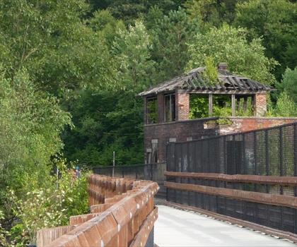
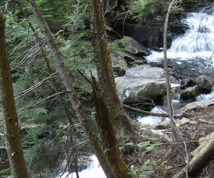
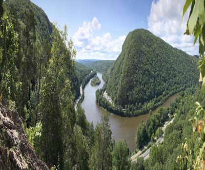
Hiking Penobscot Mountain, Pennsylvania - panoramic view  tree outdoor landscape nature mountain sky autumn plant cloud background lake painting forest surrounded distance
--°C
Loading...
See forecast →

Hiking in Penobscot Mountain, Pennsylvania: trails, map and practical info

Pocono Mountains • Pennsylvania

Penobscot Mountain, Pennsylvania (Pocono Mountains, Pennsylvania) : easy hike, 6.4 km, 655 m of elevation gain, about 2h00.

6.4 km
Distance
2h00
Duration
655 m
Elevation
Difficulty
Easy
Recommended for :
Beginners

Ready to explore Penobscot Mountain, Pennsylvania? Here's everything you need to know before you go!

Discover the trail

Oh no! We don't have any photos 😢

This trail hasn't been captured yet. Be the first to share your adventure!

Trail description

Penobscot Knob, also Penobscot Mountain, is a summit located in the western fringe of the Poconos nearest to Mountain Top, Pennsylvania which in the Solomon Gap pass below it lies an important multi-modal transportation corridor. At one time before incorporation, Mountain Top and the saddle of the pass was known by the Amerindian name Penobscot. Penobscot Mountain forms part of the drainage divide between the Lehigh Valley & greater Delaware River drainage basin and the Wyoming and Susquehanna Valley, part of the Potomac River drainage basin. The pass formed between Penobscot and Haystack Mountain a few thousand feet to the West was one of the few places a railroad could be envisioned in the 1830s when the fuel crises in eastern cities demanded easier transportation to the Northern Anthracite Coal Fields, which ironically, came to be exploited by the company with a near monopoly in providing coal from the Southern Anthracite region, Lehigh Coal & Navigation Company (LC&N, f.1821), which had built both the Lehigh Canal, but also the nation's second railway, the Summit Hill & Mauch Chunk Railroad. The whole uplands north and west faces over look the Wyoming Valley from the southeastern corner near Hazleton towards and through the greater south Wilkes-Barre area. The southern and eastern slopes just give peeks into portions of the Poconos and wider views of the Lehigh Valley descending down to White Haven, for the Poconos technically are left-bank bounded by the Lehigh. The shoulders of the peak, an elevated flat area saddle pass peak today is perhaps best known as the site of many local television and radio station transmitter antennas. WVIA-TV, WVIA-FM, WNEP, WYOU, WBRE, and WOLF-TV are some of the major stations that broadcast from the high elevation there, but the peak was known for another reason in the 19th-century, the saddle or pass on its western slope together with its other terrain features were the best place to build a railroad across the south and east faces of the bowl of the Wyoming Valley from the 'direct road' down the level water route to the Delaware Canal and Delaware River above and alongside the Lehigh Canal, cutting off nearly 100 miles from a rail trip to Philadelphia. Penobscot Hill is about 2,100 feet (640 meters) above sea level.
Free 1 page
The Essential Hiking Checklist

Everything you need for your next hike. Bilingual, printable, 1 page.

Get your free hiking checklist

Recommended gear for this trail

As an Amazon Associate I earn from qualifying purchases.

LGPO Pick
Elixir Tour Mid WP
Salomon
Elixir Tour Mid WP
4.5 (2847 reviews)
Waterproof mid-height boot ideal for rocky terrain
203.38 $
See price
Daylite Plus 20L
Osprey
Daylite Plus 20L
4.7 (3215 reviews)
Lightweight and versatile for day hikes
109.99 $
See price
Most Popular
Wide Mouth 1L
Nalgene
Wide Mouth 1L
4.8 (12540 reviews)
Unbreakable and BPA-free — a hiking essential
23.11 $
See price
Best Value
Trail Ergo Cork
Black Diamond
Trail Ergo Cork
4.4 (1456 reviews)
Comfortable cork grip for long ascents
69.99 $
See price
Actik Core 625
Petzl
Actik Core 625
4.6 (1893 reviews)
USB rechargeable with 600 lumens for early starts
103.95 $
See price
Affiliate links — LGPO may earn a commission at no extra cost to you.

Ready to go?

Everything you need to know before you go

Where?

Address
Not available
GPS coordinates
41.182511, -75.872368
Phone
Not available

When?

Opening hours
No information
Weather (next days)
Loading
What to bring?

As an Amazon Associate I earn from qualifying purchases.

Affiliate links — LGPO may earn a commission at no extra cost to you.

General hiking tips, to adapt to your outing.
Gear
Download the PDF checklist
Water & food
Tip: bring water
Plan for at least 2 L per person on an outing of 2 hours or more.
Good to know
In an emergency
Emergency
911
GPS coordinates
41.182511, -75.872368

Hikers' opinions

Be the first to review!

No hiker has shared their experience yet. Share your impressions and help other hikers!

FAQ - Frequently asked questions

Everything you need to know
Penobscot Mountain, Pennsylvania is rated easy.
The elevation gain of Penobscot Mountain, Pennsylvania is 655 m.
Allow about 2h00 for Penobscot Mountain, Pennsylvania (6.4 km).
Didn't find your answer?
Top 10 best hiking in Pocono Mountains
Our ranking based on hiker reviews

Hiking near Trenton

171 trails to explore ~144 km away

View trails near Trenton
Did you spot an error?

We work hard to provide the most up-to-date and error-free data possible. If something seems incorrect, let us know!

Update : November 2026