


Ready to explore Glenbow Ranch Provincial Park? Here's everything you need to know before you go!
Discover the trail
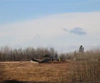
Photos: Thank you for visiting my page from Canada — CC BY 2.0 (Wikimedia Commons)
Trail description
Glenbow Ranch Provincial Park occupies a stretch of foothills between Calgary and Cochrane, preserving 1,300 hectares of native grassland, aspen parkland, and Bow River valley. The park's 24 kilometers of trails cover terrain that shifts constantly between open prairie, wooded coulees, and river-bottom flats — enough variety to keep the hiking interesting from start to finish.
Trail Network and Terrain
The trail system is well-maintained and clearly signed, which matters in a park where open grassland can make it easy to lose your bearings at junctions. Surfaces range from packed earth and gravel to boardwalk sections through wetter low-lying areas. The trails are wide enough to walk comfortably side by side, and the network is designed so you can piece together shorter loops or commit to a longer day covering more of the park's 24 kilometers.
Elevation change across the park reaches up to 200 meters, concentrated in the upland sections where the trail climbs away from the river valley onto the rolling prairie above. These climbs are steady rather than steep, and the reward is a significant shift in perspective — from the sheltered, cottonwood-lined riverbanks to exposed ridgelines with unobstructed views toward the Rocky Mountain foothills to the west. The river sections run flatter and feel more protected, while the upland routes are more exposed to wind and weather. Planning your route to mix both gives you the most complete picture of what the park offers.
A full exploration of the trail network at a comfortable pace takes around 7.5 hours, which makes this a genuine full-day outing rather than a quick afternoon walk. Most visitors doing shorter loops will be out for 2 to 4 hours depending on pace and which sections they choose.
What You'll Actually See Out There
The park moves through distinct ecosystems as you hike, and the transitions are part of what makes it worth the drive. In spring, the open grasslands come alive with prairie crocuses and other wildflowers before the heat of summer sets in. By midsummer, the full grassland ecosystem is on display — grasses, forbs, and the insects and birds that depend on them. Fall is arguably the most visually striking season, when the aspen groves turn yellow and gold and the cooler temperatures make for ideal hiking conditions.
Wildlife sightings are common throughout the park. White-tailed deer and mule deer show up regularly, especially in the early morning and at dusk. Coyotes are present but tend to keep their distance. The combination of open grassland and riparian corridor makes Glenbow Ranch a strong destination for birding — red-tailed hawks and rough-legged hawks work the uplands, while the Bow River corridor draws great blue herons, various waterfowl, and a range of songbirds depending on the season.
The Bow River itself is a constant presence along the lower sections of the trail network. Depending on the time of year and recent weather upstream, the river can range from calm and reflective to fast-moving and turbid. The cottonwood-lined banks create a noticeably different microclimate from the exposed uplands — cooler, more sheltered, and botanically distinct.
Ranching History on the Landscape
One of the things that sets Glenbow Ranch apart from a typical provincial park is the visible layer of ranching history woven into the landscape. The park preserves the legacy of late 19th-century cattle operations that shaped this part of southern Alberta, and as you hike you'll come across old fence lines, building foundations, and other remnants of that era. Interpretive signage along the trails puts these features in context, explaining how decades of grazing management influenced the grassland ecosystem you're walking through today.
This history adds a dimension to the hiking that goes beyond scenery. The current landscape is the product of both natural prairie processes and a long period of human use, and the park does a good job of making that story accessible without turning the trail into a museum exhibit.
Facilities and Access
The park has multiple parking areas that give you access to different sections of the trail network, which is useful if you want to target a specific part of the park or break a longer route into sections. Picnic areas are positioned at viewpoints and along the river, making them genuinely useful rest stops rather than afterthoughts. The interpretive signage throughout the park covers local ecology, wildlife, and historical features — worth reading if you have the time, since it adds real context to what you're seeing.
The park's location between Calgary and Cochrane makes it an easy day trip from either direction, and the range of trail options means it works for a quick two-hour outing or a full day on the trail.
Practical Notes for Your Visit
The open grassland terrain means weather exposure is a real factor here. Wind can be significant on the upland sections, and the lack of tree cover means sun protection matters in summer. Conditions can shift quickly, so layering is a good habit regardless of the forecast. The river valley sections offer more shelter but can be muddy in spring or after rain.
Weekends in summer tend to bring more visitors, particularly on the trails closest to the parking areas. If you're looking for a quieter experience, early morning starts or shoulder-season visits in late spring or early fall tend to deliver better wildlife sightings and more trail space to yourself.
Recommended gear for this trail
As an Amazon Associate I earn from qualifying purchases.


Ready to go?
Everything you need to know before you goStarting Point
The glenbow ranch provincial park is located in Cochrane, Alberta. To get to the start of the trails, take Highway 1A west from Calgary to Cochrane. Turn left onto Bow Valley Trail and follow the signs to the park.
When?
How much?
As an Amazon Associate I earn from qualifying purchases.
Affiliate links — LGPO may earn a commission at no extra cost to you.
- Hiking shoes Essential
- → Salomon Elixir Tour Mid WP · 203.38 $
- Layered clothing Essential
- Rain jacket Essential
- Trekking poles
- → Black Diamond Trail Ergo Cork · 69.99 $
- Headlamp
- → Petzl Actik Core 625 · 103.95 $
FAQ - Frequently asked questions
Everything you need to know
25 hikes under 2 hours from Montreal
Distance, elevation, parking and season for each one. The ones we go back to ourselves.
Get the guideSimilar hikes nearby
Discover other trails you might enjoy
Auburn Bay Lake
Calgary & Area
Douglas Fir Trail E
Calgary & Area
Yamnuska Ridge & CMC Valley Trailhead
Calgary & Area
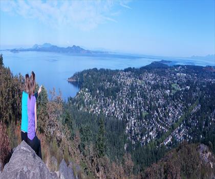
Mount Douglas Park
Calgary & Area
River Park Off Leash Dog Park
Calgary & Area
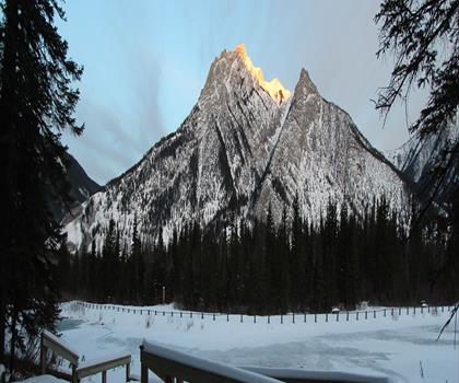
Mt Lorette Ponds
Calgary & Area
Hiking near Calgary
120 trails to explore ~26 km away
We work hard to provide the most up-to-date and error-free data possible. If something seems incorrect, let us know! Your contribution helps the whole community.
Hikers' opinions
Be the first to review!
No hiker has shared their experience yet. Share your impressions and help other hikers!