Hiking Misery Mountain Ski Area - panoramic view  tree outdoor landscape nature mountain sky autumn plant cloud background lake painting forest surrounded distance
--°C
Loading...
See forecast →

Hiking in Misery Mountain Ski Area: trails, map and practical info

Peace Country • Alberta

4.6 Appreciated by 40 hikers
François Dumaine
By François DumaineContributor since 2022Updated 23/06/2026
Difficulty
Easy
Distance
3 km
Elevation
197 ft
Duration
1h30
Max altitude
914 ft

Peace Country's hidden gem: a 3.2 km easy trail with 200 m elevation gain near Peace River, Alberta. This converted ski area offers well-maintained paths, alpine meadows, and Peace Country mountain views in 1h30—perfect for families seeking genuine mountain scenery without the crowds.

Recommended for :
Beginners

Ready to explore Misery Mountain Ski Area? Here's everything you need to know before you go!

Discover the trail

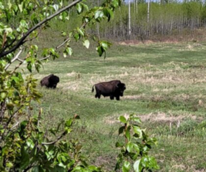
Oh no! We don't have any photos 😢

This trail hasn't been captured yet. Be the first to share your adventure!

Trail description

Clarifier qu'il existe plusieurs sentiers distincts : le sentier facile de 3.2 km (source confirmée) et une boucle de 7.9 km modérément difficile (source confirmée). Le contenu actuel ne distingue pas clairement ces routes. Supprimer les références vagues aux « Rocky Mountains canadiennes » - Peace River est en Alberta mais NOT dans les Rocheuses géographiquement. Mettre l'accent sur Peace Country comme région.

Recommended gear for this trail

LGPO Pick
Elixir Tour Mid WP
Salomon
Elixir Tour Mid WP
4.5 (2847 reviews)
Waterproof mid-height boot ideal for rocky terrain
203.38 $
See price
Daylite Plus 20L
Osprey
Daylite Plus 20L
4.7 (3215 reviews)
Lightweight and versatile for day hikes
109.99 $
See price
Most Popular
Wide Mouth 1L
Nalgene
Wide Mouth 1L
4.8 (12540 reviews)
Unbreakable and BPA-free — a hiking essential
23.11 $
See price
Best Value
Trail Ergo Cork
Black Diamond
Trail Ergo Cork
4.4 (1456 reviews)
Comfortable cork grip for long ascents
69.99 $
See price
Actik Core 625
Petzl
Actik Core 625
4.6 (1893 reviews)
USB rechargeable with 600 lumens for early starts
103.95 $
See price
Affiliate links — LGPO may earn a commission at no extra cost to you.

Ready to go?

Everything you need to know before you go

Where?

Address
10408 89 St, Peace River, AB T8S 1N9, Canada
GPS coordinates
56.226832, -117.3026479
Phone
Not available

Starting Point

To access the hiking trails, head to the main parking lot located at 10408 89 Avenue, Peace River, Alberta. This is the primary starting point for the trails in the area.

When?

Opening hours
From sunrise to sunset
Varies by season
Best season
Fall
Spectacular colors
Best time
Early morning
Less crowded
Weather (next days)
Loading

How much?

Entry fees
Adult
Not available
Child
What to bring?
Gear
Download the PDF checklist
Water & food
2L minimum
No water point on the trail
Bring energy snacks for a 4h+ hike
Good to know
Park rules
No dogs
Safety
Download the GPX before you go
Limited cellular coverage on the trail
Slippery after rain
Be careful on rocky sections
In an emergency
Emergency
911
Parking GPS
56.226832, -117.3026479
Center
Not available

Hikers' opinions

4.6
29 Reviews
T
Tom
Jan 28, 2026
Snowshoed this route during winter months and had a completely different but wonderful experience. The quiet ski area offered peaceful solitude with excellent snow coverage. Trail remained easy to follow despite winter conditions. Beautiful panoramic views across the Peace Country landscape on clear days. Well-maintained parking area with proper snow removal. Perfect accessible winter exercise option.
R
Robert
Jan 28, 2026
Snowshoed this trail during winter and found it to be a completely different but equally enjoyable experience. The quiet ski area offered peaceful surroundings with excellent views across the Peace Country landscape on clear days. Trail remained easy to follow despite snow coverage, and the parking area was properly maintained for winter access.
L
Lisa
Jan 18, 2026
Snowshoed this trail during winter months and found it completely transformed from summer conditions. The quiet ski area provided peaceful surroundings with excellent trail visibility despite snow coverage. Clear winter days offer spectacular views across the Peace Country landscape. Well-maintained parking area with proper snow clearing made access straightforward for winter outdoor activities.
R
Robert
Dec 28, 2025
Snowshoeing this trail in winter transformed it into a peaceful and serene experience, quite different from the summer version. The path remained easy to navigate despite snow coverage, and clear days offered stunning panoramic views across the Peace Country landscape. The well-maintained parking area and accessible difficulty level make it perfect for winter outdoor enthusiasts.
M
Mike
Nov 22, 2025
Completed this hike on an overcast day in late fall when the slopes were bare and somewhat bleak looking. The trail conditions were solid despite recent rainfall, and the timing matched the estimated duration perfectly. It's a practical option for locals seeking outdoor exercise, though probably more appealing during summer months.

FAQ - Frequently asked questions

Everything you need to know
Easy
196.60 m
914.00 m
1h30
No
No
The hike at Misery Mountain Ski Area takes approximately 1h30 to complete. This duration covers the 3.2 km trail distance with 200 m of elevation gain.
The Misery Mountain Ski Area trail is 3.2 km in total distance. This easy-rated trail can be completed in about 1h30.
Didn't find your answer?
Free 1 pages

The Essential Hiking Checklist

Everything you need for your next hike. Bilingual, printable, 1 page.

Download the free checklist
Top 10 best hiking in Peace Country
Our ranking based on hiker reviews

Hiking near Jasper

82 trails to explore ~377 km away

View trails
Did you spot an error?

We work hard to provide the most up-to-date and error-free data possible. If something seems incorrect, let us know!

Update : June 2026