


Ready to explore Brazeau Reservoir Loops? Here's everything you need to know before you go!
Discover the trail
Oh no! We don't have any photos 😢
This trail hasn't been captured yet. Be the first to share your adventure!Trail description
The Brazeau Reservoir Loops offer a genuinely rewarding day out in the Canadian Rockies, combining forest walking, open meadows, and shoreline stretches into a single cohesive trail system. At 14.1 km with 1,550 meters of elevation gain, this is a hard-rated route that demands a solid level of fitness and a full day — plan for around 8 hours on the trail. What you get in return is a varied, engaging hike that earns its difficulty rating through real terrain rather than just distance.
Trail Character and Terrain
The loops move through several distinct environments, and that variety is a big part of what makes this trail worth the effort. Dense stands of spruce and fir dominate the lower sections, creating shaded, cool corridors that are welcome on warm summer days. The forest floor here is lush and quiet, with the kind of stillness that makes you feel genuinely removed from everyday life.
As the trail climbs, the trees thin and the landscape opens up. Meadow sections break the canopy and give you your first real sense of the surrounding mountain terrain. These open stretches are where the elevation gain starts to pay off — the views build progressively as you move higher, and the effort of the climb becomes its own reward. With 1,550 meters of total elevation gain distributed across the loops, expect sustained climbing rather than a single sharp push. The ascents are real and consistent, so pacing yourself early matters.
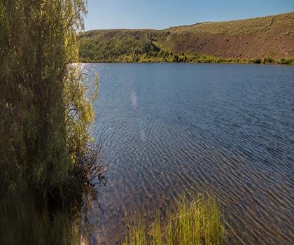
The reservoir itself anchors the lower portions of the route. Shoreline sections offer some of the most photogenic moments of the hike, with calm water reflecting the peaks above when conditions are right. These stretches also serve as natural rest points where you can take a breath, refuel, and take stock of how far you've come.
What Makes This Route Hard
The hard difficulty rating here is primarily driven by the elevation gain. At 1,550 meters over 14.1 km, this is a sustained effort — comparable to some of the more demanding day hikes in the Rockies. The terrain itself is generally well-maintained and clearly marked, so the challenge is physical rather than technical. That said, mountain conditions can shift quickly, and the upper sections of the loops will expose you to wind and weather in a way the forested lower trail does not.
If you're newer to mountain hiking, this route is better approached after building some base fitness on easier trails first. For experienced hikers, it's a satisfying full-day objective that doesn't require technical gear or scrambling skills — just solid legs and good preparation.
Wildlife and Natural Features
The mix of forest, water, and open meadow around Brazeau Reservoir creates habitat that supports a range of wildlife. Deer are commonly spotted, particularly during early morning hours when they move through the meadow sections. The varied ecosystems along the route also attract numerous bird species, and the transition zones between forest and open terrain are often the most productive spots for wildlife observation.
During summer, wildflower displays in the meadow sections add real color to the hike. The lower, sheltered areas support moisture-loving undergrowth, while the more exposed upper sections showcase the hardier vegetation typical of higher elevations in the Rockies. These ecological shifts happen gradually as you gain elevation, and paying attention to them adds another layer of interest to the day.
Viewpoints and Photography
The upper sections of the loops deliver the panoramic payoff you're working toward. From the higher viewpoints, you get unobstructed sightlines across the reservoir to the mountain ranges beyond — the kind of classic Rocky Mountain composition that justifies the effort of getting there. Morning light tends to illuminate the eastern faces of the peaks, while afternoon sun brings warmth to the water and surrounding vegetation. If you have flexibility in your start time, an early departure gives you the best light on the upper terrain and helps you avoid afternoon weather that can build over the mountains.
Planning Your Visit
An 8-hour time estimate means an early start is worth taking seriously. Leaving the trailhead by 7 or 8 a.m. gives you a comfortable buffer for the distance and elevation, time to linger at viewpoints, and a reasonable margin if conditions slow you down. Mountain weather in Alberta can change fast, and the upper sections of this route leave you exposed — afternoon thunderstorms are a real consideration in summer.
Carry more water than you think you need. The elevation gain and full-day duration mean your body will work hard, and the shoreline sections, while scenic, are not reliable water sources without treatment. Pack layers regardless of the morning forecast — temperatures at the upper elevations can drop significantly compared to the trailhead, and wind exposure on the open sections adds to the chill factor.
The trail system is well-marked, which reduces navigation stress and lets you focus on the terrain. That said, having offline trail data on your phone or a basic paper map gives you useful context for the loop options and helps you make informed decisions mid-hike if you need to adjust your route based on time or energy.
The loops are generally accessible from late spring through fall, with the best conditions typically running through the summer months once the upper sections have cleared of snow. Early season hikers should expect lingering snowpack at elevation and potentially wet, soft trail conditions in the lower sections.
Recommended gear for this trail
As an Amazon Associate I earn from qualifying purchases.


Ready to go?
Everything you need to know before you goStarting Point
The brazeau reservoir loops are located in Alberta, Canada. To get to the start of the trails, take Highway 22 west from Drayton Valley for approximately 45 minutes. Turn left onto Range Road 171 and drive for another 10 minutes until you reach the trailhead parking lot.
When?
How much?
As an Amazon Associate I earn from qualifying purchases.
Affiliate links — LGPO may earn a commission at no extra cost to you.
- Hiking shoes Essential
- → Salomon Elixir Tour Mid WP · 203.38 $
- Layered clothing Essential
- Rain jacket Essential
- Trekking poles
- → Black Diamond Trail Ergo Cork · 69.99 $
- Headlamp
- → Petzl Actik Core 625 · 103.95 $
FAQ - Frequently asked questions
Everything you need to know
25 hikes under 2 hours from Montreal
Distance, elevation, parking and season for each one. The ones we go back to ourselves.
Get the guideSimilar hikes nearby
Discover other trails you might enjoy
Ghost Lake
West Country
Siffleur Falls
West Country
Crescent Falls
West Country
Hummingbird Falls
West Country
Fish Lake Campground
West Country

Peppers Lake
West Country
Hiking near Edmonton
42 trails to explore ~155 km away
We work hard to provide the most up-to-date and error-free data possible. If something seems incorrect, let us know! Your contribution helps the whole community.
Hikers' opinions
Be the first to review!
No hiker has shared their experience yet. Share your impressions and help other hikers!