
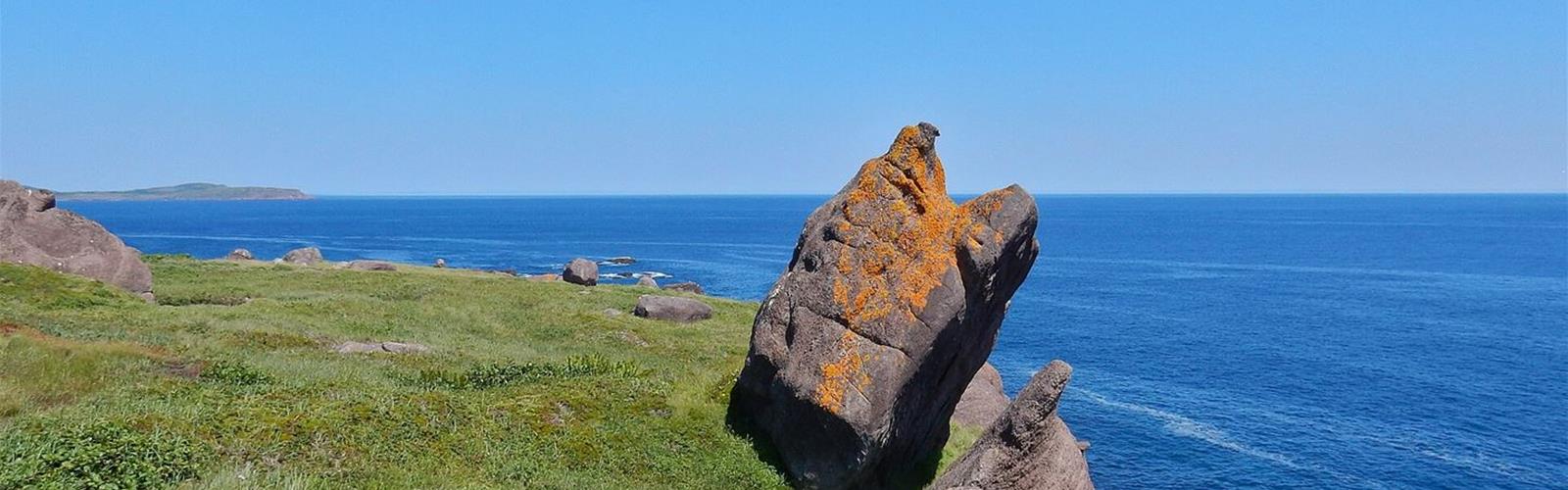
Ready to explore East Coast Trail? Here's everything you need to know before you go!
Discover the trail

Trail description
One trail, 25 paths
According to the ECTA, the East Coast Trail links more than 30 historic coastal communities. The sections between communities are called paths: each one begins and ends at a trailhead, typically at the north and south end of a community. Path 1 (Long Shore Path) starts at Topsail; path 25 (Island Meadow Path) ends at Cappahayden.
The trail is continuous and linear: it does not loop. Paths are mostly connected by a “community walk” through the town, sometimes along the road (the ECTA’s example: Flamber Head Path ends on the north side of Brigus South Harbour and Brigus Head Path starts on the south side). The 6.3-km access trail for Motion/Spout and the 1.4-km access trail for La Manche Village/Flamber Head lead from the coast back to a road or parking lot.
Choosing a path
Published distances are one way. The ECTA describes its difficulty ratings this way: easy (generally 2 to 7 km, elevation changes of no more than 25 m, bridges, steps and retaining walls), moderate (4 to 11 km, elevation changes up to 75 m), difficult (9 to 17 km, elevation changes up to 150 m, more rugged trail) and strenuous (long paths, elevation changes over 150 m, minimal trail structures). From moderate up, it warns to expect cliffs, steep climbs and an uneven trail bed.
Five paths are rated easy: Silver Mine Head (3.8 km, 2 h), Tinkers Point (5.0 km, 2 to 3 h), La Manche Village (6.4 km, 2 to 3 h), Beaches (7.1 km, 2 to 3 h) and Father Troys (8.9 km, 2 to 4 h). Four of them (Silver Mine Head, Father Troys, Beaches and Tinkers Point) are listed in the ECTA’s advisories (see below). At the other end of the scale, Piccos Ridge, White Horse and Spout are rated strenuous: 14.5 to 18.2 km, 6 to 10 hours estimated.
The 25 paths, north to south (one-way distances, times and ratings from the ECTA)
- 01. Long Shore Path (Topsail – Portugal Cove): 17.2 km, 6 to 8 h estimated, moderate to difficult
- 02. Piccos Ridge Path (Portugal Cove – Bauline): 14.5 km, 7 to 9 h estimated, strenuous
- 03. White Horse Path (Bauline – Cape St. Francis): 18.2 km, 8 to 10 h estimated, strenuous
- 04. Biscan Cove Path (Cape St. Francis – Pouch Cove): 7.0 km, 2 to 4 h estimated, moderate to difficult
- 05. Stiles Cove Path (Pouch Cove – Flatrock): 15.1 km, 5 to 7 h estimated, moderate
- 06. Father Troys Trail (Flatrock – Torbay): 8.9 km, 2 to 4 h estimated, easy — Tapper’s Cove section closed, detour of about 1 km (see “ECTA advisories”)
- 07. Silver Mine Head Path (Torbay – Outer Cove): 3.8 km, 2 h estimated, easy — roadworks on Marine Drive until November 30, 2026 (see “ECTA advisories”)
- 08. Cobblers Path (Outer Cove – Logy Bay): 5.0 km, 2 to 3 h estimated, moderate
- 09. Sugarloaf Path (Logy Bay – Quidi Vidi Village (St. John's)): 8.8 km, 3 to 5 h estimated, moderate to difficult
- 10. Deadmans Bay Path (Fort Amherst (St. John's) – Blackhead): 10.5 km, 4 to 7 h estimated, moderate to difficult
- 11. Cape Spear Path (Blackhead – Maddox Cove): 15.4 km, 5 to 7 h estimated, moderate
- 12. Motion Path (Petty Harbour – Shoal Bay Road (Goulds)): 13.8 km, 5 to 8 h estimated, moderate to difficult
- 13. Spout Path (Shoal Bay Road (Goulds) – Bay Bulls): 16.2 km, 6 to 9 h estimated, strenuous
- 14. Mickeleens Path (Bay Bulls – Witless Bay): 7.2 km, 2 to 4 h estimated, moderate — status “Open, Caution” on the path page
- 15. Beaches Path (Witless Bay – Mobile): 7.1 km, 2 to 3 h estimated, easy
- 16. Tinkers Point Path (Mobile – Tors Cove): 5.0 km, 2 to 3 h estimated, easy
- 17. La Manche Village Path (Tors Cove – La Manche Village): 6.4 km, 2 to 3 h estimated, easy
- 18. Flamber Head Path (La Manche Village – Brigus South): 11.5 km, 5 to 8 h estimated, moderate to difficult
- 19. Brigus Head Path (Brigus South – Admirals Cove): 6.4 km, 2 to 3 h estimated, moderate
- 20. Cape Broyle Head Path (Cape Broyle – Calvert): 19.4 km, 6 to 10 h estimated, difficult to strenuous
- 21. Caplin Bay Path (Calvert – Ferryland): 5.6 km, 2 to 3 h estimated, easy to moderate
- 22. Sounding Hills Path (Ferryland – Aquaforte): 5.4 km, 2 to 3 h estimated, easy to moderate — closed at the Ferryland trailhead (see “ECTA advisories”)
- 23. Spurwink Island Path (Aquaforte – Port Kirwan): 20.4 km, 7 to 10 h estimated, difficult
- 24. Bear Cove Point Path (Kingmans Cove – Renews): 11.9 km, 4 to 6 h estimated, moderate
- 25. Island Meadow Path (Renews – Cappahayden): 10.0 km, 3 to 5 h estimated, moderate
Getting back to your start
The ECTA suggests leaving a car at each end, taking a taxi back (call ahead), hiking out and back, or returning by road. Metrobus serves two trailheads: Shoal Bay Road in Goulds (Spout Path, Route 18) and Quidi Vidi Village in St. John’s (Sugarloaf Path, Route 15). These services are independent of the ECTA and can change without notice.
Before you go
The ECTA calls trail-rated hiking boots or shoes a must: sneakers, running shoes, sandals and flip-flops do not protect ankles and soles enough. It also recommends its path maps, layers, a cell phone (intermittent coverage), water (300 ml per hour per person) and an early start to finish in daylight. Fog can roll in without notice, and conditions often do not match forecasts.
When to go
According to the ECTA, the best time is April to November, when the trail is most likely free of snow and ice; it is warmest from June to early September. No trail clearing or condition updates in winter: November to April per the ECTA’s FAQ, December to March per its preparation page. Icebergs are typically seen in May and June, whales from June to August, with no guarantee.
Trail rules
- Pedestrians only: no cycling, horseback riding or wheeled vehicles, motorized or not.
- No open fires; a gas or liquid-fuel stove is allowed.
- Dogs are allowed if under their owner’s control; owners must follow provincial legislation and municipal by-laws and are asked to remove pet waste.
- The trail crosses Crown land and private property.
Camping
Six primitive campsites with pit toilets are found near the mid-point of the longest paths: White Horse (5 tent platforms), Motion (no platforms, but levelled sites), Spout (5), Flamber Head (4), Cape Broyle Head (6) and Spurwink Island (4). They are reached on foot only and cannot be reserved. Serviced camping is available at La Manche Provincial Park, reached from La Manche Village Path.
ECTA advisories (as of October 23, 2026)
- Father Troys Trail: the section through Tapper’s Cove in Torbay is closed during reconstruction of the wharf and breakwater; a detour of about 1 km is signed. The notice, updated April 15, 2026, says the closure may remain in effect until spring 2027.
- Silver Mine Head Path: Marine Drive is closed from Chad’s Lane to Lower Road from August 10 to November 30, 2026, and access to the Outer Cove trailhead may be difficult.
- Sounding Hills Path: closed at the Ferryland trailhead because of a conflict with a landowner; it is still possible to hike from Aquaforte as far as Herring Cove and return.
- Whole network: the ECTA reports more fallen trees than usual, wet and muddy sections and deteriorated structures; Stiles Cove, Beaches, Tinkers Point, Bear Cove Point and Island Meadow are named (advisories page updated December 16, 2025).
The ECTA’s Path Advisories page is the reference; the association also answers at 709-738-4453 or information@eastcoasttrail.com.
Services and amenities
Parking at trailheads; six primitive campsites with pit toilets on the longest paths; serviced camping at La Manche Provincial Park.
Everything you need for your next hike. Bilingual, printable, 1 page.
Get your free hiking checklistRecommended gear for this trail
As an Amazon Associate I earn from qualifying purchases.


Ready to go?
Everything you need to know before you goStarting Point
There is no single starting point. Path 1 (Long Shore Path) starts at Topsail and path 25 (Island Meadow Path) ends at Cappahayden. Trailheads, parking and maps for each path are on that path’s page on the ECTA website.
When?
How much?
As an Amazon Associate I earn from qualifying purchases.
Affiliate links — LGPO may earn a commission at no extra cost to you.
- Hiking shoes Essential
- → Salomon Elixir Tour Mid WP · 203.38 $
- Layered clothing Essential
- Rain jacket Essential
- Trekking poles
- → Black Diamond Trail Ergo Cork · 69.99 $
- Headlamp
- → Petzl Actik Core 625 · 103.95 $
FAQ - Frequently asked questions
Everything you need to knowSimilar hikes nearby
Discover other trails you might enjoy


Hiking near Sydney
25 trails to explore ~591 km away
We work hard to provide the most up-to-date and error-free data possible. If something seems incorrect, let us know! Your contribution helps the whole community.
Hikers' opinions
Be the first to review!
No hiker has shared their experience yet. Share your impressions and help other hikers!