
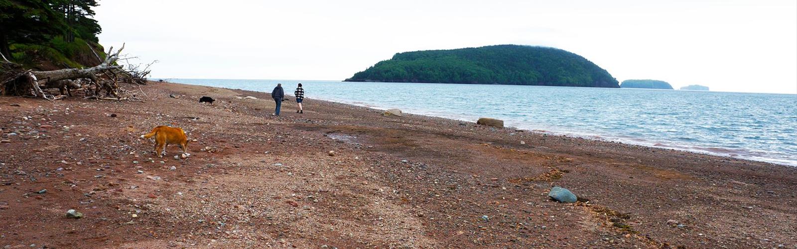

Ready to explore Five Islands Provincial Park? Here's everything you need to know before you go!
Discover the trail
Trail description
Five Islands Provincial Park sits along Nova Scotia's Glooscap Trail, where the Bay of Fundy's extreme tides have sculpted one of the most dramatic coastal landscapes in the Maritimes. The park takes its name from five distinctive islands visible offshore—Moose, Diamond, Long, Egg, and Pinnacle—each rising from the bay like ancient sentinels carved by millions of years of tidal action. At 11 kilometers with 300 meters of elevation gain, the trail system here offers a genuinely rewarding moderate hike that earns its views without demanding technical skill.
Trail Experience and Terrain
The Red Head Trail is the park's signature route, and it delivers the kind of experience that stays with you. The trail moves through dense Acadian mixed forest—towering spruce and fir closing in around you—before breaking suddenly onto exposed basalt cliffs with unobstructed views across the bay. That contrast, between the intimacy of the forest and the raw openness of the clifftops, is one of the things that makes this hike feel more substantial than its moderate rating might suggest.
Trail surfaces shift as you move through the park. Forested sections follow well-maintained dirt paths, while the coastal stretches become rockier and less predictable underfoot. There are steep sections as the trail climbs toward the cliff edges, but nothing that requires scrambling or special gear. Most reasonably fit hikers will find the 4-hour-15-minute estimated time accurate, though stopping for views—and you will stop—can stretch that comfortably.
The tidal influence here is impossible to ignore and genuinely worth planning around. The Bay of Fundy's tides rise and fall up to 16 meters twice daily, which means the landscape you see at the start of your hike may look completely different by the time you finish. At low tide, vast mudflats extend from the base of the cliffs, exposing tidal pools and fossil-bearing rocks. At high tide, waves push right up against those same cliffs, and the five islands take on a more isolated, dramatic presence. Checking tide times before you head out isn't just a nice extra—it meaningfully shapes what you'll experience.
Geological Features
Five Islands is as much a geology lesson as it is a hike. The dark columnar basalt cliffs you'll walk along formed from volcanic activity roughly 200 million years ago, part of the same geological forces that shaped much of the Bay of Fundy coastline. These formations create near-vertical walls that drop sharply to the water, contrasting with the red sandstone and mudstone layers visible elsewhere in the park.
At low tide, the exposed tidal flats reveal fossils embedded in ancient sedimentary rock—plant fossils and trace fossils from organisms that lived here long before the current landscape existed. The combination of soft sedimentary rock and extreme tidal action creates unusually good conditions for fossil exposure. Worth noting: collecting fossils is not permitted within the provincial park, so bring a camera rather than a bag.
Seasonal Considerations
Summer is the most straightforward time to visit—comfortable temperatures, long daylight hours, and the ability to plan your hike around a specific tide window. Spring brings migrating seabirds and wildflowers in the forest understory, though trails can be soft and muddy as the ground thaws. Fall is arguably the most visually striking season, with the mixed forest turning red, orange, and yellow against the dark basalt cliffs and the bay beyond. The clearer fall air also extends views across the water noticeably. Winter hiking is possible but demands real preparation—ocean spray can ice over the cliff-edge sections, and those areas become genuinely hazardous without proper footwear and caution.
Camping and Extended Stays
The park's campground serves both tent campers and RV users, with sites positioned to make the most of the coastal setting. Staying overnight lets you experience the full tidal cycle and hike the same coastal sections at different tide stages—a worthwhile exercise that shows just how dramatically this landscape transforms. Facilities include washrooms, showers, and picnic areas, making it a practical base for exploring the broader Glooscap Trail region as well.
Cultural Context
The park sits within Mi'kmaq territory, and the Glooscap Trail takes its name from a central figure in Mi'kmaq oral tradition. According to that tradition, the five islands are clods of earth thrown by the giant Glooscap at a great beaver, an origin story that ties the landscape directly to the cultural history of the people who have lived along this coastline for thousands of years. That layer of meaning adds something to the experience of standing on those cliffs and looking out at the islands—they're not just geological features, but landmarks with deep human significance.
What to Know Before You Go
- Distance: 11 km
- Elevation gain: 300 m
- Difficulty: Moderate
- Estimated time: 4 hours 15 minutes
- Tides: Check Bay of Fundy tide tables before your visit—timing matters here more than at most coastal parks
- Fossils: Visible at low tide on the tidal flats; collecting is not permitted within the park
- Camping: Available on-site for tent campers and RVs, with washrooms and showers
- Winter conditions: Ocean spray can create icy footing near cliff edges—use caution and appropriate footwear
Five Islands Provincial Park delivers a coastal hiking experience that feels genuinely wild without requiring an expedition to reach it—dramatic cliffs, ancient geology, extreme tides, and five islands that have been part of this landscape's story for far longer than any trail has existed here.
The Essential Hiking Checklist
Everything you need for your next hike. Bilingual, printable, 1 page.
Get your free hiking checklistRecommended gear for this trail
As an Amazon Associate I earn from qualifying purchases.


Ready to go?
Everything you need to know before you goStarting Point
The five islands provincial park is located in the Municipality of Argyle, Nova Scotia. To get to the start of the trails, take Highway 105 to Exit 6 and go left on Highway 329. The park is located about 5 km down the road on the right hand side.
When?
How much?
As an Amazon Associate I earn from qualifying purchases.
Affiliate links — LGPO may earn a commission at no extra cost to you.
- Hiking shoes Essential
- → Salomon Elixir Tour Mid WP · 203.38 $
- Layered clothing Essential
- Rain jacket Essential
- Trekking poles
- → Black Diamond Trail Ergo Cork · 69.99 $
- Headlamp
- → Petzl Actik Core 625 · 103.95 $
FAQ - Frequently asked questions
Everything you need to knowSimilar hikes nearby
Discover other trails you might enjoy

Ettinger Falls
Bay of Fundy & Annapolis Valley
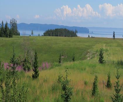
Cape Chignecto Provincial Park
Bay of Fundy & Annapolis Valley
Cape Split Trailhead
Bay of Fundy & Annapolis Valley
Burntcoat Head Park
Bay of Fundy & Annapolis Valley
McMaster Mill Historic Park
Bay of Fundy & Annapolis Valley
Shubenacadie Provincial Wildlife Park
Bay of Fundy & Annapolis Valley
Hiking near Truro
70 trails to explore ~61 km away
We work hard to provide the most up-to-date and error-free data possible. If something seems incorrect, let us know! Your contribution helps the whole community.
Hikers' opinions
Be the first to review!
No hiker has shared their experience yet. Share your impressions and help other hikers!