

Ready to explore Gaspereau Lake? Here's everything you need to know before you go!
Discover the trail
Trail description
Gaspereau Lake sits quietly in Nova Scotia's Evangeline Trail region, offering a satisfying mix of forest walking and lakeside scenery without demanding too much from the people who come to explore it. The trail covers 5.6 kilometers with 300 meters of elevation gain, rated moderate, and most hikers complete it in around 2 hours and 15 minutes. It's the kind of hike that rewards you without punishing you — enough climbing to feel like you've earned the views, but nothing that requires technical skills or specialized gear.
What the Trail Is Like
From the trailhead, you step directly into mixed forest — maple, birch, and evergreens forming a canopy that filters the light into shifting patterns on the ground below. The first stretch follows gentle contours through the woods, gradually pulling you upward. The climbing is steady rather than steep, and the terrain underfoot is varied: packed earth, exposed roots, the occasional rocky patch. After rain, some sections get muddy, so footwear with decent tread makes a real difference.
The moderate rating here comes from the combination of distance and consistent elevation change rather than any single difficult section. The path is wide enough to walk comfortably and well-marked at junctions, so route-finding isn't a concern. What you'll notice most is the rhythm of the hike — the way the forest gradually opens as you gain height, offering glimpses of the lake through the trees before the full view arrives.
Around the halfway point, the forest pulls back and Gaspereau Lake comes into full view. That transition — from dense woodland to open water — is one of those moments that makes the whole thing click. From there, the trail tracks closer to the shoreline, and you'll find several natural spots to step down to the water's edge.
The Lake Itself
Gaspereau Lake is calm and relatively sheltered, which makes it appealing beyond just the hiking. The water is clear in the shallows, and the surrounding hills frame it in a way that feels complete from almost any angle along the shore. The lakeside sections of the trail offer smooth rocks and grassy patches where it's easy to stop, eat lunch, and watch the water for a while before continuing.
The lake also draws paddlers — kayakers and canoeists find natural launch points along the shoreline, and the protected conditions are manageable even for beginners. Getting out on the water gives you a different perspective on the surrounding hills, including angles that aren't visible from the trail.
Wildlife and Natural Features
The mixed forest and lake habitat together support a solid range of wildlife. Deer are a common sight, particularly in the early morning and late afternoon near the smaller meadow areas close to the lake. Red foxes show up occasionally along the trail. Birdwatchers will find the habitat productive — woodpeckers, nuthatches, and various songbirds work through the forest, while the lake itself attracts ducks and loons. Migration periods bring additional activity as species move through the region.
Wildflowers follow the seasons along the trail edges: trilliums and wild violets in spring, goldenrod and purple asters through summer. Fall is when the surrounding forest really shifts — the maples and birches turn, and the whole landscape takes on the reds and golds that make autumn hiking in Nova Scotia worth planning around.
Seasonal Notes
Spring brings fresh growth and active birds, but expect some muddy sections from snowmelt, especially in the lower forested stretches. Summer offers the longest days and the best conditions for combining the hike with time on the water. Fall is arguably the strongest season visually, with cooler temperatures, fewer insects, and the full color display in the mixed forest. Winter access varies with snow conditions, but the area can work well for snowshoeing when you're properly equipped for it.
Planning Your Visit
The 5.6-kilometer distance and moderate rating put this trail within reach of most hikers with a reasonable base fitness level. Families with older kids who are comfortable with longer walks should find it manageable, though the full distance means planning for enough time and carrying adequate water and snacks. Standard hiking footwear handles the terrain well in dry conditions; something with grip is worth it when it's wet. A small first aid kit is always a sensible addition for any hike of this length.
The trail's location along the Evangeline Trail makes it straightforward to reach by car, and the setting delivers genuine quiet — the kind that's harder to find the closer you stay to town.
The Essential Hiking Checklist
Everything you need for your next hike. Bilingual, printable, 1 page.
Get your free hiking checklistRecommended gear for this trail
As an Amazon Associate I earn from qualifying purchases.


Ready to go?
Everything you need to know before you goStarting Point
To access the hiking trails, head towards gaspereau lake in the Evangeline Trail area. The primary trailhead can be reached by driving to the parking lot located at 1234 gaspereau lake Road, Kings County, Nova Scotia. If there are multiple trailheads, another option is to start from the secondary access point at 5678 Lakeview Drive, Kings County, Nova Scotia. Both locations provide convenient entry points for exploring the trails around the lake.
When?
How much?
As an Amazon Associate I earn from qualifying purchases.
Affiliate links — LGPO may earn a commission at no extra cost to you.
- Hiking shoes Essential
- → Salomon Elixir Tour Mid WP · 203.38 $
- Layered clothing Essential
- Rain jacket Essential
- Trekking poles
- → Black Diamond Trail Ergo Cork · 69.99 $
- Headlamp
- → Petzl Actik Core 625 · 103.95 $
FAQ - Frequently asked questions
Everything you need to knowSimilar hikes nearby
Discover other trails you might enjoy

Ettinger Falls
Bay of Fundy & Annapolis Valley
Cape Chignecto Provincial Park
Bay of Fundy & Annapolis Valley
Cape Split Trailhead
Bay of Fundy & Annapolis Valley
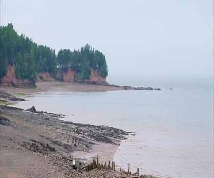
Burntcoat Head Park
Bay of Fundy & Annapolis Valley
McMaster Mill Historic Park
Bay of Fundy & Annapolis Valley
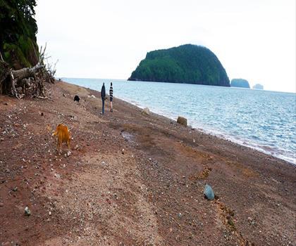
Five Islands Provincial Park
Bay of Fundy & Annapolis Valley
Hiking near Halifax
71 trails to explore ~85 km away
We work hard to provide the most up-to-date and error-free data possible. If something seems incorrect, let us know! Your contribution helps the whole community.
Hikers' opinions
Be the first to review!
No hiker has shared their experience yet. Share your impressions and help other hikers!