
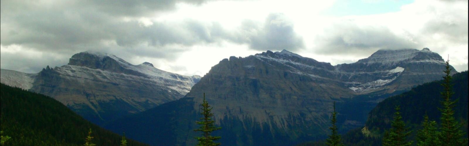

Ready to explore Batchawana Mountain, Ontario? Here's everything you need to know before you go!
Discover the trail
Oh no! We don't have any photos 😢
This trail hasn't been captured yet. Be the first to share your adventure!Trail description
Batchawana Mountain is one of those hikes in Northeastern Ontario that quietly earns its reputation. It's not a technical climb, but it delivers a genuine sense of accomplishment — a steady ascent through boreal forest that opens up to sweeping views over the Lake Superior highlands. With 8 km of trail, 626 m of elevation gain, and an estimated 3.5 hours on the trail, it sits in that satisfying sweet spot: accessible enough for motivated beginners, rewarding enough for experienced hikers looking for a solid half-day outing.
The Terrain
The trail gains elevation consistently as you move through the forest. The boreal landscape here is classic Northeastern Ontario — spruce, fir, and birch dominate the canopy, with rocky outcrops becoming more frequent as you climb. The footing is generally manageable, though some sections involve exposed roots and uneven ground, so trail shoes or light hiking boots are a better call than runners. The 626 m of elevation gain is real and cumulative, meaning you'll feel it in your legs even if no single section is brutally steep. The trail is rated Easy, but that rating reflects the absence of technical scrambling rather than a flat or effortless walk.
What You'll See at the Top
The payoff at the summit is the view. From the top of Batchawana Mountain, you get a wide panorama over the surrounding highlands and boreal landscape — the kind of perspective that reminds you just how vast and undeveloped this part of Ontario remains. On a clear day, the visibility is exceptional. This is the kind of summit view that makes the climb feel entirely worth it, and it's a good spot to take a proper break before heading back down.
Planning Your Hike
The 8 km distance is the full out-and-back, so plan accordingly. At 3.5 hours estimated, most hikers will want to budget a bit of extra time if they plan to linger at the top or move at a relaxed pace. Bring enough water for the full round trip — there are no reliable water sources on the trail itself. Snacks or a light lunch at the summit make the experience more enjoyable, especially if you're hiking with kids or less experienced companions.
- Distance: 8 km
- Elevation gain: 626 m
- Difficulty: Easy (steady climb, no technical scrambling)
- Estimated time: 3 hours 30 minutes
- Trail type: Out-and-back
Getting There
Batchawana Mountain is located in the Batchawana Bay area of Northeastern Ontario, north of Sault Ste. Marie along the Lake Superior coast. The region is accessible via Highway 17, which runs along the eastern shore of Lake Superior. If you're making a day trip from Sault Ste. Marie, factor in the drive time when planning your start time — an early morning departure gives you the best chance of catching clear skies at the summit and avoiding any afternoon weather that can roll in off the lake.
Best Time to Go
Summer and early fall are the prime seasons for Batchawana Mountain. The trail is most enjoyable from late June through early October. Fall is particularly striking in this part of Ontario — the boreal forest puts on a strong colour show, and the cooler temperatures make the climb more comfortable. Early season hikers should be aware that the trail can be muddy and wet through May and into June depending on snowmelt. Winter access is possible for those equipped for it, but the trail is not maintained for winter use.
A Few Things Worth Knowing
Northeastern Ontario's weather can shift quickly, especially in the Lake Superior highlands. Even on a warm day in the valley, conditions at the summit can be cooler and windier than expected — bring an extra layer. Cell service in this area is limited or nonexistent, so download your maps offline before you leave. Let someone know your plans before heading out, particularly if you're hiking solo.
Batchawana Mountain is the kind of hike that fits naturally into a broader Lake Superior North Shore itinerary — the surrounding area offers camping, fishing, and access to Batchawana Bay Provincial Park, making it easy to build a full weekend around the region.
The Essential Hiking Checklist
Everything you need for your next hike. Bilingual, printable, 1 page.
Get your free hiking checklistRecommended gear for this trail
As an Amazon Associate I earn from qualifying purchases.


Ready to go?
Everything you need to know before you goStarting Point
To access the hiking trails, head to the Batchawana Mountain area. The primary trailhead can be reached by taking Highway 17 north from Sault Ste. Marie. After approximately 80 kilometers, turn onto Batchawana Bay Road and continue for about 10 kilometers until you reach the designated parking area near the trailhead. There are no alternative trailheads for this location.
When?
How much?
As an Amazon Associate I earn from qualifying purchases.
Affiliate links — LGPO may earn a commission at no extra cost to you.
- Hiking shoes Essential
- → Salomon Elixir Tour Mid WP · 203.38 $
- Layered clothing Essential
- Rain jacket Essential
- Trekking poles
- → Black Diamond Trail Ergo Cork · 69.99 $
- Headlamp
- → Petzl Actik Core 625 · 103.95 $
FAQ - Frequently asked questions
Everything you need to knowSimilar hikes nearby
Discover other trails you might enjoy
Lake Superior Provincial Park
Sault Ste. Marie - Algoma
Aubrey Falls
Sault Ste. Marie - Algoma
Chippewa Falls
Sault Ste. Marie - Algoma
Pancake Bay Provincial Park
Sault Ste. Marie - Algoma
Searchmont Resort
Sault Ste. Marie - Algoma

Spider Lakes
Sault Ste. Marie - Algoma
Hiking near Barrie
146 trails to explore ~473 km away
We work hard to provide the most up-to-date and error-free data possible. If something seems incorrect, let us know! Your contribution helps the whole community.
Hikers' opinions
Be the first to review!
No hiker has shared their experience yet. Share your impressions and help other hikers!