

Ready to explore Cedar Creek Conservation Area? Here's everything you need to know before you go!
Discover the trail
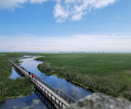
Oh no! We don't have any photos 😢
This trail hasn't been captured yet. Be the first to share your adventure!Trail description
Description
Cedar Creek Conservation Area delivers a hiking experience that captures the essence of Southwest Ontario's conservation landscape: accessible terrain, manageable elevation, and an environment where your attention shifts from conquering peaks to engaging with the subtle details of a protected natural area. With just 50 meters of elevation gain and an easy difficulty rating, this conservation area positions itself as a destination where the hiking experience is shaped by steady movement through varied terrain rather than by sustained climbs or technical challenges.As a Southwest Ontario hiking destination, Cedar Creek Conservation Area fits naturally into the region's profile of field-oriented, observation-friendly walks. This is the kind of place where hikers come seeking a grounded, accessible outing—one where the emphasis falls on experiencing the conservation area's character rather than chasing big numbers or dramatic elevation. The area supports that approach naturally, inviting you to hike with awareness switched on, treating the landscape as the main feature and your movement through it as the method for understanding what makes this place distinct.
Terrain character and effort distribution
With 50 meters of elevation gain spread across the route, Cedar Creek Conservation Area creates an effort profile defined by gentle undulations and gradual transitions rather than any single sustained ascent. The work here is distributed in manageable increments—small rises that briefly increase your breathing rate, followed by equally gentle descents that allow for natural recovery. This creates a hiking rhythm that rewards steady pacing over aggressive bursts of speed.The terrain encourages hikers to settle into a consistent cadence early and maintain it throughout. Instead of the climb-and-recover pattern you'd find on steeper routes, Cedar Creek allows you to stay in a conversational effort zone for most of the hike. Your body can find its natural rhythm and hold it, making this an ideal setting for practicing efficient hiking technique: light steps, steady breathing, and posture that stays relaxed and upright even as the ground rises and falls beneath you.
Because the elevation changes are modest and well-distributed, fatigue tends to accumulate gradually rather than hitting you in sudden waves. Managing your energy here is about maintaining comfort over time—staying hydrated, keeping your stride natural, and avoiding the common mistake of starting too fast simply because the initial terrain feels effortless. The conservation area rewards hikers who understand that "easy" doesn't mean "effortless," and that sustainable pacing pays dividends over the full distance.
How the hiking experience develops
Cedar Creek Conservation Area is the type of hike where progression unfolds as a gradual deepening of your connection to the place rather than a dramatic shift from easy to challenging terrain. The experience typically begins with an inviting opening: fresh legs, effortless pace, and terrain that seems to encourage quick movement. The smarter approach is to treat that early ease as an opportunity to hike intentionally rather than aggressively—especially if you want to make the most of the conservation area as a place to observe and absorb.As you continue deeper into the area, the gentle elevation changes create a subtle but noticeable pattern. Small rises require momentary increases in effort, followed by brief recoveries on the descents. Over time, these micro-changes can accumulate in your perceived exertion, particularly if you've been maintaining a brisk pace. The most efficient way to handle this terrain is to keep your output steady, shorten your stride slightly when the ground tilts upward, and resist the urge to "power over" small hills. This approach protects your energy reserves and keeps your movement smooth and sustainable.
The conservation area's terrain also lends itself well to group hiking. Without major climbs that can split groups by fitness level, it's easier to keep everyone together and maintain a shared rhythm. This makes Cedar Creek an excellent choice for mixed-ability groups or hikers who value a cohesive, social outing where conversation can flow naturally alongside the walking.
Sensory engagement and environmental awareness
A conservation area carries an implicit invitation: you're moving through a landscape that's been set aside for its natural and recreational value. At Cedar Creek, this translates into a hiking experience where the environment isn't just scenery passing by—it's an active part of what makes the outing worthwhile. The most rewarding approach is to dial down your internal pace clock and shift from distance-focused hiking to place-focused exploration.In practical terms, this means allowing your attention to work on multiple levels: scanning broadly to take in the overall character of the conservation area, then narrowing your focus to notice details as they emerge. It means listening as much as looking, and staying aware of how the area's character shifts as you move through different sections. Even without dramatic elevation changes, the route can feel varied and engaging because your awareness is actively engaged with the surroundings.
Because the terrain doesn't force frequent stops for recovery, you have the freedom to choose your pauses based on interest rather than necessity. This creates opportunities to develop your own rhythm of movement and stillness: walk steadily when the trail flows, pause when something catches your attention, then resume without needing a long restart effort. The conservation area becomes a place where you can practice the art of attentive hiking—moving with purpose while remaining open to what the landscape offers.
Ideal hiker profile and expectations
Cedar Creek Conservation Area aligns well with hikers seeking an outing that emphasizes accessibility and environmental engagement over physical challenge. If you're newer to hiking, returning after time away from the trails, or looking for a lower-impact walk that still feels like a legitimate outdoor adventure, the gentle elevation profile supports a comfortable experience while providing the satisfaction of exploring Southwest Ontario's conservation landscape on foot.The area also appeals to experienced hikers who value intentional time outdoors over pure physical challenge. This can serve as an excellent "active recovery" outing—a walk that keeps you moving and engaged without depleting your energy reserves—while still feeling purposeful because you're navigating real terrain and engaging with a protected natural area on its own terms.
For hikers who enjoy a field-style experience—moving deliberately through a conservation setting, maintaining environmental awareness, and letting the landscape set the tone—Cedar Creek provides an ideal framework. The manageable terrain allows you to focus on observation and appreciation rather than simply surviving the physical demands of the route.
Practical approach and preparation mindset
Approach Cedar Creek Conservation Area with a preparation strategy that matches its character: you're hiking in a conservation setting where comfort and sustained awareness matter more than extreme gear or aggressive pacing. Choose footwear that supports steady walking over varied terrain and maintains comfort throughout your time on the trail. When elevation changes are gentle, the repetitive nature of steps becomes more noticeable, making proper fit and support crucial for preventing accumulated foot fatigue.Pacing becomes the primary skill to master here. Establish a tempo you can maintain without conscious effort, and resist treating the trail as a speed test simply because the terrain feels forgiving. Keep your posture relaxed, shoulders down, and breathing quiet and steady. If you're carrying a pack, ensure it's properly adjusted to prevent bouncing—on gentler terrain, small equipment annoyances can become disproportionately prominent because nothing else is demanding your immediate attention.
Most importantly, carry yourself with the mindset appropriate to a conservation area: move deliberately, stay attentive to your surroundings, and treat the hike as quality time spent in a place with its own distinct character. The reward at Cedar Creek Conservation Area isn't measured by how hard you pushed yourself physically—it's measured by how fully you experienced this piece of Southwest Ontario on foot, at a pace that allows the conservation area to reveal its character step by step.
Recommended gear for this trail


Ready to go?
Everything you need to know before you goStarting Point
The cedar creek conservation area is located in Ontario, Canada. To get to the start of the trails, take Highway 401 to exit 496 and go north on County Road 2 for about 5 km. The conservation area will be on your left.
When?
How much?
- Hiking shoes Essential
- → Salomon Elixir Tour Mid WP · 203.38 $
- Layered clothing Essential
- Rain jacket Essential
- Trekking poles
- → Black Diamond Trail Ergo Cork · 69.99 $
- Headlamp
- → Petzl Actik Core 625 · 103.95 $
FAQ - Frequently asked questions
Everything you need to knowThe Essential Hiking Checklist
Everything you need for your next hike. Bilingual, printable, 1 page.
Download the free checklistSimilar hikes nearby
Discover other trails you might enjoy

Lynn Valley Trails
Southwest Ontario
Point Pelee National Park High Point, Ontario
Southwest Ontario
Oxford Thames River Trail
Southwest Ontario
Ojibway Prairie Provincial Nature Reserve
Southwest Ontario
Pinery Provincial Park
Southwest Ontario
Springbank Park
Southwest Ontario
Hiking near Kitchener
142 trails to explore ~248 km away
We work hard to provide the most up-to-date and error-free data possible. If something seems incorrect, let us know! Your contribution helps the whole community.
Hikers' opinions