Hiking Ganatchio Trail - panoramic view  tree outdoor landscape nature mountain sky autumn plant cloud background lake painting forest surrounded distance
--°C
Loading...
See forecast →

Hiking in Ganatchio Trail: trails, map and practical info

Southwest Ontario • Ontario

4.0 Appreciated by 17 hikers
François Dumaine
By François DumaineContributor since 2013Updated 22/05/2026
Distance
8 km
Elevation
10 ft
Duration
1h15

Explore Windsor's 8 km multi-use pathway featuring rare dual cycling lanes in each direction—a design shared only with the Riverfront Trail. This 1h15 walk or ride through Southwest Ontario connects urban neighborhoods to beach access points along Lake St. Clair.

Recommended for :

Ready to explore Ganatchio Trail? Here's everything you need to know before you go!

Discover the trail

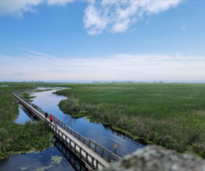
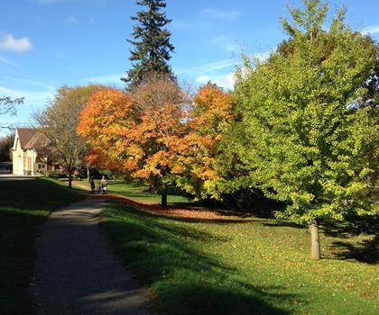
Oh no! We don't have any photos 😢

This trail hasn't been captured yet. Be the first to share your adventure!

Trail description

Description

The Ganatchio Trail stands as Windsor's second major cycling and walking pathway, stretching 5.3 kilometers through diverse neighborhoods and offering a unique multi-use experience in southwestern Ontario. Named after the First Nations word for Lake St. Clair, this trail represents a thoughtful conversion of urban infrastructure into recreational space, transforming the former Clairview Avenue into a wide, accessible corridor for cyclists and pedestrians.

What sets the Ganatchio Trail apart from most regional pathways is its generous width, designed with two "lanes" in each direction. This feature, shared only with Windsor's Riverfront Bike Trail, allows two bicycles to ride side-by-side in each direction without collision concerns—a practical advantage during busy summer periods when the trail sees heavy use. The posted speed limit of 20 km/h helps maintain safe conditions for the mix of recreational cyclists, commuters, and walkers who share the space.

Route and Neighborhoods

The trail begins at Wyandotte Street and Vernon Crescent, winding through several distinct Windsor neighborhoods including Riverside and Little River before reaching the Windsor-Tecumseh border. This route takes you through varied urban landscapes, from residential areas to more natural settings near the waterfront access points.

A notable feature along the route is the special roundabout where the Ganatchio Trail intersects with the Little River Extension. This traffic circle includes commemorative signage displaying the trail's length, map location, and recognition of the Lions Club International and Rotary International, who funded the original construction in 1996. Additional commemorative signs mark the trail from beginning to end, providing historical context and wayfinding assistance.

The trail serves as a connector to two popular beach destinations: Sandpoint Beach and Stop 26 Beach and Park. These access points make the Ganatchio Trail particularly valuable for families looking to combine cycling or walking with waterfront recreation.

Trail Construction and Layout

The Ganatchio Trail's development occurred in phases, with the initial construction beginning in 1971 following the closure of Clairview Avenue. The trail incorporates much of this former narrow residential street, with some sections completely sealed off and others rerouted or truncated at intersecting streets. Where Clairview Street remains intact, the trail runs alongside it, but many cross streets like Watson Avenue were closed to vehicle traffic, creating pedestrian and cyclist-only passages.

From Watson to Genevieve Avenue, the original Clairview Avenue was a boulevard with two carriageways. The trail conversion transformed the second carriageway into the bike path, while some sections became complete greenways. This design creates a more natural feel in certain areas, moving beyond simple pavement conversion to incorporate landscaped elements.

The eastern portion of the trail, extending from Riverview Road to Tecumseh and including the bridge over Little River, was completed in 1979 and received significant rehabilitation and upgrades in 1983. This section connects the trail system toward Tecumseh, with extensions built in stages to create a more comprehensive regional network.

Trail Experience and Terrain

The Ganatchio Trail offers a predominantly flat, paved surface suitable for road bikes, hybrid bikes, and comfortable walking. The minimal elevation change makes it accessible for users of varying fitness levels and ages. The wide, well-maintained surface accommodates wheelchairs, strollers, and other mobility devices effectively.

As you travel the trail, you'll experience a mix of urban and semi-natural environments. The sections that follow the former Clairview Avenue retain some residential character, while the greenway conversions and areas near the Little River provide a more natural setting. The trail passes through forests and wetlands that offer seasonal wildlife viewing opportunities and a sense of escape from urban surroundings despite the trail's city location.

The bridge crossing over Little River provides a scenic highlight, offering views of the waterway and surrounding wetland areas. This section particularly showcases the trail's natural elements and demonstrates how urban trail development can preserve and highlight environmental features.

Seasonal Use and Traffic Patterns

Summer brings the heaviest use to the Ganatchio Trail and its Little River Extension, though traffic levels remain more manageable than those found on Windsor's busier Riverfront Bike Trail. This makes the Ganatchio Trail an excellent alternative for those seeking a substantial ride or walk without the crowds that can develop on the waterfront route during peak times.

The trail's connection to beach access points makes it particularly popular during warm weather when families combine trail use with beach visits. The wide design helps accommodate these higher summer volumes while maintaining comfortable conditions for all users.

Community Connections

The trail serves several community facilities, including the Riverside Sportsman's Club, a fraternal organization similar to the Lions Club International and Rotary International. These groups, along with the Riverside Sportsman's Club, provided funding for the trail's construction, demonstrating strong community investment in recreational infrastructure.

The Ganatchio Trail functions as both a recreational amenity and a practical transportation corridor, connecting neighborhoods and providing car-free access to waterfront areas. Its integration with the broader Windsor trail system, including connections to the Little River Extension and eventual links toward Tecumseh, makes it a valuable component of regional active transportation networks.

Ready to go?

Everything you need to know before you go

Where?

Address
Ganatchio Trail, Ontario, Canada
GPS coordinates
42.3332533, -82.922399
Phone
Not available

Starting Point

The ganatchio trail is located in Windsor, Ontario. To get to the start of the trails, take Highway 401 to the Ambassador Bridge. Cross the bridge and take the first exit (Huron Church Road). Turn left onto Huron Church Road and drive for about 2 kilometers. The trailhead will be on your right.

When?

Opening hours
From sunrise to sunset
Varies by season
Best season
Fall
Spectacular colors
Best time
Early morning
Less crowded
Weather (next days)
Loading

How much?

Entry fees
Adult
Not available
Child
What to bring?
Gear
  • Hiking shoes Essential
  • Layered clothing Essential
  • Rain jacket Essential
  • Trekking poles
  • Headlamp
Download the PDF checklist
Water & food
2L minimum
No water point on the trail
Bring energy snacks for a 4h+ hike
Good to know
Park rules
No dogs
Safety
Download the GPX before you go
Limited cellular coverage on the trail
Slippery after rain
Be careful on rocky sections
In an emergency
Emergency
911
Parking GPS
42.3332533, -82.922399
Center
Not available

Hikers' opinions

4.0
14 Reviews
D
David
Mar 14, 2026
Nice paved trail for outdoor activities with decent river views, though I found the fees somewhat steep for what's offered. The flat terrain makes it easy for beginners or those wanting a casual outdoor experience. It gets quite busy on weekends, so early morning visits tend to be more peaceful and enjoyable.
D
David
Mar 14, 2026
Outstanding waterfront experience with panoramic views of the international border and city skyline. The 8km distance is perfect for a good workout without being too challenging, and the flat terrain allows you to focus on the scenery. The trail is clean, safe, and offers a unique perspective of the Windsor-Detroit corridor.
J
Jennifer
Jan 8, 2026
Enjoyed a peaceful walk along this well-designed trail with minimal elevation changes, making it suitable for leisurely strolls. The waterfront location provides refreshing breezes and interesting boat watching opportunities. The only downside is the cost structure, but the maintained facilities and beautiful river views compensate for the expense.
J
Jennifer
Jan 8, 2026
Great spot for a morning walk with beautiful river views and minimal elevation changes. The paved surface is well-maintained even in winter conditions, making it suitable year-round. While there are costs involved for access and parking, the scenic route and proximity to downtown Windsor make it worth the expense for regular visits.
L
Lisa
Dec 3, 2025
This trail delivers a pleasant outdoor experience along Windsor's waterfront with consistent views of the Detroit River. The smooth paved surface is excellent for walking or jogging, and the minimal elevation gain means it's not too challenging. While the paid access might deter some visitors, the quality and maintenance justify the cost.

FAQ - Frequently asked questions

Everything you need to know
10.00
1h15
No
No
The Ganatchio Trail is 8 km long. At a moderate pace, most hikers complete it in approximately 1h15.
The Ganatchio Trail has a minimal elevation gain of 10 m, making it a relatively flat hike suitable for most fitness levels.
The Ganatchio Trail is open from sunrise to sunset daily.
Didn't find your answer?
Free 1 pages

The Essential Hiking Checklist

Everything you need for your next hike. Bilingual, printable, 1 page.

Download the free checklist
Top 10 best hiking in Southwest Ontario
Our ranking based on hiker reviews

Hiking near Kitchener

142 trails to explore ~234 km away

View trails
Did you spot an error?

We work hard to provide the most up-to-date and error-free data possible. If something seems incorrect, let us know!

Update : June 2026