

Ready to explore Sentier De La Rivière Rupert? Here's everything you need to know before you go!
Discover the trail


Trail description
{
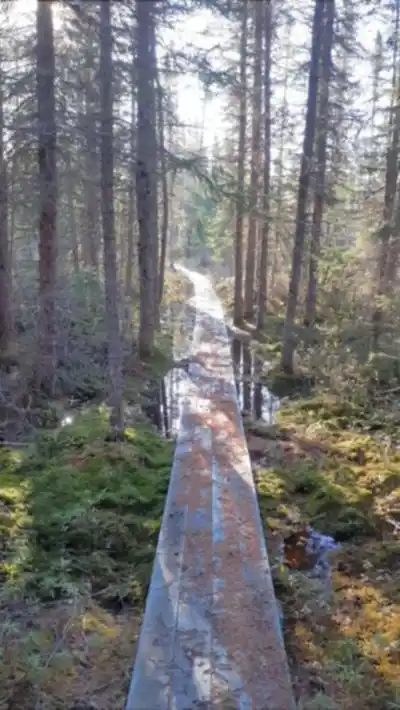
"duration_correction": "Plan for 0.5 to 1 hour to complete this trail, depending on your pace and how often you pause to enjoy the river views and cascades.",
"cascade_addition": "
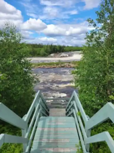
Waterfalls and viewpoints
One of the trail's key features are the cascades de la Rivière Rupert. Two belvederes along the route offer scenic vantage points to view the waterfalls. Wooden stairs are integrated into the trail to safely navigate these sections and enhance access to the scenic overlooks.
","remove_section": "Remove or significantly reduce the 'Camping nearby' section as it is not verified by any web source and appears to be speculative content."
}
Recommended gear for this trail


Ready to go?
Everything you need to know before you goStarting Point
To access the hiking trails, you can start at the main trailhead located near the Rupert River. The primary parking area is accessible via Route de la Baie James (James Bay Road). From there, follow signs directing you to the designated parking lot for hikers. Note that this is a remote area, so ensure your vehicle is well-prepared for long-distance travel and check local conditions before heading out.
When?
How much?
- Hiking shoes Essential
- → Salomon Elixir Tour Mid WP · 203.38 $
- Layered clothing Essential
- Rain jacket Essential
- Trekking poles
- → Black Diamond Trail Ergo Cork · 69.99 $
- Headlamp
- → Petzl Actik Core 625 · 103.95 $
FAQ - Frequently asked questions
Everything you need to knowThe Essential Hiking Checklist
Everything you need for your next hike. Bilingual, printable, 1 page.
Download the free checklistSimilar hikes nearby
Discover other trails you might enjoy


Hiking near Gatineau
48 trails to explore ~666 km away
We work hard to provide the most up-to-date and error-free data possible. If something seems incorrect, let us know! Your contribution helps the whole community.
Hikers' opinions