

Ready to explore Cascade de la Pisse? Here's everything you need to know before you go!
Discover the trail
Trail description
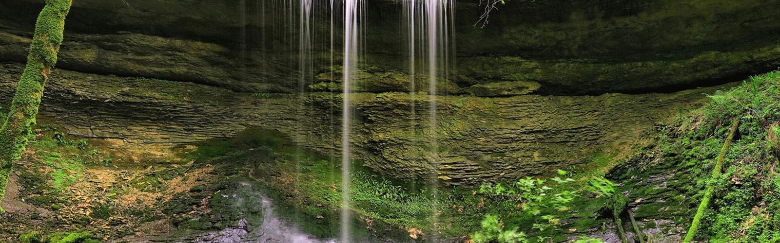
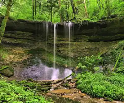
The Cascade de la Pisse offers one of the most accessible waterfall experiences in the Isère department of the Auvergne-Rhône-Alpes region. Located near the charming village of Saint-Pierre-de-Chartreuse, this impressive cascade system draws visitors throughout the year with its dramatic multi-tiered falls and convenient roadside access from departmental road D 1091.
What sets this waterfall apart from others in the region is its spectacular series of cascades that tumble down the mountainside over approximately 200 meters of rocky terrain. Rather than a single dramatic drop, the Cascade de la Pisse presents visitors with a sequence of falls, each offering its own character and viewing opportunities. The highest individual waterfall reaches about 20 meters, creating a thunderous display of water power that echoes through the surrounding forest.
The Trail Experience
The 4.5-kilometer hike to fully explore the waterfall system involves 500 meters of elevation gain, making it a moderate challenge that most hikers can handle in about 2 hours and 15 minutes. The trail begins near the road access point and immediately plunges into the dense forest environment that characterizes the Chartreuse massif.
Multiple well-maintained paths wind through the forest around the waterfall system, allowing visitors to experience the cascade from numerous angles and elevations. These trails range from short, easy walks suitable for families to more challenging routes that climb alongside the falls for elevated perspectives. The path network has been thoughtfully designed to minimize environmental impact while maximizing viewing opportunities.
The terrain varies considerably as you progress through the trail system. Initial sections follow relatively gentle grades through the forest floor, but the path becomes more demanding as you approach the upper cascades. Rocky sections require careful footing, especially when wet from waterfall spray, and some steeper climbs involve natural stone steps carved by years of foot traffic.
Natural Setting and Viewpoints
The waterfall emerges from a pristine forest environment dominated by towering beech and fir trees that create a natural cathedral around the cascading water. This mixed forest composition provides a stunning backdrop throughout the seasons, with the beech trees offering brilliant autumn colors and the evergreen firs maintaining the site's beauty even in winter months.
Each viewpoint along the trail system offers a different perspective on the waterfall's character. Lower viewpoints provide close-up views of the powerful water flow and the intricate rock formations carved by centuries of erosion. Here, you can feel the mist on your face and hear the full force of water crashing against limestone ledges. Higher vantage points reveal the full scope of the 200-meter cascade system and offer glimpses of the surrounding Chartreuse landscape through breaks in the forest canopy.
The forest floor around the waterfall is typical of the Chartreuse massif, with moss-covered rocks, fallen logs, and rich understory vegetation that thrives in the moist environment created by constant spray from the falls. The contrast between the white rushing water and the deep green forest creates some of the most photogenic scenes in the region.
What Makes This Hike Special
Beyond its accessibility, the Cascade de la Pisse stands out for its multi-faceted character that rewards both quick visits and extended exploration. The series of falls means there's always something new to discover, whether it's a hidden pool between cascades, an unusual rock formation carved by the water, or a particularly striking view through the forest canopy.
The moderate difficulty level makes this trail an excellent introduction to hiking in the Chartreuse region. You get a real workout with the 500-meter elevation gain, but the well-maintained paths and clear route-finding mean you can focus on enjoying the scenery rather than worrying about navigation or technical challenges.
The waterfall's setting within the broader Chartreuse landscape adds to its appeal. This region is known for its dramatic limestone peaks, deep valleys, and pristine forests, and the Cascade de la Pisse provides an excellent introduction to these natural features while offering a satisfying destination for those seeking a focused outdoor experience.
Seasonal Considerations
Summer represents peak season for the Cascade de la Pisse, when the combination of accessible roads, comfortable hiking weather, and full water flow creates ideal conditions. During these months, the waterfall runs at substantial volume from snowmelt and seasonal precipitation, creating the most dramatic displays. However, this popularity means summer weekends can see significant crowds, particularly at the most accessible viewpoints.
Spring offers perhaps the most spectacular water flow as snowmelt from higher elevations feeds the cascade system. The forest begins its seasonal awakening during this period, with fresh green growth providing a vibrant contrast to the rushing white water. Trail conditions can be muddy and slippery during spring months, requiring appropriate footwear and extra caution on steeper sections.
Winter transforms the waterfall into an entirely different experience, with ice formations creating sculptural elements alongside the flowing water. While the main cascade typically continues flowing throughout winter, smaller side streams may freeze completely, creating dramatic icicle formations. Winter access requires careful attention to road and trail conditions, as ice and snow can make both driving and hiking more challenging.
Access and Practical Details
The waterfall's location near departmental road D 1091 makes it one of the most accessible natural attractions in the Saint-Pierre-de-Chartreuse area. This road connection means you can reach the trailhead without requiring four-wheel drive vehicles or extensive hiking experience, making it perfect for day trips from larger cities in the region.
Parking availability varies by season, with summer months requiring early arrival to secure convenient spots near the trailhead. The road access also means the site can accommodate visitors with varying mobility levels, as the shortest routes to waterfall viewpoints require minimal hiking distance for those who prefer not to tackle the full trail system.
The Essential Hiking Checklist
Everything you need for your next hike. Bilingual, printable, 1 page.
Get your free hiking checklistRecommended gear for this trail
As an Amazon Associate I earn from qualifying purchases.


Ready to go?
Everything you need to know before you goStarting Point
The Cascade de la Pisse trailhead is located in Saint-Étienne-de-Fontbellon, in the Auvergne-Rhône-Alpes region. To get there, take the D4 towards Saint-Étienne-de-Fontbellon. After 2.5 km, turn right on the D120 and continue for 1.5 km. The trailhead is on your left.
When?
How much?
As an Amazon Associate I earn from qualifying purchases.
Affiliate links — LGPO may earn a commission at no extra cost to you.
- Hiking shoes Essential
- → Salomon Elixir Tour Mid WP · 203.38 $
- Layered clothing Essential
- Rain jacket Essential
- Trekking poles
- → Black Diamond Trail Ergo Cork · 69.99 $
- Headlamp
- → Petzl Actik Core 625 · 103.95 $
FAQ - Frequently asked questions
Everything you need to knowSimilar hikes nearby
Discover other trails you might enjoy
Hiking near Sydney
22 trails to explore ~5028 km away
We work hard to provide the most up-to-date and error-free data possible. If something seems incorrect, let us know! Your contribution helps the whole community.
Hikers' opinions
Be the first to review!
No hiker has shared their experience yet. Share your impressions and help other hikers!