
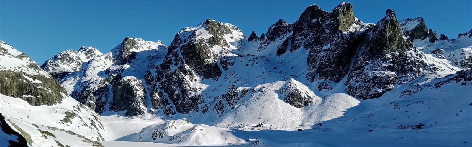

Ready to explore Cascade de l’Oursière? Here's everything you need to know before you go!
Discover the trail
Trail description
The Cascade de l'Oursière stands as one of Isère's most rewarding waterfall hikes, offering a substantial climb through varied terrain to reach a spectacular cascade tucked into the mountainside. This 4.2-kilometer trail delivers a genuine mountain experience with its 520-meter elevation gain over approximately 2.5 hours, taking hikers through multiple ecosystems as they ascend from valley floor to the waterfall's dramatic setting.
The journey begins in mixed deciduous forest, where the path winds steadily upward through oak and beech groves. Early in the hike, you'll cross several small streams that hint at the larger water feature awaiting above. The trail surface varies from packed earth to rocky sections, with some areas requiring careful footing, especially after rain when the path can become slippery.
As you gain elevation, the forest composition shifts noticeably. Conifers begin to dominate the landscape, and the understory becomes more sparse, allowing better views of the surrounding peaks. The sound of rushing water grows stronger as you approach the waterfall, building anticipation for the final reveal.
The Waterfall Experience
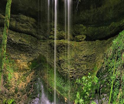
Cascade de l'Oursière presents itself as a multi-tiered waterfall that plunges down a rocky cliff face in several distinct drops. The main cascade falls approximately 30 meters, creating a misty environment that supports unique vegetation in the immediate vicinity. Moss-covered rocks and ferns thrive in this microclimate, creating a lush green backdrop that contrasts beautifully with the white water.
The viewing area provides multiple vantage points for photography and rest. A natural amphitheater of rocks allows hikers to sit comfortably while taking in the spectacle. The pool at the base of the falls remains cold throughout the year, fed by snowmelt and mountain springs, making it refreshing but typically too chilly for swimming except perhaps on the hottest summer days.
What makes this waterfall particularly striking is its setting within the rugged landscape of the French Alps. The cascade emerges from a narrow gorge, framed by towering rock walls that amplify the sound of falling water. On sunny days, the mist creates rainbow effects that add an almost magical quality to the scene.
Trail Conditions and Terrain
The path to Cascade de l'Oursière challenges hikers with its consistent upward grade, though the moderate difficulty rating makes it accessible to those with reasonable fitness levels. Rocky outcroppings appear more frequently in the upper sections, and hikers will encounter several switchbacks designed to ease the steepest portions of the climb.
Root systems cross the trail in multiple locations, particularly in the lower forested sections. These natural obstacles require attention but add to the authentic mountain hiking experience. The final approach to the waterfall involves navigating some loose rock, so sturdy hiking boots with good ankle support prove essential.
The trail's character changes dramatically as you ascend. What begins as a gentle forest walk gradually transforms into a more demanding mountain hike. The middle section features the steepest sustained climbing, where the path zigzags up rocky slopes. Here, the terrain becomes more exposed, offering glimpses of the surrounding Alpine landscape.
Weather conditions significantly impact trail difficulty. Spring snowmelt can make stream crossings more challenging, while autumn leaves can obscure trail markers and create slippery conditions. Summer offers the most stable hiking conditions, though afternoon thunderstorms remain a consideration in the mountains.
Flora and Wildlife
The diverse elevation range creates habitat for various plant and animal species. In the lower elevations, wildflowers bloom throughout spring and early summer, including wild roses, foxgloves, and various alpine species. The transition zone features mountain ash and pine species that provide food sources for local wildlife.
Wildlife sightings may include red squirrels, various bird species including woodpeckers and mountain finches, and occasionally deer in the early morning or evening hours. Marmots inhabit the higher rocky areas near the waterfall, and their distinctive whistles often alert hikers to their presence before they're spotted visually.
The waterfall area itself supports specialized plant communities adapted to the constant moisture. Rare ferns and mosses create miniature gardens on the wet rock faces, while hardy alpine plants cling to crevices in the cliff walls above the cascade.
Seasonal Considerations
Spring hiking reveals the waterfall at its most powerful, as snowmelt feeds the cascade with maximum volume. However, this season also presents the most challenging trail conditions, with potential snow patches in shaded areas and muddy sections where the ground hasn't fully dried. The contrast between the rushing water and patches of remaining snow creates particularly dramatic scenery.
Summer provides optimal hiking conditions with stable weather and fully accessible trails. The waterfall maintains good flow throughout the summer months, though not as dramatic as spring levels. This season offers the best opportunities for photography and extended time at the falls, with comfortable temperatures for rest breaks and lunch stops.
Autumn transforms the lower forest sections with brilliant foliage colors, creating stunning contrast against the evergreens higher up. The waterfall flow decreases but remains impressive, and cooler temperatures make the uphill climb more comfortable. This season often provides the clearest mountain views as atmospheric conditions stabilize.
Winter access becomes significantly more challenging and potentially dangerous due to ice formation on the trail and around the waterfall area. Only experienced winter hikers with proper equipment should attempt this trail during snow season.
Practical Hiking Information
The substantial elevation gain requires adequate preparation and pacing. Most hikers find the ascent takes significantly longer than the descent, so plan accordingly when calculating total trip time. The steady climb demands good cardiovascular fitness, though the moderate rating means it's achievable for most regular hikers.
Bringing plenty of water is essential, as the physical demands of the climb increase hydration needs considerably. Trekking poles prove valuable for the steeper sections and help maintain stability on the varied terrain. The rocky areas near the waterfall can be slippery from spray, so extra caution is warranted in the final approach area.
Weather can change rapidly in mountain environments, making layers essential regardless of season. A waterproof jacket provides protection from both potential rain and the mist generated by the waterfall itself. The trail offers limited shade in some sections, particularly in the middle elevations where the forest opens up, so sun protection becomes important during summer months.
The deep forest sections can feel quite cool even on warm days, especially early in the morning, making the layering system particularly important for comfort throughout the hike.
The Essential Hiking Checklist
Everything you need for your next hike. Bilingual, printable, 1 page.
Get your free hiking checklistRecommended gear for this trail
As an Amazon Associate I earn from qualifying purchases.


Ready to go?
Everything you need to know before you goWhen?
How much?
As an Amazon Associate I earn from qualifying purchases.
Affiliate links — LGPO may earn a commission at no extra cost to you.
- Hiking shoes Essential
- → Salomon Elixir Tour Mid WP · 203.38 $
- Layered clothing Essential
- Rain jacket Essential
- Trekking poles
- → Black Diamond Trail Ergo Cork · 69.99 $
- Headlamp
- → Petzl Actik Core 625 · 103.95 $
FAQ - Frequently asked questions
Everything you need to knowSimilar hikes nearby
Discover other trails you might enjoy
Hiking near Sydney
22 trails to explore ~5000 km away
We work hard to provide the most up-to-date and error-free data possible. If something seems incorrect, let us know! Your contribution helps the whole community.
Hikers' opinions
Be the first to review!
No hiker has shared their experience yet. Share your impressions and help other hikers!