
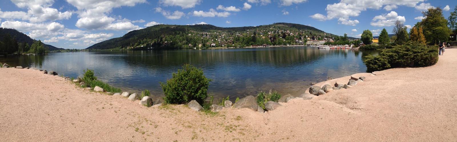

Ready to explore Cascade de Mérelle? Here's everything you need to know before you go!
Discover the trail
Available trails
| TrailTrails | Dist.Distance | GainElevation | TimeDuration | Difficulty | GPX |
|---|---|---|---|---|---|
|
|
1.64 km | — | 22min | GPX |
GPX track: © OpenStreetMap contributors — ODbL 1.0
Trail description
The Cascade de Mérelle stands as one of the Ain department's most rewarding waterfall hikes, offering a perfect blend of forest walking and dramatic water features. This accessible 2.5-kilometer trail winds through the rolling terrain of the Jura foothills, where limestone cliffs create the perfect conditions for spectacular cascades that flow year-round. With just 300 meters of elevation gain spread over approximately 1 hour and 15 minutes of hiking, this easy-rated trail welcomes families and casual hikers while still delivering the satisfaction of reaching a stunning natural destination.
The waterfall itself drops in multiple tiers through a narrow gorge carved into the local limestone, creating a series of pools and smaller falls before the main cascade. During spring snowmelt and after heavy rains, the volume increases dramatically, turning the falls into a thundering display of white water against dark rock. Even in drier summer months, the consistent flow maintains the falls' beauty while creating a refreshing mist that cools the surrounding forest.
Trail Experience and Terrain
The path to Cascade de Mérelle follows well-established forest trails that showcase the diverse ecosystems of the Ain region. Hikers begin in mixed deciduous forest dominated by beech and oak, with an understory rich in ferns and wildflowers during spring and early summer. The gentle grade makes conversation easy as you walk, and the wide path accommodates hikers of varying experience levels comfortably.
As the trail progresses toward the waterfall, the forest composition shifts to include more conifers, creating a cooler microclimate that supports different plant communities. The 300-meter elevation gain is distributed so gradually that many hikers barely notice the climb until they pause to look back at the distance covered. This makes the trail particularly appealing for those building hiking fitness or introducing children to longer forest walks.
The terrain varies from smooth forest paths lined with soft earth and fallen leaves to rockier sections near the waterfall, where the sound of rushing water grows steadily louder as you approach your destination. Tree roots occasionally cross the path, and some sections can become muddy after rain, but nothing requires technical hiking skills or specialized equipment beyond sturdy footwear.
Several viewpoints along the route offer glimpses of the surrounding Jura landscape, with its characteristic mix of forested hills and agricultural valleys. These natural clearings provide excellent spots for rest breaks and photography, especially during autumn when the deciduous trees create a tapestry of gold and red against the evergreen backdrop.
The Waterfall Area
The Cascade de Mérelle reveals itself gradually as hikers approach through the forest. The sound arrives first, echoing off the limestone walls of the narrow gorge. Then glimpses of white water appear through the trees before the full spectacle comes into view. This gradual reveal adds to the anticipation and makes the final destination feel well-earned despite the relatively easy approach.
The main waterfall drops approximately 25 meters in a single dramatic plunge, but the entire cascade system extends much higher up the cliff face. Multiple smaller falls and cascades feed into the main drop, creating a complex water feature that changes character with the seasons and water levels. The limestone geology creates natural viewing platforms where visitors can safely observe and photograph the falls from multiple angles.
The pool at the base of the falls provides a natural amphitheater where visitors can sit on the smooth rocks and enjoy the display. The limestone has been carved and polished by centuries of water flow, creating interesting formations and small caves behind the falling water. During summer, the pool offers a refreshing spot to cool feet, though the water remains quite cold year-round due to its source in underground springs.
Flora and Fauna
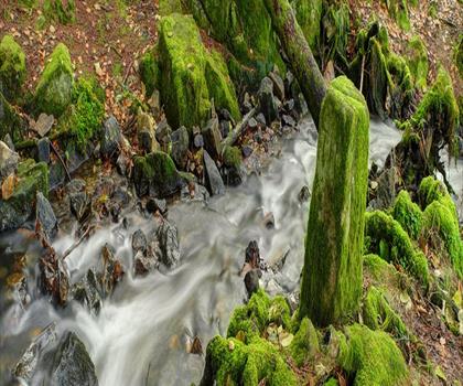
The diverse habitats along this trail support a rich variety of plant and animal life typical of the Jura foothills ecosystem. The moist environment near the waterfall creates ideal conditions for mosses, liverworts, and ferns that carpet the rocks and fallen logs. Several species of orchids bloom in the forest clearings during late spring and early summer, rewarding observant hikers who take time to examine the forest floor.
Wildlife sightings are common, particularly in early morning or late afternoon when animals are most active. Red squirrels are frequently seen in the coniferous sections, their chattering calls often audible before they come into view. The mixed forest areas host various songbirds including woodpeckers, nuthatches, and seasonal migrants that fill the canopy with activity during spring and fall migrations.
Deer tracks are often visible on muddy sections of trail, and patient observers may spot roe deer in the clearings, especially during quieter weekday visits. The waterfall area attracts specialized wildlife adapted to the spray zone and rocky environment. Several species of salamanders inhabit the moist crevices, and the pools support small fish and aquatic insects that form the base of the local food web.
Seasonal Considerations
Each season offers a different perspective on the Cascade de Mérelle, making this a trail worth revisiting throughout the year. Spring brings the highest water levels as snowmelt from higher elevations feeds the cascade system. This is also when wildflowers are most abundant, and the fresh green of new leaves creates excellent photographic opportunities. The forest floor comes alive with blooming plants that have been dormant through winter.
Summer provides the most comfortable hiking conditions, with warm temperatures and stable weather patterns. While water levels may be lower than spring peaks, the falls maintain their beauty, and the cooler microclimate around the cascade offers welcome relief from heat. This season is ideal for families with young children, as longer daylight hours provide flexibility in timing.
Autumn transforms the forest into a spectacular display of color, with the waterfall providing a dramatic focal point against the changing leaves. This season often brings increased rainfall that boosts water levels after the summer lows, combining the best of both visual drama and comfortable hiking temperatures.
Winter hiking is possible but requires appropriate equipment and caution. Ice can form around the waterfall creating stunning formations, but trails may be slippery and daylight hours are limited. Microspikes or light crampons are recommended during freezing conditions, and hikers should be prepared for potentially challenging footing on the rockier sections near the falls.
Practical Hiking Information
The trail is particularly suitable for families with children who are comfortable with moderate hiking distances and some uneven terrain. The gradual elevation gain and interesting features along the way help maintain young hikers' interest throughout the journey. However, supervision is important near the waterfall area where wet rocks can be slippery and the drop-offs require respect.
Dogs are welcome on this trail but should be kept under control, particularly near the waterfall where the rocky terrain and swift water could pose hazards. The forest sections provide plenty of opportunities for dogs to explore safely while remaining on leash as required in most French natural areas.
Standard day hiking equipment is sufficient for most conditions. Sturdy hiking boots with good traction are recommended, especially for the rocky areas near the waterfall where limestone can become slippery when wet. A camera or smartphone is essential for capturing the scenic beauty, and a small daypack for water and snacks will enhance the experience without adding unnecessary weight for this relatively short hike.
The Essential Hiking Checklist
Everything you need for your next hike. Bilingual, printable, 1 page.
Get your free hiking checklistRecommended gear for this trail
As an Amazon Associate I earn from qualifying purchases.


Ready to go?
Everything you need to know before you goWhen?
How much?
As an Amazon Associate I earn from qualifying purchases.
Affiliate links — LGPO may earn a commission at no extra cost to you.
- Hiking shoes Essential
- → Salomon Elixir Tour Mid WP · 203.38 $
- Layered clothing Essential
- Rain jacket Essential
- Trekking poles
- → Black Diamond Trail Ergo Cork · 69.99 $
- Headlamp
- → Petzl Actik Core 625 · 103.95 $
FAQ - Frequently asked questions
Everything you need to knowSimilar hikes nearby
Discover other trails you might enjoy
Hiking near Sydney
22 trails to explore ~4927 km away
We work hard to provide the most up-to-date and error-free data possible. If something seems incorrect, let us know! Your contribution helps the whole community.
Hikers' opinions
Be the first to review!
No hiker has shared their experience yet. Share your impressions and help other hikers!