

Ready to explore Saut du Bouchot? Here's everything you need to know before you go!
Discover the trail
Trail description
Saut du Bouchot is a waterfall in the Vosges region that earns its reputation the moment the cascade comes into view. Located in the forested hills of the Grand Est and protected within the Parc naturel Régional des Ballons des Vosges, this 28-meter waterfall drops over layered Vosges sandstone in a way that feels genuinely wild — not manicured, not overdeveloped, just a mountain stream doing what it's been doing for thousands of years. The main approach covers roughly 1.3 km round trip with moderate elevation gain, making it an accessible outing that delivers a real payoff in less than an hour.
The trail is classified as easy and well-suited for families with children and casual hikers. You're looking at roughly 30 minutes to 1 hour of walking depending on your pace and how long you spend at the waterfall, which makes it an ideal half-morning or afternoon option without time pressure.
Getting Into the Forest
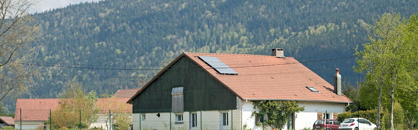
The approach sets the tone early. You're moving through classic Vosges mixed forest — beech, fir, and spruce growing dense enough that the canopy closes overhead and the light filters down in broken patches. The forest floor is layered with fallen leaves, moss-covered boulders, and exposed roots that give the trail some texture without making it technical. Sections of the path follow older, wider tracks that hint at the region's logging history before narrowing into single-track that feels more tucked into the landscape.
The red sandstone that defines so much of the Vosges geology shows up throughout the walk — in outcroppings along the trail, in the boulders scattered through the understory, and eventually in the cliff face over which the waterfall drops. It's a consistent visual thread that ties the whole experience together.
As you get closer to the falls, the sound of water starts to build before you can see anything. That gradual audio cue is part of what makes the arrival feel earned. The trail doesn't hand you the waterfall immediately — it lets you hear it first, then offers glimpses through the trees, and finally opens up to the full view.
The Waterfall
The cascade drops 28 meters over stacked layers of sandstone, each band of rock representing a different chapter in the geological history of these mountains. The water has worked its way into the rock over time, carving smooth channels and shallow pools at the base that change character depending on how much water is running. After heavy rain or during spring snowmelt, the cascade runs with real volume and sends mist into the surrounding forest, feeding the ferns and mosses that cling to the rock face. In drier stretches, the flow pulls back and you can get closer to the base, where the detail work in the stone becomes more visible.
There's no single correct way to take in the falls. The head-on view gives you the full height of the drop, while moving around to the sides or down to the base changes the perspective entirely. The light shifts throughout the day as it filters through the canopy, which means the scene looks different depending on when you show up. Morning light tends to hit the rock face directly; later in the day, the forest shadow softens everything.
Wildlife and Forest Life
The mixed forest along this route supports a solid range of wildlife. Red deer move through these woods, though they tend to stay out of sight during the middle of the day — early morning and late afternoon visits give you better odds of a sighting. Woodpeckers are a consistent presence, and you'll likely hear them drumming before you spot them. Red squirrels work the upper canopy and are easier to catch in the act.
The understory shifts with the seasons. Spring brings wildflowers to the forest floor while the canopy is still opening up. Later in the season, wild blueberries appear in clearings and along forest edges. Autumn is when the deciduous trees — particularly the beeches — turn the whole forest into something worth stopping for, with gold and orange foliage contrasting against the dark green of the firs and spruces.
Trail Conditions and Footwear
The trail is well-established and generally well-maintained, but conditions shift with the weather. The broader sections near the start offer reliable footing, while the terrain gets more uneven as you approach the waterfall. Tree roots cross the path in several spots and require some attention underfoot, especially on the descent when your legs are a bit more tired.
Near the base of the falls, the rocks get slippery from mist and spray. Vosges sandstone has a split personality in this regard — it grips well when dry, but becomes genuinely treacherous when wet. Hiking shoes or trail runners with decent traction are the right call here. Casual sneakers will work on the main trail but become a liability around the waterfall itself, particularly after rain.
If you're visiting during or right after a wet period, expect muddy sections on the approach and extra caution around the cascade. The payoff for a rainy-season visit is a more powerful waterfall, but the footing demands more respect.
Seasonal Notes
Spring is when Saut du Bouchot runs at its strongest. Snowmelt from the higher Vosges terrain feeds the stream, and the waterfall is at its most dramatic. The forest is also coming back to life, which adds to the overall energy of the walk.
Summer brings the most comfortable hiking temperatures, and the forest canopy keeps the trail shaded even on warm days. Water levels drop during dry stretches, so the falls are less powerful, but the trail conditions are at their best and the approach is genuinely pleasant.
Autumn shifts the visual emphasis to the forest itself. The foliage display around the waterfall is worth the trip on its own, and cooler temperatures make for good hiking weather. Trails can get muddy after autumn rain, so check conditions before heading out.
Winter visits are possible but require more preparation. Snow and ice can cover the trail, and the rocks near the waterfall become significantly more hazardous. The reward is a transformed landscape, with ice formations building up on the sandstone cliff face — a version of Saut du Bouchot that most visitors never see.
Quick Trail Facts
- Distance: 1.3 km round trip (main direct route)
- Elevation gain: ~28-91 m (varies by route variant)
- Difficulty: Easy
- Estimated time: 30 min to 1 hour
- Waterfall height: 28 meters
- Terrain: Mixed forest, some rocky sections near the waterfall
- Footwear: Hiking shoes recommended, especially in wet conditions
- Family-friendly: Yes, suitable for families with older children
The Essential Hiking Checklist
Everything you need for your next hike. Bilingual, printable, 1 page.
Get your free hiking checklistRecommended gear for this trail
As an Amazon Associate I earn from qualifying purchases.


Ready to go?
Everything you need to know before you goWhen?
How much?
As an Amazon Associate I earn from qualifying purchases.
Affiliate links — LGPO may earn a commission at no extra cost to you.
- Hiking shoes Essential
- → Salomon Elixir Tour Mid WP · 203.38 $
- Layered clothing Essential
- Rain jacket Essential
- Trekking poles
- → Black Diamond Trail Ergo Cork · 69.99 $
- Headlamp
- → Petzl Actik Core 625 · 103.95 $
FAQ - Frequently asked questions
Everything you need to knowSimilar hikes nearby
Discover other trails you might enjoy
Hiking near Sydney
22 trails to explore ~4924 km away
We work hard to provide the most up-to-date and error-free data possible. If something seems incorrect, let us know! Your contribution helps the whole community.
Hikers' opinions
Be the first to review!
No hiker has shared their experience yet. Share your impressions and help other hikers!