
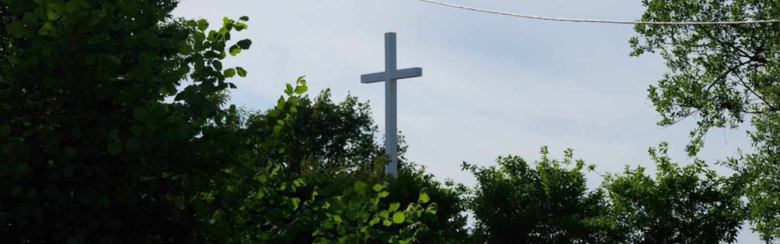

Ready to explore Le Sentier De La Croix Glorieuse? Here's everything you need to know before you go!
Discover the trail


Trail description
Le Sentier de la Croix Glorieuse winds through the rolling countryside of Calvados, offering hikers a peaceful journey through one of Normandy's most charming agricultural landscapes. This trail takes you along ancient pathways that have connected rural communities for centuries, passing through a mosaic of apple orchards, hedgerow-lined fields, and traditional Norman farmsteads with a gentle 150-meter elevation gain that makes it accessible to most hikers.
The path begins in gently undulating terrain typical of the Calvados region, where the famous apple trees that produce the area's renowned cider and Calvados brandy create natural corridors for walkers. As you progress along the route, the trail gradually ascends through a series of small hills and valleys, providing increasingly expansive views over the surrounding bocage landscape without demanding technical hiking skills.
Trail Experience and Terrain
The terrain varies pleasantly throughout the hike, starting on well-maintained dirt paths that meander between traditional Norman hedgerows. These ancient field boundaries, known locally as bocage, create a distinctive patchwork pattern across the landscape and provide natural windbreaks that have shaped farming practices here for generations. The hedgerows are particularly beautiful in spring when hawthorn and blackthorn burst into bloom, and again in autumn when the leaves turn brilliant shades of gold and crimson.
As the trail gains its 150 meters of elevation, you'll encounter sections of grass paths and occasional rocky outcrops that require more careful footing. The ascent is gradual rather than steep, making it accessible to hikers with moderate fitness levels and earning its easy difficulty rating. Along the way, traditional stone walls and wooden gates mark property boundaries, and you'll often hear the gentle lowing of Norman cattle grazing in nearby pastures.
The higher portions of the trail offer glimpses of the broader Calvados countryside, with its characteristic mix of agricultural land, small woodlands, and distant church spires marking village centers. On clear days, the views extend across the rolling hills toward the coast, though the English Channel itself remains hidden beyond the horizon. The elevation gain provides just enough height to appreciate the intricate pattern of fields and hedgerows that defines this corner of Normandy.
Natural Environment and Wildlife
The diverse habitats along Le Sentier de la Croix Glorieuse support a rich variety of Norman wildlife. The hedgerows provide nesting sites for numerous bird species, including wrens, robins, and blackbirds whose songs accompany hikers throughout much of the year. In the more open areas, you might spot kestrels hovering over the fields hunting for small mammals, while the wooded sections harbor woodpeckers and various finch species.
The trail passes through several small copses where oak, beech, and chestnut trees create shaded interludes during warmer months. These woodland patches often contain remnants of the ancient forests that once covered much of Normandy, and careful observers may notice wild flowers like wood anemones and bluebells carpeting the forest floor in spring.
The agricultural landscape itself tells the story of centuries of careful land management. The apple orchards showcase both traditional high-stem varieties and more modern plantings, while the pastures support the distinctive black and white Norman cattle that are integral to the region's dairy industry. The bocage system creates microclimates that support different plant communities, from moisture-loving species in the sheltered hollows to hardy grasses on the more exposed slopes.
Cultural and Historical Elements
Walking Le Sentier de la Croix Glorieuse provides insight into rural Norman life both past and present. The trail name itself suggests religious significance, likely connected to one of the many wayside crosses or small chapels that dot the Calvados countryside. These markers served both as navigation aids and places of reflection for travelers in earlier centuries.
The path follows routes that have been used for generations, connecting farms to markets and villages to each other. Many of the stone buildings you'll see along the way date back several centuries, their thick walls and steep-pitched roofs designed to withstand the changeable Norman weather. Traditional half-timbered construction is evident in some of the older farmhouses, showcasing building techniques that have remained largely unchanged for hundreds of years.
The working farms along the route demonstrate the continuity of agricultural traditions in Calvados. You'll likely encounter tractors and modern equipment alongside more traditional farming methods, and the careful maintenance of the bocage system shows how historical land management practices continue to shape the contemporary landscape. The apple orchards represent centuries of cultivation expertise, with some trees bearing varieties that have been grown in Normandy since medieval times.
Seasonal Considerations and Hiking Experience
Each season brings its own character to Le Sentier de la Croix Glorieuse. Spring hiking reveals the countryside awakening from winter, with apple blossoms creating clouds of white and pink throughout the orchards. The hedgerows come alive with new growth, and wildflowers begin to appear along the path margins. The moderate elevation gain feels particularly rewarding as you climb through this renewal of the landscape.
Summer offers the fullest experience of the trail's agricultural setting, with crops growing in the fields and the hedgerows thick with foliage. However, some sections may become overgrown, and the lack of shade on open portions can make midday hiking challenging during hot weather. The easy difficulty rating makes it manageable even for families, though early morning or evening starts are recommended during the warmest months.
Autumn transforms the landscape into a tapestry of warm colors, and this is harvest time for the famous Calvados apples. The cooler temperatures make for comfortable hiking, and the 150-meter elevation gain provides excellent vantage points for viewing the autumn colors across the bocage. However, increased rainfall can make some sections muddy.
Winter hiking requires more preparation, as the exposed nature of much of the trail means you'll feel the full force of Norman weather. The bare hedgerows reveal the underlying structure of the landscape, and the views are often clearest during the colder months when the air is crisp and visibility extends furthest across the Calvados countryside.
Practical Information for Hikers
The rural nature of this trail means that facilities are limited, so hikers should come prepared with adequate water and snacks. The nearest villages may offer cafes or small shops, but these shouldn't be relied upon during your hike. Sturdy hiking boots are recommended, particularly during wetter months when the grass paths and field edges can become slippery.
The trail's easy difficulty rating and moderate elevation gain make it suitable for families with older children who are comfortable with longer walks. The gradual ascent means that the physical challenge builds slowly, allowing hikers to adjust their pace as needed while still providing a sense of accomplishment as you gain those 150 meters of elevation.
Weather in Calvados can change quickly, so layered clothing and rain protection are essential regardless of the season. The exposed nature of much of the trail means that wind can be a factor, particularly on the higher sections where the elevation gain opens up views across the Norman countryside.
The Essential Hiking Checklist
Everything you need for your next hike. Bilingual, printable, 1 page.
Get your free hiking checklistRecommended gear for this trail
As an Amazon Associate I earn from qualifying purchases.


Ready to go?
Everything you need to know before you goWhen?
How much?
As an Amazon Associate I earn from qualifying purchases.
Affiliate links — LGPO may earn a commission at no extra cost to you.
- Hiking shoes Essential
- → Salomon Elixir Tour Mid WP · 203.38 $
- Layered clothing Essential
- Rain jacket Essential
- Trekking poles
- → Black Diamond Trail Ergo Cork · 69.99 $
- Headlamp
- → Petzl Actik Core 625 · 103.95 $
FAQ - Frequently asked questions
Everything you need to knowHiking near Sydney
22 trails to explore ~4408 km away
We work hard to provide the most up-to-date and error-free data possible. If something seems incorrect, let us know! Your contribution helps the whole community.
Hikers' opinions
Be the first to review!
No hiker has shared their experience yet. Share your impressions and help other hikers!