

Ready to explore Landes et carrières de Guizengeard? Here's everything you need to know before you go!
Discover the trail
Trail description
The Landes et carrières de Guizengeard trail is one of those routes that rewards curiosity. At 3.5 kilometers with 143 meters of elevation gain, it's a manageable loop — most hikers finish in around an hour and a half — but the landscape packs in enough variety to keep you genuinely engaged from start to finish. This is Charente at its most layered: heathland, abandoned quarries, regenerating woodland, and the quiet evidence of generations of human work written into the terrain.
What the Trail Actually Looks Like
The route moves through a mosaic of environments rather than committing to any single landscape type, which is a big part of what makes it interesting. The heathlands — the "landes" of the trail's name — cover much of the circuit. These are open, low-growing stretches of hardy shrubs and grasses, the kind of terrain that feels almost coastal in its exposure even though you're well inland in southwestern France. The sky feels big here, and on clear days the views across the surrounding Charente countryside are genuinely worth pausing for.
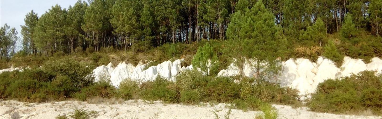
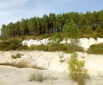
The quarry sections are the trail's most distinctive feature and the reason this loop stands apart from a standard countryside walk. These former extraction sites have been slowly reclaimed by nature over the years. Some have partially filled with water, creating still pools edged with specialized vegetation. Others show exposed rock faces that read like open geology textbooks, the layers of stone that once made this area economically valuable now serving as a record of the landscape's deeper history. The floors of the abandoned workings have become their own small ecosystems — quieter, more sheltered, and noticeably different in character from the open heathland above.
Between these two main environments, the trail threads through patches of regenerating woodland and follows old access roads that once served the quarrying operations. The footing shifts accordingly: packed earth through the heathland sections, rockier and more uneven near the quarry areas. Nothing technically demanding, but varied enough that you'll want proper footwear rather than casual sneakers.
Elevation and Difficulty
The moderate rating is accurate and honest. The 143 meters of elevation gain doesn't come in one sharp climb — it's distributed across rolling terrain, with the ascents feeling gradual rather than punishing. That said, the combination of uneven surfaces and occasional rocky sections means this isn't a flat, groomed path. Hikers with basic fitness and decent footwear will handle it comfortably. Families with older children who are used to being on their feet for an hour or more should find it well within reach.
Wildlife and Natural Features
The habitat diversity along this trail translates directly into wildlife diversity. The open heathland supports ground-nesting birds and small mammals adapted to open country — spring and early summer are when this is most apparent, with larks and other grassland species audible across the heath. The quarry pools attract a different set of residents: amphibians breed in the still water, and the rocky edges around the former workings are reliable basking spots for reptiles on warmer days.
The plant communities are worth paying attention to as well. The heathland flora shifts noticeably with the seasons, with wildflower displays peaking in spring. The vegetation that has colonized the quarry areas includes both common species and more specialized plants that have adapted to the particular growing conditions — thin soils, exposed rock, fluctuating moisture — that the old extraction sites created. It's a good example of ecological succession playing out in real time, and you can see different stages of it within a single short loop.
Historical Context
The quarrying heritage embedded in this trail reflects a broader chapter in Charente's economic history. Stone extraction was part of the local fabric for generations, providing material for construction across the region. Walking through the abandoned workings today, it's easy to read the scale of that activity in the landscape — the cut faces, the leveled floors, the old access routes that the trail now follows.
What's interesting about a trail like this is how it reframes former industrial land as something worth exploring rather than something to move past. The quarries aren't incidental to the experience here; they're central to it. The transition from active extraction site to recreational and ecological resource is itself part of the story the trail tells.
Getting There and Trail Logistics
The trailhead is accessible by car, with parking available near the starting point. The loop format keeps logistics simple — you finish where you started, which is straightforward for anyone arriving by vehicle. The trail is well-marked throughout, though bringing a map or a GPS-enabled device is always a reasonable habit on any outdoor outing.
Given the exposed nature of much of the route — particularly through the heathland sections — sun protection and adequate water matter more here than on a heavily forested trail. There's limited natural shade across a good portion of the circuit, so timing your visit for morning or late afternoon makes a real difference during warmer months.
When to Go
The trail is walkable year-round, and each season genuinely changes what you're looking at. Spring is the most visually active period: wildflowers across the heathland, bird activity at its peak, and comfortable temperatures for moving at a relaxed pace. Autumn shifts the palette toward warmer tones in the scattered trees and shrubs, and the clearer air that often comes with the season improves the views from the higher points on the route.
Winter strips the landscape back to its underlying structure, which has its own appeal — the quarry features read more clearly against dormant vegetation, and the trail is noticeably quieter. Summer works fine with adjusted timing and enough water on hand, since the open terrain means you're in direct sun for much of the hike.
Quick Reference
- Distance: 3.5 km (loop)
- Elevation gain: 143 m
- Estimated time: 1h30
- Difficulty: Moderate
- Footwear: Hiking boots or trail shoes recommended
- Parking: Available near the trailhead
The Essential Hiking Checklist
Everything you need for your next hike. Bilingual, printable, 1 page.
Get your free hiking checklistRecommended gear for this trail
As an Amazon Associate I earn from qualifying purchases.


Ready to go?
Everything you need to know before you goWhen?
How much?
As an Amazon Associate I earn from qualifying purchases.
Affiliate links — LGPO may earn a commission at no extra cost to you.
- Hiking shoes Essential
- → Salomon Elixir Tour Mid WP · 203.38 $
- Layered clothing Essential
- Rain jacket Essential
- Trekking poles
- → Black Diamond Trail Ergo Cork · 69.99 $
- Headlamp
- → Petzl Actik Core 625 · 103.95 $
FAQ - Frequently asked questions
Everything you need to knowSimilar hikes nearby
Discover other trails you might enjoy

Hiking near Sydney
22 trails to explore ~4563 km away
We work hard to provide the most up-to-date and error-free data possible. If something seems incorrect, let us know! Your contribution helps the whole community.
Hikers' opinions
Be the first to review!
No hiker has shared their experience yet. Share your impressions and help other hikers!