
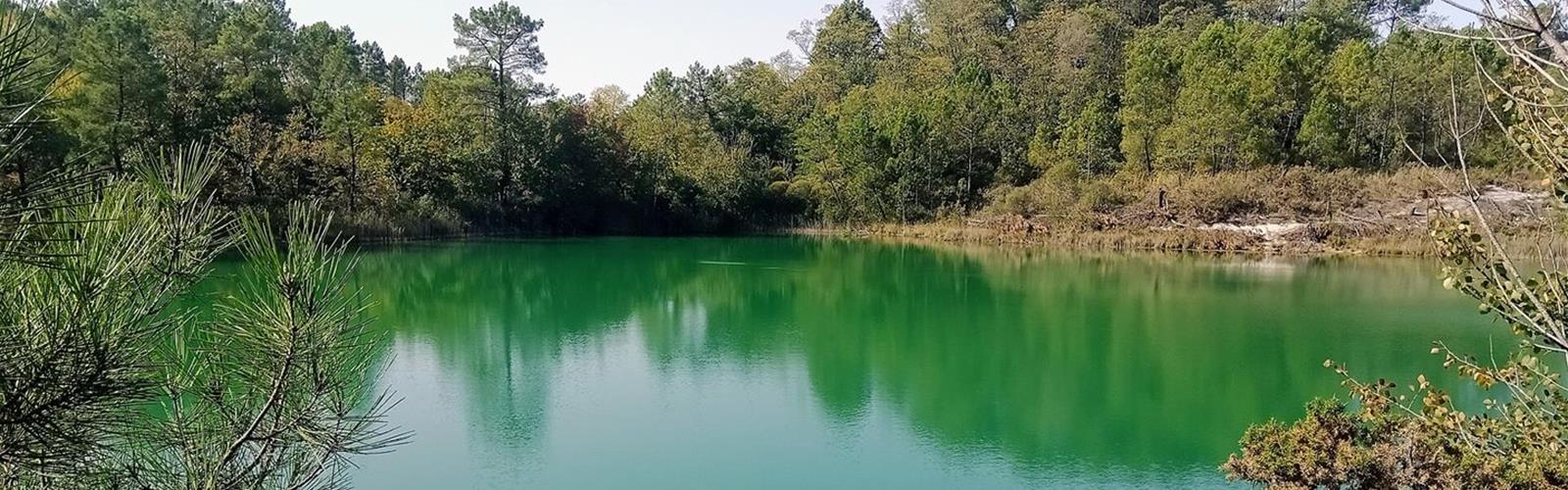
Ready to explore Carrières de Touvérac? Here's everything you need to know before you go!
Discover the trail
Trail description
The site
According to the Sud Charente tourist office, the company AGS began extracting kaolin in the late 1960s and kept going until 2000. The workings left four ponds, spoil heaps planted with pines, and cliffs above the water. Since extraction stopped, heathland, grassland, ponds and reedbeds have come back.
The Charente Department has labelled the site a Sensitive Natural Area (ENS). The Conservatoire d'espaces naturels de Nouvelle-Aquitaine (CEN) has managed it since 1996, when the owner, AGS, entrusted it to the CEN under a thirty-year lease.
The trail
The tourist office describes a marked discovery trail of about 4 km (about 2 hours) that makes two loops around the four former quarries. Its Cirkwi listing puts the route between 90 m and 128 m above sea level. Elevation gain is not published, and neither is a difficulty rating.
The trail passes through oak, chestnut and pine woods. In late summer, heather and gorse colour the heathland; in spring, the reeds and willows turn green.
The soil is clay. The CEN notes that the wet areas on its Touvérac and Guizengeard sites are hard to walk after heavy rain, in any season; in May 2025 it widened paths and laid wooden boardwalks there. The tourist office warns that it is dangerous to go near the cliff edges and says viewpoints have been built so visitors can look safely.
Starting point and parking
The tourist office's Cirkwi listing lists two car parks. The first, "Les Lacs Bleus de Touvérac", is a dirt car park on route d'Oriolles (D131), at 45.374752, -0.198407. The second is at the junction of impasse des Étangs Bleus and route du Relais de Poste, at 45.376187, -0.183809. The office says parking is free.
According to the office's Cirkwi listing, the car park is not accessible to motorhomes, which can park at the Touvérac town hall car park.
Site rules
The site is covered by a prefectoral biotope protection order (APPB 16-2024-08-05-00003). According to the CEN, it was signed on August 5, 2024 and covers 301.7521 ha. The CEN and the tourist office list these bans, among others: swimming and water sports, fires, camping and bivouacking, drone flights, picking plants, fishing, motorized vehicles. Dogs must be on a leash. Stay on the marked trails to limit trampling and disturbance to wildlife, take your litter home and respect the quiet of the place.
Temporary closures
Closures are possible during wildfire-risk periods in summer. The tourist office states that the site lies in a forest massif at high risk of fire. In July 2022, the Charente prefecture issued an order temporarily banning access to forest massifs at high risk, and the CEN said the Touvérac quarries would stay closed through August 15. In August 2026, France 3 Nouvelle-Aquitaine (article of August 11) reported, citing the Charente Department on its social media, that the sensitive natural areas of the Touvérac and Guizengeard quarries were "exceptionnellement fermés au public" (exceptionally closed to the public). The article gives neither an end date nor a reopening date.
The tourist office's Cirkwi listing, updated in early September 2026, gives opening as every day of the year and does not mention this closure. Before you go, check with the Sud Charente tourist office (+33 5 45 98 57 18) or the CEN Nouvelle-Aquitaine head office in Saint-Gence (+33 5 55 03 29 07).
Good to know before you go
- Free, independent visit, open every day of the year according to the tourist office, subject to the closures described above.
- Not suitable for people with reduced mobility or for strollers (tourist office's Cirkwi listing).
- The tourist office lists only parking as a facility: no other services, such as toilets or food, are indicated.
- Wildlife named in the tourist office's Cirkwi listing: butterflies, dragonflies, lizards and, if you are quiet, the European pond turtle, which basks in the sun on the pond banks.
Services and amenities
Everything you need for your next hike. Bilingual, printable, 1 page.
Get your free hiking checklistReady to go?
Everything you need to know before you goStarting Point
Dirt car park "Les Lacs Bleus de Touvérac", route d'Oriolles (D131), 16360 Touvérac, according to the Sud Charente tourist office.
When?
Open every day of the year, according to the Sud Charente tourist office. Closures are possible during wildfire-risk periods in summer (for example through August 15, 2022, and in August 2026 according to France 3): check with the Sud Charente tourist office before you go.
How much?
- Hiking shoes Essential
- Layered clothing Essential
- Rain jacket Essential
- Trekking poles
- Headlamp
FAQ - Frequently asked questions
Everything you need to knowOutings near Carrières de Touvérac
Discover other trails you might enjoy
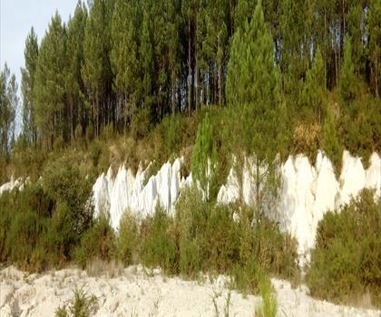
Landes et carrières de Guizengeard
Charente · 10.8 km away
Le Grand Etang de La Jemaye
Dordogne · 44.3 km away
Lac de Cadarsac
Gironde · 57.1 km away

Lac de la Cadie
Gironde · 62.8 km away
Parc de Pombonne
Dordogne · 78.2 km away
Lac de L'Escourou
Dordogne · 89.5 km away
Hiking near Sydney
25 trails to explore ~4553 km away
We work hard to provide the most up-to-date and error-free data possible. If something seems incorrect, let us know! Your contribution helps the whole community.
Hikers' opinions
Be the first to review!
No hiker has shared their experience yet. Share your impressions and help other hikers!