


Ready to explore Gorges de Trévans? Here's everything you need to know before you go!
Discover the trail
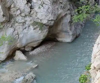
Trail description
The Gorges de Trévans cuts a dramatic path through the limestone landscape of Alpes-de-Haute-Provence, delivering one of the most striking canyon experiences in the region. Towering rock walls rise sharply from the canyon floor, creating an almost cathedral-like atmosphere as you move deeper into the gorge. The scale here is intimate rather than overwhelming — this isn't a vast open canyon but a tight, winding passage where the geology feels close enough to touch, and often is.
What makes the Gorges de Trévans stand out among canyon hikes in Provence-Alpes-Côte d'Azur is how much the landscape shifts as you progress through it. The walls display distinct geological layers — bands of cream-colored limestone interspersed with darker sedimentary rock — that tell the story of ancient seas and tectonic upheaval. Water has spent thousands of years carving smooth curves, unexpected alcoves, and intricate surface patterns into the stone, and the results are worth stopping to examine up close.
Trail Experience and Terrain
The route covers 6 km with 500 meters of elevation gain, and most hikers complete it in around 1 hour 50 minutes. That said, the terrain rewards a slower pace. The trail follows what was once a more substantial watercourse, and the path surface shifts constantly — smooth rock slabs, loose scree, patches of packed earth where vegetation has taken hold in sheltered corners. There's no single dominant surface type, which keeps the hiking engaging but also demands consistent attention to foot placement.
Expect sections where the walls close in dramatically, forming natural tunnels and narrow passages that require basic scrambling. These aren't technical climbing moves, but you will use your hands for balance and support in places. The limestone is generally solid and provides good grip when dry. When wet — from rain or morning dew — it becomes noticeably slippery, and extra caution is warranted.
The 500 meters of elevation gain isn't concentrated in one brutal climb. It's distributed throughout the gorge, with gentler inclines alternating with steeper sections over rock steps and natural staircases. The most demanding ascents tend to occur where the trail gains height to bypass particularly narrow canyon sections or to reach viewpoints that put the gorge's full scope into perspective.
Flora and Wildlife
The microclimate inside the Gorges de Trévans supports more plant diversity than you might expect from a limestone canyon. In areas where water collects and humidity stays higher, ferns cascade from cracks in the rock walls and hardy alpine plants find purchase in seemingly impossible spots. During spring and early summer, wildflowers add color to the otherwise monochromatic stone, with species specifically adapted to the canyon's particular light and moisture conditions.
Wildlife sightings tend to be subtle. Ravens are a reliable presence — you'll likely hear their calls echoing off the walls before you see them. Smaller songbirds nest in rock crevices throughout the gorge, and lizards are common on sun-warmed surfaces. The gorge also functions as a travel corridor for larger mammals moving between elevations, though actual sightings require patience and quiet movement.
Seasonal Conditions
Spring brings the most active water features to the gorge, as snowmelt from higher elevations feeds the seasonal streams that originally carved these passages. Wildflowers peak during this window, but expect muddy conditions and higher water levels that can make stream crossings more demanding than they appear on a map.
Summer offers the most stable footing, with dry rock and minimal water obstacles. The canyon walls absorb and radiate heat during midday hours, so early morning or late afternoon starts are noticeably more comfortable — and the light is better for photography during those windows anyway.
Fall is arguably the most pleasant season for this hike. Temperatures are cooler, weather patterns are stable, and reduced water flow exposes rock formations and geological features that stay hidden during wetter periods.
Winter requires careful assessment before heading in. Ice forms in shaded sections of the gorge and can make the scrambling passages genuinely dangerous. The canyon's orientation means icy conditions can persist well into spring in the most sheltered areas, so checking recent conditions before a late-season visit is worth the effort.
Navigation
The canyon's natural boundaries make the general direction obvious, but route finding gets more complex where the gorge splits into multiple channels or where rockfall has altered the established path. Cairns mark the main route through most sections, though they can be displaced by weather or other hikers. Basic map and compass skills are a practical asset here rather than just a precaution.
GPS reliability can be inconsistent inside the gorge — the canyon walls interfere with satellite signals in certain areas. Key landmarks to orient yourself include distinctive rock formations, major bends in the canyon, and the points where side canyons or gullies branch off and offer alternative routes or exit options.
What to Bring
- Footwear: Sturdy hiking boots with solid ankle support are essential. The limestone can be sharp in places, and the scrambling sections put real demands on footwear.
- Clothing: Pants rather than shorts are recommended — they protect your legs during the more technical passages where contact with rock is unavoidable.
- Water: Carry more than you'd typically bring for a hike of this length. The canyon environment is dehydrating, and reliable water sources along the route are not guaranteed.
- Navigation: A paper map and compass as backup, given the GPS limitations inside the gorge.
- Lighting: A headlamp is useful for exploring deeper alcoves or for early starts before full daylight reaches the canyon floor.
- First aid: Basic supplies are particularly important given how remote sections of the route feel once you're inside the gorge.
- Camera gear: If photography matters to you, a tripod handles the dramatic contrast between sunlit rock faces and deep shadow that occurs when light filters down through the narrow canyon openings.
Recommended gear for this trail


Ready to go?
Everything you need to know before you goWhen?
How much?
- Hiking shoes Essential
- → Salomon Elixir Tour Mid WP · 203.38 $
- Layered clothing Essential
- Rain jacket Essential
- Trekking poles
- → Black Diamond Trail Ergo Cork · 69.99 $
- Headlamp
- → Petzl Actik Core 625 · 103.95 $
FAQ - Frequently asked questions
Everything you need to know
25 hikes under 2 hours from Montreal
Distance, elevation, parking and season for each one. The ones we go back to ourselves.
Get the guideSimilar hikes nearby
Discover other trails you might enjoy

Hiking near Sydney
22 trails to explore ~5084 km away
We work hard to provide the most up-to-date and error-free data possible. If something seems incorrect, let us know! Your contribution helps the whole community.
Hikers' opinions
Be the first to review!
No hiker has shared their experience yet. Share your impressions and help other hikers!