

Ready to explore Quail Mountain, California? Here's everything you need to know before you go!
Discover the trail
Trail description
Quail Mountain is the highest peak in Joshua Tree National Park, and reaching its summit is one of the more rewarding — and underrated — objectives in California's Inland Empire desert. This is not a manicured trail with signage every hundred meters. It's a cross-country route that demands navigation skills, solid footwear, and a genuine respect for the desert environment. If you're looking for a challenge that goes beyond the typical park experience, Quail Mountain delivers.
The Terrain
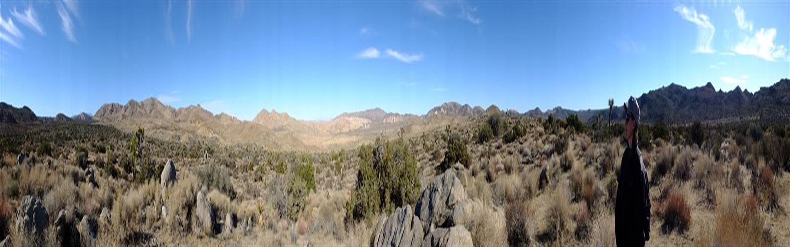
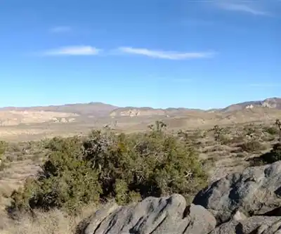
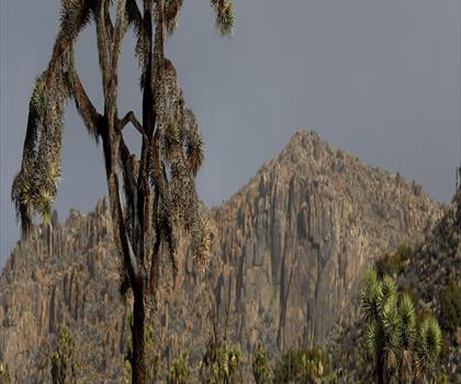
The approach to Quail Mountain takes you through classic high Mojave Desert landscape — open flats of Joshua trees giving way to boulder fields, pinyon pine, and juniper as you gain elevation. The terrain is rugged and largely unmarked. There is no maintained trail to the summit, which means you'll be picking your own line through scrub, loose rock, and granite outcroppings. Topo map reading and a GPS device are strongly recommended. The summit itself sits at the highest point in the park, offering sweeping views across the park's interior and beyond on a clear day.
The rock underfoot varies considerably depending on your chosen route. Lower sections tend to be sandy desert floor with scattered vegetation, while the upper mountain becomes increasingly rocky and technical in places. Nothing requires technical climbing gear, but you'll want your hands free for balance on some of the steeper boulder sections near the top.
What Makes This Climb Stand Out
Most visitors to Joshua Tree stick to the well-known trails in the western section of the park. Quail Mountain sits in a quieter corner, and that solitude is a big part of its appeal. You're unlikely to encounter crowds here. The route rewards people who are comfortable with self-reliance — route-finding, managing water, and reading the terrain as conditions change.
Because this is a peak-bagging objective rather than a loop trail, the experience is goal-oriented. You're working toward a specific high point, and the satisfaction of standing on the highest summit in Joshua Tree National Park is real. The views from the top give you a sense of the park's scale that you simply can't get from the valley floor.
The Joshua tree forest at the base of the mountain is particularly dense and photogenic, especially in the early morning light. The transition from open desert to the more sheltered, vegetated upper slopes is gradual but noticeable — the air cools, the plant life shifts, and the landscape takes on a different character as you climb.
Navigation and Route-Finding
This is where Quail Mountain separates itself from beginner-friendly hikes. There is no official trail. Most parties start from the Keys View Road area or approach via the Lost Horse Valley, but the exact line you take is up to you. Before heading out, study your topo map carefully and identify landmarks you can use to stay oriented. The terrain can look deceptively similar in multiple directions once you're in the middle of it.
A GPS track downloaded in advance is a smart move, but don't rely on it exclusively — battery life and signal can be unpredictable. Carry a paper map and compass as backup. If you're new to off-trail navigation, this is not the best place to learn on the fly.
Practical Information
- Trail type: Off-trail, cross-country route to summit — no maintained path
- Navigation required: Yes — map, compass, and/or GPS strongly recommended
- Location: Joshua Tree National Park, Inland Empire, California
- Park entry fee: Standard Joshua Tree National Park entrance fees apply — check the National Park Service website for current rates
- Dogs: Dogs are not permitted on off-road routes in Joshua Tree National Park
- Water: There is no water available on the route — carry all water you'll need from the trailhead
- Cell service: Minimal to none in most of the park interior
When to Go
Desert conditions make timing critical on Quail Mountain. The shoulder seasons — spring and fall — offer the most comfortable temperatures for this kind of sustained effort. Summer heat in the Mojave can be genuinely dangerous, and midday temperatures on exposed terrain can become life-threatening quickly. If you go in summer, an early alpine start is non-negotiable. Winter ascents are possible and can be spectacular, but be prepared for cold temperatures at elevation and the possibility of snow or ice on the upper mountain.
What to Bring
- Water: Carry significantly more than you think you'll need — there is no water on route
- Navigation tools: Downloaded GPS track, topo map, compass
- Sun protection: Hat, sunscreen, sunglasses — desert exposure is intense
- Sturdy footwear: Trail runners at minimum; hiking boots preferred for the rocky upper sections
- Layers: Temperature drops significantly at elevation, especially in the morning and evening
- Snacks and emergency supplies: Given the remote nature of this route, carry a basic emergency kit
Who This Is For
Quail Mountain is best suited to hikers who already have experience with off-trail travel and are comfortable navigating without a marked path. It's a genuine wilderness objective within a national park setting. If you've done your share of trail hiking and are ready to step up to something that requires more self-sufficiency, this is an excellent next challenge. Experienced desert hikers will find it a satisfying and memorable day in one of California's most iconic landscapes.
First-timers to Joshua Tree or hikers without off-trail navigation experience should build up to this one — there are plenty of excellent marked trails in the park to get your bearings before tackling the high point.
The Essential Hiking Checklist
Everything you need for your next hike. Bilingual, printable, 1 page.
Get your free hiking checklistRecommended gear for this trail
As an Amazon Associate I earn from qualifying purchases.


Ready to go?
Everything you need to know before you goWhen?
How much?
As an Amazon Associate I earn from qualifying purchases.
Affiliate links — LGPO may earn a commission at no extra cost to you.
- Hiking shoes Essential
- → Salomon Elixir Tour Mid WP · 203.38 $
- Layered clothing Essential
- Rain jacket Essential
- Trekking poles
- → Black Diamond Trail Ergo Cork · 69.99 $
- Headlamp
- → Petzl Actik Core 625 · 103.95 $
FAQ - Frequently asked questions
Everything you need to knowSimilar hikes nearby
Discover other trails you might enjoy
Hiking near Victoria
93 trails to explore ~1707 km away
We work hard to provide the most up-to-date and error-free data possible. If something seems incorrect, let us know! Your contribution helps the whole community.
Hikers' opinions
Be the first to review!
No hiker has shared their experience yet. Share your impressions and help other hikers!