

Ready to explore Santa Rosa Mountain, California? Here's everything you need to know before you go!
Discover the trail
Trail description
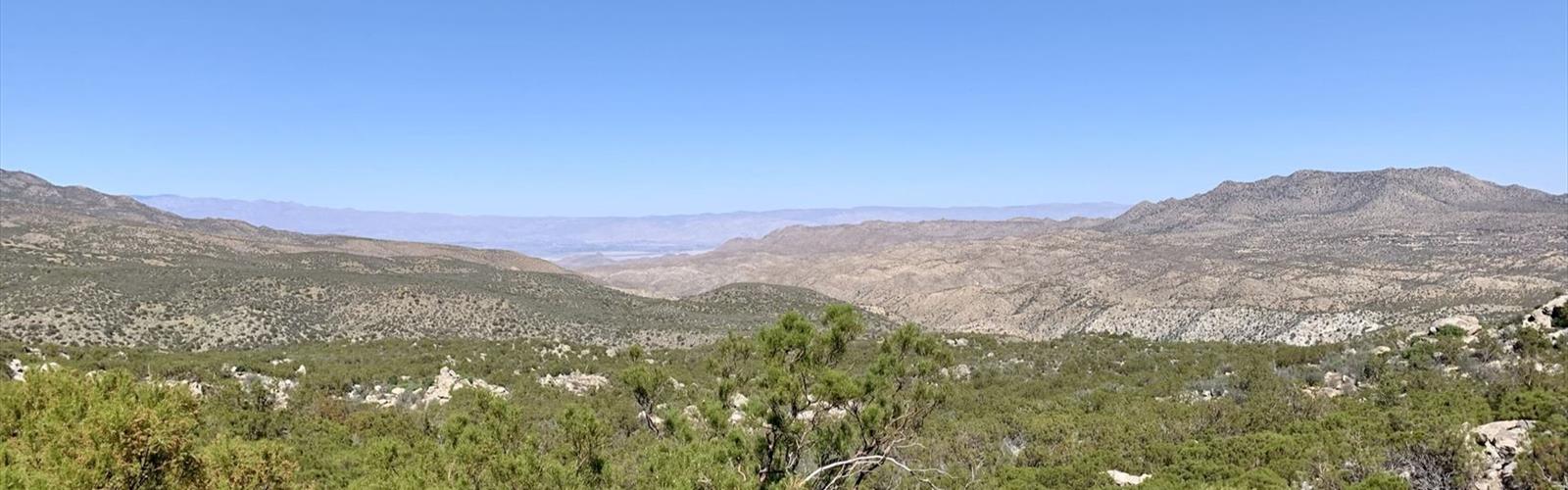
Santa Rosa Mountain sits in the heart of the Inland Empire region of Southern California, rising as one of the more rewarding summit objectives in the area. This is a real mountain climb — not a casual nature walk — and it draws hikers who want elevation gain, open ridgelines, and a genuine sense of accomplishment when they reach the top. If you're looking for a challenge that gets you above the desert floor and into cooler, more rugged terrain, Santa Rosa Mountain delivers.
The Terrain
The landscape here shifts noticeably as you gain elevation. Lower sections move through chaparral and scrub typical of the Inland Empire's drier zones — manzanita, chamise, and scattered oaks. As you push higher, the vegetation opens up and the views start to expand in every direction. The upper mountain is exposed and rocky, with the kind of terrain that demands you pay attention to your footing. This isn't technical climbing in the mountaineering sense, but it's a genuine ascent that will test your legs and lungs.
The mountain is part of the Santa Rosa and San Jacinto Mountains National Monument, a federally protected area managed jointly by the Bureau of Land Management and the U.S. Forest Service. That designation means the landscape is well-preserved — you're not going to find a lot of development up here, which is exactly the point.
What the Climb Feels Like
Santa Rosa Mountain is the kind of objective where the effort is front-loaded. You're working to gain elevation, and the trail doesn't let you forget it. The reward is the summit itself — a high point with sweeping views across the Coachella Valley, the surrounding desert ranges, and on clear days, a sense of scale that's hard to get anywhere else in the region.
The route is exposed for much of its upper section, which means wind can be a real factor. It also means there's little shade once you're above the chaparral belt. Come prepared for sun, bring more water than you think you need, and check conditions before you head out — temperatures at the base and at the summit can differ significantly.
Getting There
Access to Santa Rosa Mountain is via the Inland Empire region of Southern California. The approach roads into this area can be rough depending on recent weather and road maintenance, so a vehicle with decent clearance is worth considering. Check current road conditions before your trip, especially if you're visiting after rain or during the cooler months when the upper elevations can see frost or snow.
What to Bring
- Water: The mountain is dry and exposed. Carry more than you expect to use.
- Sun protection: Hat, sunscreen, and sunglasses are essential on the open upper ridgeline.
- Layers: Summit temperatures can drop quickly, especially with wind. A light jacket is worth the extra weight.
- Sturdy footwear: Trail runners work for experienced hikers, but hiking boots with ankle support are a solid choice given the rocky terrain.
- Navigation: Download an offline map before you go. Cell service in this area is unreliable.
Best Times to Visit
Spring and fall are the most comfortable seasons for climbing Santa Rosa Mountain. Summer heat in the Inland Empire and surrounding desert regions can make the exposed upper sections genuinely dangerous, especially mid-day. Winter visits are possible but require awareness of potential snow and ice on the upper mountain, as well as road access conditions. Early morning starts are strongly recommended regardless of season — you want to be off the exposed ridgeline before afternoon heat or afternoon thunderstorms build.
Wildlife and Natural Features
The Santa Rosa and San Jacinto Mountains National Monument is recognized for its ecological diversity, spanning from low desert to high mountain environments. The monument provides habitat for Peninsular bighorn sheep, a species that uses the rocky slopes and rugged terrain of ranges like Santa Rosa Mountain. Keep your eyes on the hillsides — a bighorn sighting is one of the genuine highlights of spending time in this landscape. Raptors are also commonly spotted riding thermals above the ridgelines.
Leave No Trace
As part of a national monument, Santa Rosa Mountain falls under land management guidelines that prioritize conservation. Stay on established trails, pack out everything you bring in, and give wildlife plenty of space. The Peninsular bighorn sheep in particular are sensitive to human disturbance — if you spot them, observe from a distance and avoid any behavior that might cause them to move off their terrain.
Who This Hike Is For
Santa Rosa Mountain is best suited for hikers who already have some experience with sustained climbs and exposed terrain. If you're comfortable with elevation gain, don't mind working hard for your views, and come prepared for a full day out, this is a satisfying objective. It's not the right choice for beginners or for anyone who underestimates the desert mountain environment — the combination of heat, exposure, and distance from services means you need to be self-sufficient and well-prepared.
For hikers based in the Inland Empire or visiting the greater Southern California desert region, Santa Rosa Mountain stands out as one of the more serious and rewarding summit experiences available without leaving the area.
The Essential Hiking Checklist
Everything you need for your next hike. Bilingual, printable, 1 page.
Get your free hiking checklistRecommended gear for this trail
As an Amazon Associate I earn from qualifying purchases.


Ready to go?
Everything you need to know before you goWhen?
How much?
As an Amazon Associate I earn from qualifying purchases.
Affiliate links — LGPO may earn a commission at no extra cost to you.
- Hiking shoes Essential
- → Salomon Elixir Tour Mid WP · 203.38 $
- Layered clothing Essential
- Rain jacket Essential
- Trekking poles
- → Black Diamond Trail Ergo Cork · 69.99 $
- Headlamp
- → Petzl Actik Core 625 · 103.95 $
FAQ - Frequently asked questions
Everything you need to knowSimilar hikes nearby
Discover other trails you might enjoy
Ontario Peak Trail
Inland Empire
Chalk Hill, California
Inland Empire
Gold Mountain, California
Inland Empire
Monument Hill, California
Inland Empire
Pine Mountain Ridge, California
Inland Empire
Ranger Peak, California
Inland Empire
Hiking near Victoria
93 trails to explore ~1751 km away
We work hard to provide the most up-to-date and error-free data possible. If something seems incorrect, let us know! Your contribution helps the whole community.
Hikers' opinions
Be the first to review!
No hiker has shared their experience yet. Share your impressions and help other hikers!