
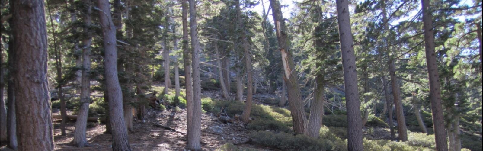

Ready to explore Ontario Peak Trail? Here's everything you need to know before you go!
Discover the trail
Oh no! We don't have any photos 😢
This trail hasn't been captured yet. Be the first to share your adventure!Trail description
Ontario Peak Trail is one of those climbs in the San Gabriel Mountains that rewards the effort with sweeping views and a genuine sense of accomplishment. The trail pushes through rugged terrain in the Cucamonga Wilderness, part of the San Bernardino National Forest, and delivers a summit experience that stands out even in a region packed with strong hiking options.
The Terrain
The route gains serious elevation as it works its way up toward Ontario Peak. Hikers move through chaparral-covered slopes in the lower sections, where manzanita, scrub oak, and sage line the trail. As you climb, the vegetation shifts and the views start opening up. The upper sections feel more exposed, with rocky terrain underfoot and the ridgeline coming into focus. The trail is well-defined but demands attention — loose rock and steep pitches are part of the deal, especially closer to the summit.
The Cucamonga Wilderness designation means the area is protected and managed to preserve its natural character. There are no motorized vehicles, and the wilderness feel is genuine. You're not going to find paved paths or interpretive signs every hundred meters. It's a proper mountain hike.
What to Expect on the Way Up
Most hikers access Ontario Peak Trail via the Icehouse Canyon trailhead, which sits at the end of Icehouse Canyon Road off of Mount Baldy Road. The trailhead has a parking area, and a National Forest Adventure Pass or equivalent federal pass is required to park here — make sure you have that sorted before you go.
From the trailhead, the route follows Icehouse Canyon before branching toward the Cucamonga Peak and Ontario Peak area. The trail junction is clearly marked, and once you're on the Ontario Peak spur, the climb becomes more direct and sustained. The final push to the summit is steep and rocky, but the payoff is a true summit with panoramic views that stretch across the Inland Empire, out toward the Pacific on clear days, and back into the San Gabriel range.
The trail is not a loop — plan on retracing your steps back to the trailhead. That return descent on tired legs is something to factor into your timing and energy management.
The Summit
Ontario Peak sits prominently in the Cucamonga Wilderness and offers one of the more dramatic viewpoints in this part of the San Gabriels. On a clear day, the visibility is exceptional — you can pick out landmarks across a wide stretch of Southern California. The summit itself is rocky and open, with enough space to take a break, eat something, and take in the surroundings before heading back down.
This is not a crowded summit by any measure. The length and elevation gain of the approach filter out casual visitors, so you're likely to share the top with people who put in the same effort to get there.
Difficulty and Who It's For
Ontario Peak Trail is best suited for hikers with solid experience and a good fitness base. The elevation gain is substantial, the terrain is rocky and uneven in places, and the distance makes it a full-day commitment. If you're comfortable on steep mountain trails and have done similar climbs in the San Gabriels or comparable ranges, you'll be well-prepared for what this trail asks of you.
Beginners or hikers looking for a casual outing should look elsewhere. This one earns its reputation as a challenging route, and that's exactly why it attracts the hikers it does.
Practical Information
- Trailhead access: Icehouse Canyon trailhead off Mount Baldy Road. The road into the canyon can be narrow — drive carefully and be aware of oncoming traffic.
- Parking: A National Forest Adventure Pass or America the Beautiful pass is required. Have it displayed on your dashboard before you park.
- Dogs: Dogs are permitted in the San Bernardino National Forest, but the Cucamonga Wilderness requires that pets be on leash at all times. Be prepared for a long day on rough terrain if you're bringing a dog.
- Water: There is water in Icehouse Canyon in the lower sections of the trail, but do not rely on it as your primary source. Carry enough water for the full round trip — the upper sections are dry and exposed.
- Cell service: Limited to nonexistent in the canyon and on the upper trail. Download offline maps before you go.
- Wilderness permit: A free self-issue wilderness permit is required to enter the Cucamonga Wilderness. These are available at the trailhead.
Conditions and Timing
The upper sections of Ontario Peak Trail can hold snow well into spring, and winter conditions can make the route significantly more technical. Check current conditions with the San Bernardino National Forest before heading out if you're going outside of the summer and early fall window. The trail can also be hot and exposed during peak summer — an early start is strongly recommended to avoid afternoon heat and potential afternoon thunderstorms that can develop over the mountains.
What Makes This Trail Worth It
Ontario Peak doesn't get the same traffic as some of the more famous summits in the San Gabriels, and that's part of its appeal. The Cucamonga Wilderness feels genuinely remote despite being within reach of a large urban area. The climb is honest — it asks something of you — and the summit delivers views that match the effort. For hikers who want a real mountain day in Southern California without the crowds of more popular destinations, Ontario Peak Trail is a strong choice.
The combination of wilderness designation, sustained elevation gain, and an open rocky summit makes this one of the more satisfying hikes in the Gold Country region of California's mountain landscape.
The Essential Hiking Checklist
Everything you need for your next hike. Bilingual, printable, 1 page.
Get your free hiking checklistRecommended gear for this trail
As an Amazon Associate I earn from qualifying purchases.


Ready to go?
Everything you need to know before you goWhen?
How much?
As an Amazon Associate I earn from qualifying purchases.
Affiliate links — LGPO may earn a commission at no extra cost to you.
- Hiking shoes Essential
- → Salomon Elixir Tour Mid WP · 203.38 $
- Layered clothing Essential
- Rain jacket Essential
- Trekking poles
- → Black Diamond Trail Ergo Cork · 69.99 $
- Headlamp
- → Petzl Actik Core 625 · 103.95 $
FAQ - Frequently asked questions
Everything you need to knowSimilar hikes nearby
Discover other trails you might enjoy
Chalk Hill, California
Inland Empire
Gold Mountain, California
Inland Empire
Monument Hill, California
Inland Empire
Pine Mountain Ridge, California
Inland Empire
Ranger Peak, California
Inland Empire
Santa Rosa Mountain, California
Inland Empire
Hiking near Victoria
93 trails to explore ~1647 km away
We work hard to provide the most up-to-date and error-free data possible. If something seems incorrect, let us know! Your contribution helps the whole community.
Hikers' opinions
Be the first to review!
No hiker has shared their experience yet. Share your impressions and help other hikers!