
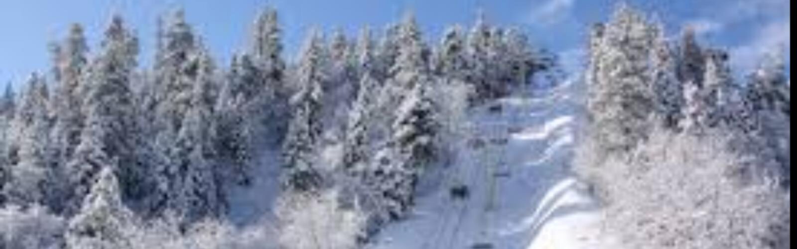
Ready to explore Mountain High? Here's everything you need to know before you go!
Discover the trail
Oh no! We don't have any photos 😢
This trail hasn't been captured yet. Be the first to share your adventure!Available trails
| TrailTrails | Dist.Distance | GainElevation | Est. timeEstimated time | Difficulty | GPX |
|---|---|---|---|---|---|
|
Beginner
|
0.8 km | — | Beginner | ||
|
Beginner
|
1.61 km | — | Beginner | ||
|
Beginner
|
0.8 km | — | Beginner | ||
|
Beginner
|
0.8 km | — | Beginner | ||
|
Intermediate
|
4.83 km | 152 m | ≈ 1h30 | Intermediate | |
|
Intermediate
|
6.44 km | 335 m | ≈ 2h | Intermediate | |
|
Intermediate
|
6.44 km | 152 m | ≈ 2h | Intermediate | |
|
Intermediate
|
3.22 km | 152 m | ≈ 57min | Intermediate | |
|
Intermediate
|
7.24 km | — | Intermediate | ||
|
Advanced
|
12.87 km | 853 m | ≈ 4h30 | Advanced | |
|
Advanced
|
6.44 km | 610 m | ≈ 2h30 | Advanced |
Trail description
Summer trails according to the resort
Mountain High's "Fall in the Mountains" page has a "Nature Hikes" section: about a dozen trails within a short distance of the resort, from easy to strenuous, with proper footwear recommended. It links to a PDF brochure, "Big Pines Area Hikes", which rates eleven trails in the Big Pines area (Angeles National Forest) as easy, moderate or strenuous, with their length.
The eleven trails in the brochure
Lengths are the brochure's, converted to kilometres in the table; "RT" means round trip. The brochure gives an approximate elevation change ("+/-") for some trails only.
Easy
- Big Pines Interpretive Trail: 1/2 mile. Trailhead up the rock stairs behind the Big Pines Ranger Station.
- Table Mountain Interpretive Trail: 1/2 mile. Trailhead on the south side of the Table Mountain Campground entrance.
- Lightning Ridge Nature Trail: 1/2 mile. Trailhead behind the restroom building at Inspiration Point, going down to the right.
- Grassy Hollow Loop Trail: 1 mile, along a section of the Pacific Crest Trail. Trailhead across from the Grassy Hollow Visitor Center.
Moderate
- Big Horn Mine: 3 miles round trip, about 500 ft of elevation change. Trailhead on the south side of the Vincent Gap parking area, behind the gate, on the old mining road. The brochure says not to enter the mine, which it calls extremely unstable and dangerous.
- Table Mountain Loop Trail: 2 miles round trip, about 500 ft. Follows the perimeter of the Table Mountain Campground; trailhead on the north side of the campground entrance.
- Blue Ridge Trail: 4 miles round trip, about 1,100 ft. From Big Pines to the top of Blue Ridge, where it meets the Pacific Crest Trail. Trailhead across from the Big Pines Ranger Station, near the exit for the ski area.
- Inspiration Point to Jackson Flat Campground: 4 miles round trip, about 500 ft. Trailhead behind the restroom building at Inspiration Point; a version 1.5 miles shorter starts at the Grassy Hollow Visitor Center.
Strenuous
- Mt. Baden-Powell: 8 miles round trip, about 2,800 ft, 41 switchbacks. Trailhead at the Vincent Gap parking lot.
- Pine Mountain (Mt. Baldy): 4 to 8 miles round trip, about 2,000 ft. The brochure calls it likely the most difficult hiking trail in the area: about 2 miles to the summit of Pine Mountain, then about 2 more miles to Mt. Baldy. The access road is closed in winter and the brochure says the trail is often not recommended until after Memorial Day because of snow and ice.
- Throop Peak: 4.5 miles round trip. The brochure calls it a moderate walk, but at high elevation. The trail is open only when Highway 2 is open in summer.
Table Mountain Nature Trail
Another page of the brochure covers the Table Mountain Nature Trail: 0.5 mile (about 0.8 km) and a walk of about 30 minutes. Twelve numbered posts line the trail and the brochure explains each one: a Jeffrey pine with a lightning scar, a canyon oak rooted in rock, the Blue Ridge skyline, plant succession, decomposition, the view of Mt. Baden Powell, dead trees and a trunk with a fire scar.
The brochure asks visitors not to smoke on the trail, to stay on the trail at all times and not to remove anything from the forest. Its map also shows the Table Mountain Loop and the North Lodge Nature Trail, as well as the Table Mountain Campground and the North Lodge Grill & Pub.
Inspiration Point and Vincent Gap
The resort's website names Inspiration Point and Vincent Gap as trailheads where the parking pass is required. The brochure puts the summit of Mt. Baden Powell at 9,400 feet (about 2,865 m) and notes ancient limber pines, some over 2,000 years old, near the top.
Parking and parking pass
The Big Pines Parking Pass replaces the Forest Service Adventure Pass at the day-use areas managed by Mountain High and at the Vincent Gap and Inspiration Point trailheads. It costs $5 per day or $30 per season. At Jackson Lake, the resort lists $10 per day (free with the annual pass). It sells the pass at its North Lodge, at Mountain Hardware, at the Wrightwood Market, at Jackson Lake, at Inspiration Point and at Vincent Gap.
The resort lists the day-use areas as open through October. Outside that period, confirm by phone at (760) 316-7828 before you go.
Getting there and services nearby
The resort's address is 24510 State Highway 2, Wrightwood, California. It says it is about an hour and a half from Los Angeles and Orange County. The North Lodge Grill & Pub serves burgers and sandwiches. The resort also lists five campgrounds with more than 100 sites in the Big Pines area, and Jackson Lake, open daily for swimming, fishing and picnicking.
In winter
On its mountain information page, the resort says it is open from mid-November through mid-April, conditions permitting; a single lift ticket is good at both resorts, East and West, and lift tickets, rentals and lessons must be purchased in advance. Yeti's Snow Play (tubing, sledding and snow play), at the East Resort, is open from Thanksgiving through mid-March, conditions permitting. The resort's snow conditions page, updated November 13, 2026, at 5:01 p.m., showed a banner announcing opening day on November 28, weather permitting, and a notice saying that, with cold temperatures and light snow forecast at upper elevations, an opening on Saturday, November 28, was looking more and more likely; at that time, no lifts or trails were open.
Services and amenities
Everything you need for your next hike. Bilingual, printable, 1 page.
Get your free hiking checklistRecommended gear for this trail
As an Amazon Associate I earn from qualifying purchases.


Ready to go?
Everything you need to know before you goWhen?
How much?
As an Amazon Associate I earn from qualifying purchases.
Affiliate links — LGPO may earn a commission at no extra cost to you.
- Hiking shoes Essential
- → Salomon Elixir Tour Mid WP · 203.38 $
- Layered clothing Essential
- Rain jacket Essential
- Trekking poles
- → Black Diamond Trail Ergo Cork · 69.99 $
- Headlamp
- → Petzl Actik Core 625 · 103.95 $
FAQ - Frequently asked questions
Everything you need to knowOutings near Mountain High
Discover other trails you might enjoy
Pine Mountain Ridge, California
Inland Empire · 5.5 km away
Telegraph Peak, California
Inland Empire · 15.4 km away
Ontario Peak Trail
Inland Empire · 17.0 km away
Chalk Hill, California
Inland Empire · 17.4 km away
Mount Zion, California
Greater Los Angeles · 35.9 km away
Mount Wilson, California
Greater Los Angeles · 38.1 km away
Hiking near Victoria
105 trails to explore ~1630 km away
We work hard to provide the most up-to-date and error-free data possible. If something seems incorrect, let us know! Your contribution helps the whole community.
Hikers' opinions
Be the first to review!
No hiker has shared their experience yet. Share your impressions and help other hikers!