
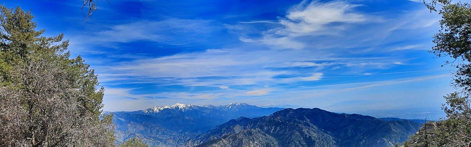

Ready to explore Mount Zion, California? Here's everything you need to know before you go!
Discover the trail
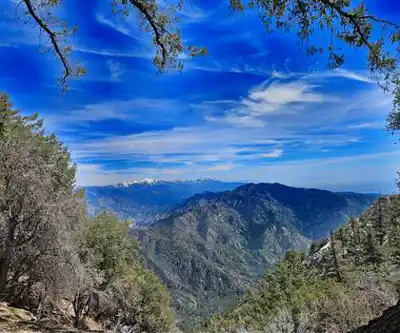
Trail description
Mount Zion in the San Gabriel Mountains is one of those peaks that rewards the effort without demanding technical climbing experience. Located in the greater Los Angeles area, this summit offers a genuine mountain experience within reach of one of the most populated regions in the country — and that contrast is a big part of what makes it worth the trip.
The Terrain
The route to Mount Zion takes you through classic San Gabriel Mountain terrain: chaparral-covered slopes, shaded canyon sections, and open ridgelines where the views start opening up in every direction. The trail gains elevation steadily, moving through a mix of oak woodland and dense brush before breaking out onto the upper slopes where the summit becomes visible.
The footing is generally solid, but expect rocky sections and some loose gravel on steeper pitches. This is not a manicured path — it has the feel of a real mountain trail, which is exactly what draws people out here. The upper section involves some hands-on scrambling, which is where the "climbing" designation in the trail name earns its meaning. Nothing requires ropes or specialized gear, but you'll want to use your hands on a few moves near the top.
What the Climb Feels Like
The approach builds gradually, giving your legs time to warm up before the trail gets serious. As you gain elevation, the vegetation shifts and the air cools noticeably — a welcome change if you're coming up from the Los Angeles basin on a warm day. The canyon sections provide shade and a sense of depth, with the sound of the terrain changing underfoot as you move from dirt to rock.
The final push to the summit is where the route distinguishes itself. The scramble to the top of Mount Zion is engaging without being intimidating — it's the kind of climbing that makes you feel like you actually earned the view. Once you're up there, the panorama across the San Gabriel range is the payoff: ridgelines stacking up in every direction, with the urban sprawl of greater Los Angeles visible in the distance on clear days.
Who This Trail Is For
Mount Zion is a solid choice for hikers who are comfortable on uneven terrain and want something more engaging than a standard out-and-back trail. The scrambling near the summit means this isn't the right pick for young children or anyone who isn't confident moving over rocky ground without a defined path. That said, experienced hikers and those looking to step up from easier trails will find this route genuinely satisfying.
Trail runners also use this route, though the rocky upper section slows things down considerably. If you're coming from a fitness background and want a mountain workout close to the city, Mount Zion delivers.
Getting There and Practical Notes
Access to the Mount Zion area falls within the Angeles National Forest, which means you'll need to be aware of current conditions and any permit or pass requirements before heading out. The San Gabriel Mountains see heavy use on weekends, so an early start is strongly recommended — both to beat the crowds and to avoid afternoon heat during warmer months.
Parking in this part of the San Gabriels can fill up quickly on busy days. Arriving before 8 a.m. on weekends gives you a much better chance of securing a spot without stress. Check current road and trail conditions before you go, as fire closures and storm damage can affect access in this range more than in many other areas of Southern California.
What to Bring
- Water: Carry more than you think you need. The exposed upper slopes and the physical effort of the scramble will push your consumption higher than a typical hike of similar length.
- Footwear: Trail runners work, but hiking boots with ankle support are a better call given the rocky scramble near the summit.
- Sun protection: The upper ridgeline offers little shade. Hat, sunscreen, and sunglasses are essential.
- Layers: Temperatures at the summit can be significantly cooler than at the trailhead, especially in the morning or when clouds move in.
- Navigation: Download an offline map before you go. Cell service in the San Gabriels is unreliable, and some junctions can be easy to miss.
The Bigger Picture
What makes Mount Zion stand out in the greater Los Angeles hiking scene is the combination of accessibility and genuine mountain character. You don't have to drive hours into the backcountry to get a summit experience that feels real — the San Gabriels rise sharply from the basin, and Mount Zion sits in that zone where the terrain gets serious fast.
The scramble to the top is a reminder that not every peak in Southern California is a walk-up, and that's a good thing. It keeps the summit feeling like something you worked for, not just a destination you strolled to.
Current Conditions
The Angeles National Forest is subject to fire closures, especially during and after fire season. Always check with the U.S. Forest Service for current trail status before heading out. Storm damage in winter and spring can also affect trail conditions significantly in this range. The Angeles National Forest website and local hiking forums are your best resources for up-to-date information specific to the Mount Zion area.
The Essential Hiking Checklist
Everything you need for your next hike. Bilingual, printable, 1 page.
Get your free hiking checklistRecommended gear for this trail
As an Amazon Associate I earn from qualifying purchases.


Ready to go?
Everything you need to know before you goWhen?
How much?
As an Amazon Associate I earn from qualifying purchases.
Affiliate links — LGPO may earn a commission at no extra cost to you.
- Hiking shoes Essential
- → Salomon Elixir Tour Mid WP · 203.38 $
- Layered clothing Essential
- Rain jacket Essential
- Trekking poles
- → Black Diamond Trail Ergo Cork · 69.99 $
- Headlamp
- → Petzl Actik Core 625 · 103.95 $
FAQ - Frequently asked questions
Everything you need to knowSimilar hikes nearby
Discover other trails you might enjoy

Mount Lowe, California
Greater Los Angeles
Mount Lukens, California
Greater Los Angeles
Mount Wilson, California
Greater Los Angeles
Lake Piru
Greater Los Angeles
South Coast Botanic Garden
Greater Los Angeles
Port Hueneme
Greater Los Angeles
Hiking near Victoria
93 trails to explore ~1640 km away
We work hard to provide the most up-to-date and error-free data possible. If something seems incorrect, let us know! Your contribution helps the whole community.
Hikers' opinions
Be the first to review!
No hiker has shared their experience yet. Share your impressions and help other hikers!