

Ready to explore Mount Disappointment, California? Here's everything you need to know before you go!
Discover the trail
Trail description
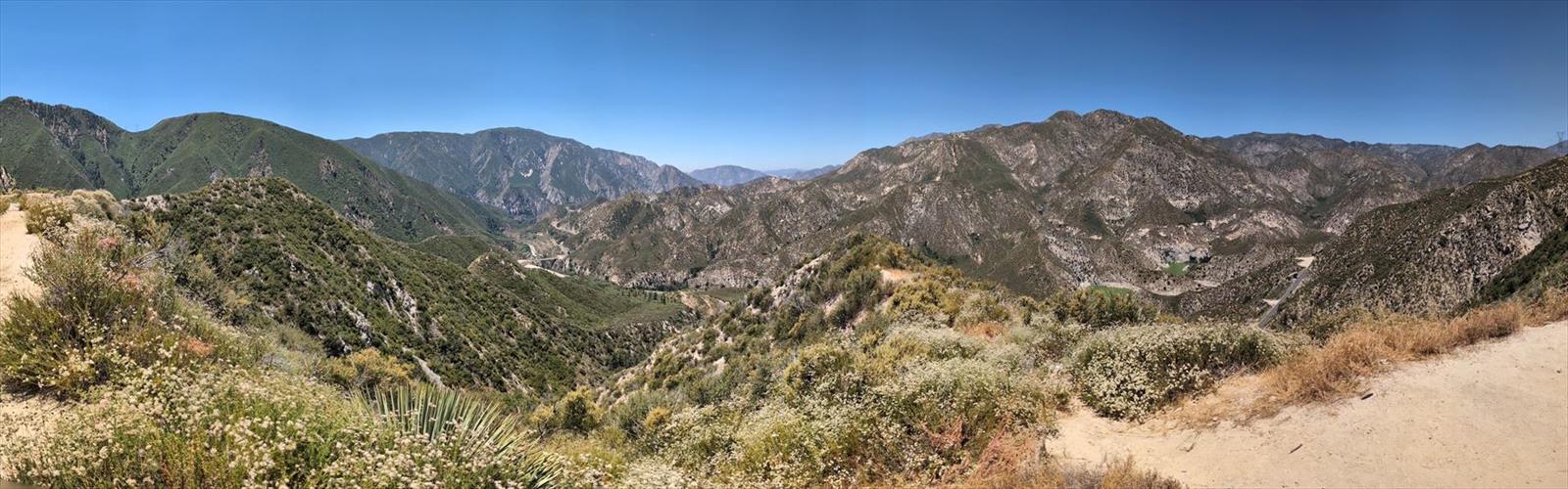
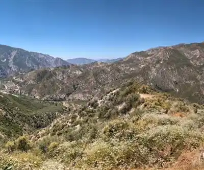
Mount Disappointment sits in the San Gabriel Mountains above the Greater Los Angeles area, and despite its name, it delivers a genuinely rewarding hike with sweeping views over the LA Basin and the surrounding peaks. The name itself has a story — early surveyors who climbed it expecting to reach the highest point in the area found themselves outranked by nearby Mount Wilson, and the name stuck. That bit of history gives the place a personality you don't forget.
The Terrain
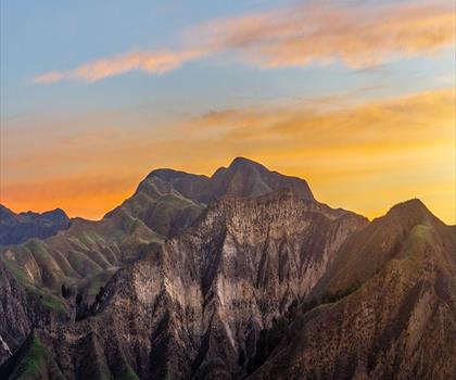
The trail climbs through the chaparral-covered slopes typical of the San Gabriel range. You'll move through dense brush, exposed ridgelines, and patches of oak and pine as you gain elevation. The landscape shifts noticeably as you climb — lower sections feel dry and scrubby, while the upper terrain opens up with wider sightlines and a more alpine feel. The footing is generally solid, though some sections involve loose rock and steeper pitches that ask for a bit of attention.
The summit area itself is marked by the remnants of a former military radar installation — a Cold War-era facility that once sat on top of the mountain. The concrete foundations and structures are still visible, giving the hike an unexpected historical layer on top of the natural scenery.
The Views
On a clear day, the summit offers a broad panorama that takes in the LA Basin to the south, the San Gabriel Valley spread out below, and the higher peaks of the range — including Mount Wilson and Mount Lowe — to the north and east. Smog and marine layer can limit visibility, especially in summer, so early morning starts or visits after a rain tend to give you the best conditions. When the air is clear, the view is genuinely impressive for a peak this accessible from the city.
Access and Trailhead
Mount Disappointment is located within the Angeles National Forest. Access to the area typically requires an Adventure Pass for parking, which is standard for national forest day-use areas in Southern California. The trailhead is reachable from the Angeles Crest Highway (Highway 2), which winds through the San Gabriel Mountains and connects several trailheads in the area.
It's worth checking current road and trail conditions before heading out — Highway 2 has a history of closures due to fire damage, rockslides, and winter weather. The Angeles National Forest website and local hiking forums are reliable sources for up-to-date access information.
What to Expect on the Trail
This is a hike that rewards preparation. The elevation gain is real, and the exposed chaparral sections can get hot in the middle of the day during summer months. Bringing more water than you think you need is always the right call in this environment. Sun protection matters too — there's limited shade on the upper portions of the trail.
The hike attracts a mix of local regulars who use it as a fitness trail and visitors drawn by the history and the views. Weekends can be busy, particularly on clear days when the views are at their best. Weekday mornings tend to be quieter if you prefer a more solitary experience.
The Cold War History
One of the things that sets Mount Disappointment apart from other peaks in the San Gabriels is the visible history at the top. The site was home to a Nike missile radar installation during the Cold War, part of a network of anti-aircraft defense systems built around major American cities in the 1950s and 1960s. The infrastructure left behind — concrete pads, foundations, and remnants of the facility — is unusual to encounter on a hiking trail and gives you something to think about beyond the scenery. It's a reminder that these mountains, while wild-feeling, have been part of the urban and military history of Los Angeles for a long time.
Practical Notes
- Parking: An Adventure Pass is typically required for parking in the Angeles National Forest.
- Access road: Highway 2 (Angeles Crest Highway) — check for closures before your trip.
- Water: No water sources on the trail; bring everything you need.
- Best conditions: Early morning starts and post-rain days offer the clearest views.
- Dogs: Check current Angeles National Forest regulations for pet policies on this trail.
Mount Disappointment is one of those LA-area hikes that punches above its weight — accessible enough to do on a weekend morning, but with enough history, elevation, and scenery to make it feel like more than just a workout.
The Essential Hiking Checklist
Everything you need for your next hike. Bilingual, printable, 1 page.
Get your free hiking checklistRecommended gear for this trail
As an Amazon Associate I earn from qualifying purchases.


Ready to go?
Everything you need to know before you goWhen?
How much?
As an Amazon Associate I earn from qualifying purchases.
Affiliate links — LGPO may earn a commission at no extra cost to you.
- Hiking shoes Essential
- → Salomon Elixir Tour Mid WP · 203.38 $
- Layered clothing Essential
- Rain jacket Essential
- Trekking poles
- → Black Diamond Trail Ergo Cork · 69.99 $
- Headlamp
- → Petzl Actik Core 625 · 103.95 $
FAQ - Frequently asked questions
Everything you need to knowSimilar hikes nearby
Discover other trails you might enjoy

Mount Lowe, California
Greater Los Angeles
Mount Lukens, California
Greater Los Angeles

Mount Wilson, California
Greater Los Angeles
Mount Zion, California
Greater Los Angeles
Lake Piru
Greater Los Angeles

South Coast Botanic Garden
Greater Los Angeles
Hiking near Victoria
93 trails to explore ~1634 km away
We work hard to provide the most up-to-date and error-free data possible. If something seems incorrect, let us know! Your contribution helps the whole community.
Hikers' opinions
Be the first to review!
No hiker has shared their experience yet. Share your impressions and help other hikers!