
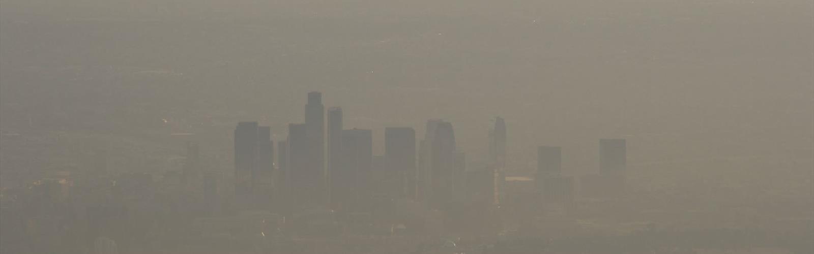

Ready to explore Mount Wilson, California? Here's everything you need to know before you go!
Discover the trail
Trail description
Mount Wilson rises above the Greater Los Angeles area in the central San Gabriel Mountains, offering one of the most iconic summit experiences in Southern California. The mountain is best known for the historic Mount Wilson Observatory perched at its peak, but for hikers and climbers, it represents a serious and rewarding objective that demands respect and preparation. Whether you're pushing up from the Sierra Madre trailhead or tackling one of the steeper routes, reaching the top of Mount Wilson feels genuinely earned.
The Terrain
The San Gabriel Mountains are not gentle hills. The trails leading to Mount Wilson gain significant elevation through chaparral-covered slopes, shaded canyon bottoms, and exposed ridgelines. The landscape shifts noticeably as you climb — dense scrub and manzanita give way to big-cone Douglas fir, incense cedar, and eventually the open, rocky terrain near the summit. The trails are well-established but can be rocky and rooted in sections, with some exposed traverses that require sure footing. This is not a casual stroll, and the mountain has a way of reminding you of that fact, especially on the return trip when tired legs meet steep descents.
The climbing routes on Mount Wilson attract those looking for something beyond standard trail hiking. The mountain's granite faces and ridges offer technical challenges that draw climbers from across the Los Angeles area. The rock quality varies, so route-finding and judgment matter here. If you're coming specifically for the climbing, local beta and up-to-date conditions are worth seeking out before you head up.
What Makes Mount Wilson Stand Out
In a region packed with hiking destinations, Mount Wilson holds a particular place. The summit infrastructure is unlike anything else in the San Gabriels — the observatory complex, the historic hotel site, the broadcast towers, and the sweeping views across the Los Angeles Basin all combine to make the top feel like a destination in itself, not just a turnaround point. On a clear day, the view stretches from the Pacific Ocean to the desert, with the city grid laid out below in a way that genuinely reframes your sense of scale.
The mountain also carries real historical weight. The Mount Wilson Observatory has been operating since the early twentieth century and played a central role in some of the most important astronomical discoveries in modern history. Walking up to that complex under your own power adds a layer to the experience that driving up the toll road simply doesn't provide.
Getting There
Mount Wilson is accessible from multiple trailheads within the Angeles National Forest. The most commonly used approaches include the Mount Wilson Trail from Sierra Madre and trails originating from the Red Box area along Angeles Crest Highway. The Angeles National Forest requires an Adventure Pass for parking at most trailheads, so make sure you have one before you go. Check current road and trail conditions before heading out — Angeles Crest Highway can be closed due to snow, fire damage, or maintenance, and conditions in the San Gabriels can change quickly.
- Mount Wilson Trail (Sierra Madre): The San Gabriels' oldest maintained trail, climbing relentlessly from Sierra Madre to the historic observatory. This classic route offers 14.5 miles and 4,500 feet of elevation gain with minimal crowds.
- Red Box / Kenyon Devore Trail: A more direct route to the summit from the highway, popular with those looking for a focused summit push.
- Mount Wilson Toll Road: The historic road that once carried visitors to the observatory is now a hiking and cycling route, offering a long but relatively consistent grade to the top.
Flora and Wildlife
The San Gabriel Mountains support a surprisingly diverse range of plant communities, and the Mount Wilson area is a good place to observe that transition. Lower elevations are dominated by coastal sage scrub and chaparral — ceanothus, chamise, and scrub oak are common. As you gain elevation, the vegetation shifts toward a mixed conifer zone with big-cone Douglas fir, which is a species native to Southern California and distinct from the Douglas firs found further north. Keep an eye out for mule deer, California scrub jays, and the occasional black bear. Mountain lion activity has been documented in the San Gabriels, though encounters are rare.
Practical Considerations
Mount Wilson is a serious mountain by Southern California standards, and a few things are worth keeping in mind before you head out:
- Water: Carry more than you think you need. Water sources along the trail are not reliable, and the climb is physically demanding.
- Heat: Summer temperatures in the San Gabriels can be extreme, especially on south-facing slopes. Early morning starts are strongly recommended during warm months.
- Fire history: The Angeles National Forest has experienced significant wildfire activity over the years. Some trail sections may pass through burn areas where shade is limited and the terrain is more exposed.
- Adventure Pass: Required for parking at most trailheads in the Angeles National Forest. Available online and at local vendors.
- Cell service: Spotty to nonexistent on many sections of the trail. Download offline maps before you leave.
Who This Is For
Mount Wilson suits hikers who are comfortable with sustained elevation gain and want a summit experience that goes beyond a viewpoint. It's a strong choice for Los Angeles-area residents looking to push themselves on a day trip without leaving the region. For climbers, the technical routes add a different dimension to the mountain and are worth exploring if you have the skills and the right partner. Beginners should be honest about their fitness level and choose their route accordingly — some approaches to Mount Wilson are genuinely challenging, and the mountain's proximity to a major city can create a false sense of accessibility.
The combination of natural terrain, historical significance, and genuine physical challenge makes Mount Wilson one of the most complete mountain experiences available within reach of Greater Los Angeles.
The Essential Hiking Checklist
Everything you need for your next hike. Bilingual, printable, 1 page.
Get your free hiking checklistRecommended gear for this trail
As an Amazon Associate I earn from qualifying purchases.


Ready to go?
Everything you need to know before you goWhen?
How much?
As an Amazon Associate I earn from qualifying purchases.
Affiliate links — LGPO may earn a commission at no extra cost to you.
- Hiking shoes Essential
- → Salomon Elixir Tour Mid WP · 203.38 $
- Layered clothing Essential
- Rain jacket Essential
- Trekking poles
- → Black Diamond Trail Ergo Cork · 69.99 $
- Headlamp
- → Petzl Actik Core 625 · 103.95 $
FAQ - Frequently asked questions
Everything you need to knowSimilar hikes nearby
Discover other trails you might enjoy

Mount Lowe, California
Greater Los Angeles
Mount Lukens, California
Greater Los Angeles
Mount Zion, California
Greater Los Angeles
Lake Piru
Greater Los Angeles
South Coast Botanic Garden
Greater Los Angeles
Port Hueneme
Greater Los Angeles
Hiking near Victoria
93 trails to explore ~1638 km away
We work hard to provide the most up-to-date and error-free data possible. If something seems incorrect, let us know! Your contribution helps the whole community.
Hikers' opinions
Be the first to review!
No hiker has shared their experience yet. Share your impressions and help other hikers!