

Ready to explore Cobb Mountain, California? Here's everything you need to know before you go!
Discover the trail
Trail description
Cobb Mountain sits in Lake County, California, as part of the larger Mayacamas Mountain range in the North Bay Area. It's one of the more prominent peaks in the region, and the climb to its summit draws hikers looking for a genuine workout with a rewarding payoff. The mountain is closely associated with The Geysers geothermal area, one of the largest geothermal complexes in the world, which gives this corner of California a distinctly volcanic character you can feel underfoot.
The Terrain
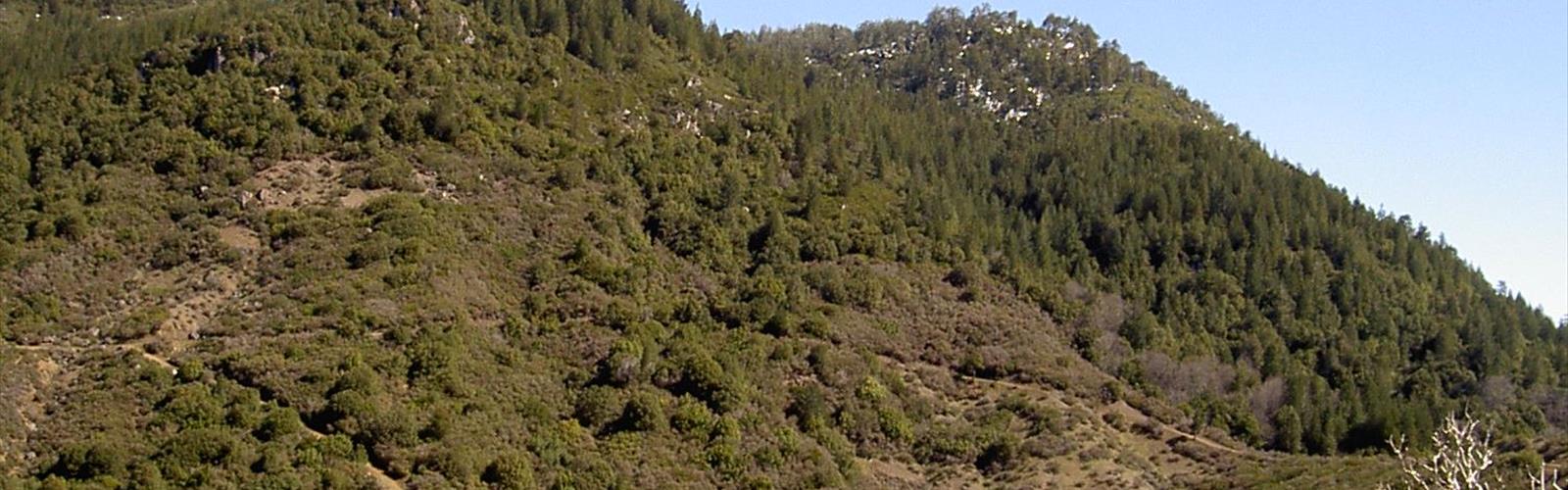
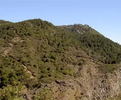
Cobb Mountain rises through a mix of mixed conifer forest, chaparral, and oak woodland. As you gain elevation, the vegetation shifts noticeably — lower slopes are dominated by manzanita and scrub oak, while the upper reaches open into ponderosa pine and Douglas fir. The trail surface varies between packed dirt, loose volcanic rock, and exposed root systems, so solid footwear with ankle support is a smart call.
The mountain's volcanic geology makes itself known throughout the climb. You'll notice the soil has a reddish, mineral-rich quality, and in places the rock underfoot has a rough, almost glassy texture typical of volcanic formations. It's a different feel from the sandstone and granite trails common elsewhere in the Bay Area.
The Climb
The ascent to Cobb Mountain's summit is a genuine climb — not a casual stroll. The route gains significant elevation over its course, and the upper section in particular pushes you with sustained steep pitches. Hikers should expect to use their hands in a few spots where the trail narrows and the grade sharpens. This is the kind of hike where you'll want to pace yourself early, because the mountain has a way of feeling manageable at the base and demanding near the top.
The trail isn't heavily trafficked compared to more popular Bay Area destinations, which means you're more likely to have stretches of it to yourself. That relative solitude is part of the appeal — Cobb Mountain rewards hikers who are willing to drive a bit further and put in the effort.
Views from the Summit
The summit of Cobb Mountain delivers wide, open views across Lake County and into the surrounding mountain ranges. On a clear day, you can see out over Clear Lake — the largest natural freshwater lake entirely within California — as well as the rolling ridgelines of the Mayacamas range stretching toward Napa and Sonoma counties. The perspective from the top gives you a real sense of just how remote and undeveloped this part of Northern California remains.
The summit area itself is open and exposed, which makes it a good spot to stop, eat, and take in the landscape before heading back down. Wind can pick up considerably at the top, so a light layer in your pack is worth having even on warm days.
Wildlife and Nature
Lake County's mountains support a healthy range of wildlife, and Cobb Mountain is no exception. Black-tailed deer are common along the lower and mid-elevation sections of the trail. Raptors — including red-tailed hawks and turkey vultures — are frequently spotted riding thermals above the ridgeline. The chaparral zones are good habitat for western fence lizards and various songbirds, particularly in the warmer months.
The geothermal influence on the landscape is worth paying attention to. The Geysers complex nearby has shaped the local ecology in subtle ways, and the mineral-rich soils support plant communities you won't find in most other parts of the Bay Area.
Practical Information
Cobb Mountain is located in the community of Cobb, in Lake County, roughly two hours north of San Francisco. The drive itself takes you through some beautiful back-country roads, and the area has a quiet, off-the-beaten-path character that feels genuinely removed from the Bay Area's more crowded outdoor spaces.
- Access: The mountain is accessible via roads through the Cobb community. Trailhead access points vary, so checking current conditions before you go is recommended.
- Footwear: Sturdy hiking boots with ankle support are strongly recommended given the rocky, uneven volcanic terrain.
- Water: Carry all the water you'll need. There are no reliable water sources on the trail.
- Weather: Lake County summers can be hot and dry. Early morning starts are advisable in summer months to avoid peak heat. Spring and fall offer more moderate temperatures for the climb.
- Cell service: Coverage is limited or nonexistent in much of this area. Download offline maps before you leave.
Who This Hike Is For
Cobb Mountain is best suited for hikers who are comfortable with sustained elevation gain and uneven, rocky footing. It's not the right choice for beginners or anyone looking for a flat, easy walk. That said, experienced hikers who want a less crowded alternative to the more famous peaks in the Bay Area will find Cobb Mountain genuinely satisfying — it's a real mountain with real climbing, and the summit views over Clear Lake and the surrounding ranges make the effort worthwhile.
If you're coming from the Bay Area and want something that feels more remote and less manicured than the trails closer to the city, Cobb Mountain delivers exactly that kind of experience.
The Essential Hiking Checklist
Everything you need for your next hike. Bilingual, printable, 1 page.
Get your free hiking checklistRecommended gear for this trail
As an Amazon Associate I earn from qualifying purchases.


Ready to go?
Everything you need to know before you goWhen?
How much?
As an Amazon Associate I earn from qualifying purchases.
Affiliate links — LGPO may earn a commission at no extra cost to you.
- Hiking shoes Essential
- → Salomon Elixir Tour Mid WP · 203.38 $
- Layered clothing Essential
- Rain jacket Essential
- Trekking poles
- → Black Diamond Trail Ergo Cork · 69.99 $
- Headlamp
- → Petzl Actik Core 625 · 103.95 $
FAQ - Frequently asked questions
Everything you need to knowSimilar hikes nearby
Discover other trails you might enjoy

Hiking near Victoria
93 trails to explore ~1070 km away
We work hard to provide the most up-to-date and error-free data possible. If something seems incorrect, let us know! Your contribution helps the whole community.
Hikers' opinions
Be the first to review!
No hiker has shared their experience yet. Share your impressions and help other hikers!