

Ready to explore Wilson Peak? Here's everything you need to know before you go!
Discover the trail
Oh no! We don't have any photos 😢
This trail hasn't been captured yet. Be the first to share your adventure!Trail description
The Mountain and Its Character
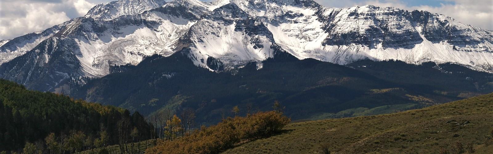
Wilson Peak stands as one of Colorado's celebrated fourteeners, meaning it tops out above 14,000 feet. It is located in the San Juan Mountains in southwestern Colorado. The terrain here is serious — this isn't a casual walk-up. The upper mountain involves exposed ridgelines, loose rock, and route-finding that demands your full attention. That said, Wilson Peak is considered one of the more approachable fourteeners in the San Juans, which is saying something given how rugged this part of Colorado tends to be.
The landscape shifts dramatically as you gain elevation. Lower sections move through dense subalpine forest, with spruce and fir giving way to open tundra as you push above treeline. Above that, it's all rock — talus fields, scrambling terrain, and the kind of wide-open exposure that makes you feel genuinely small. The views from the upper mountain stretch across a sea of peaks, with neighboring Mount Wilson and El Diente Peak visible nearby, forming one of the most impressive mountain groupings in the state.
Getting There
Access to Wilson Peak typically comes via the Rock of Ages Trail trailhead. The route begins on the historic Rock of Ages mining roads. From Telluride, head towards Placerville and take a left on Silver Pick Road. Head up the road roughly four miles and take a right onto the 622 Road, take this road (and stay right at the fork) to the Rock of Ages Trail Head. The trailhead itself is remote — this is not a place you stumble upon accidentally. Plan your drive carefully and give yourself extra time, especially if you're coming from a distance.
The Lizard Head Wilderness designation means no motorized or mechanized equipment is permitted in the backcountry. That means no mountain bikes, no drones, and no shortcuts. It also means the trails stay quieter than many other fourteener approaches in Colorado, which is a genuine bonus on a busy summer weekend.
The Route
The standard route to Wilson Peak follows the Rock of Ages trail, climbing steadily through forest before breaking out into alpine terrain. From there, the route heads toward the Rock of Ages Saddle at approximately 13,000 feet, which serves as the key decision point before the final push to the summit. From the saddle, the route traverses across a loose, rugged slope and crosses a saddle located between Wilson Peak and Gladstone Peak. The route then navigates around the south side before climbing up to the southwest ridge. The upper section involves Class 3 scrambling — hands-on-rock territory where route-finding matters and loose rock is a constant companion. Helmets are worth considering here, both for your own protection and for the safety of anyone below you on the mountain.
The summit itself is a narrow, rocky perch with exposure on multiple sides. On a clear day, the panorama is extraordinary — layers of San Juan peaks in every direction, with the distinctive spire of Lizard Head visible to the south. It's the kind of view that makes the effort feel completely worth it.
What to Expect on the Trail
Wilson Peak is a genuine wilderness experience. There are no maintained facilities at the trailhead beyond basic amenities, and once you're on the trail, you're on your own. Cell service is essentially nonexistent in this area, so download your maps offline before you leave and let someone know your plans.
The trail sees a mix of day hikers going for the summit and backpackers using Navajo Lake as a base camp — the lake itself is a beautiful destination and a popular overnight spot. If you're planning a summit attempt, starting early is not optional. Afternoon thunderstorms are a serious and consistent hazard in the San Juans throughout the summer months. Being on or near the summit after noon significantly increases your exposure to lightning risk. Most experienced hikers aim to summit before noon and are well below treeline by early afternoon.
Difficulty and Who It's For
Wilson Peak is best suited for hikers with solid experience in high-altitude, off-trail, and scrambling terrain. If you've done a few easier fourteeners and are comfortable with Class 3 scrambling, Wilson Peak is a logical next step. If you're new to fourteeners or high-altitude hiking in general, this one isn't the right starting point — there are gentler introductions to Colorado's high peaks that will serve you better before you take this on.
Altitude is a real factor here. If you're coming from sea level or a lower-elevation city, spending at least one or two nights at altitude before attempting the summit will make a meaningful difference in how you feel on the mountain. Symptoms of altitude sickness — headache, nausea, fatigue — can affect anyone regardless of fitness level, and they're not something to push through on a technical route.
Dogs and Leave No Trace
Dogs are permitted in the Lizard Head Wilderness, but the terrain on the upper mountain is demanding for four-legged companions. Sharp talus and exposed scrambling sections can be hard on paws and difficult to navigate for dogs. Know your animal's abilities honestly before bringing them along on a summit attempt.
The San Juans are a fragile alpine environment. Stay on established trails where they exist, pack out everything you bring in, and be especially careful above treeline where vegetation is slow to recover from foot traffic. Cairns mark sections of the route, but resist the urge to build new ones — the existing markers are enough, and unnecessary cairns can actually mislead other hikers in poor visibility.
Best Season
The window for a safe summit attempt on Wilson Peak is generally mid-July through mid-September, once the snowpack has melted sufficiently from the upper mountain. Early season attempts can involve significant snow travel and avalanche terrain that requires specialized gear and experience. By late September, early winter storms can return quickly, and conditions can deteriorate fast. Check current conditions and recent trip reports before heading out, regardless of the time of year.
The Essential Hiking Checklist
Everything you need for your next hike. Bilingual, printable, 1 page.
Get your free hiking checklistRecommended gear for this trail
As an Amazon Associate I earn from qualifying purchases.


Ready to go?
Everything you need to know before you goWhen?
How much?
As an Amazon Associate I earn from qualifying purchases.
Affiliate links — LGPO may earn a commission at no extra cost to you.
- Hiking shoes Essential
- → Salomon Elixir Tour Mid WP · 203.38 $
- Layered clothing Essential
- Rain jacket Essential
- Trekking poles
- → Black Diamond Trail Ergo Cork · 69.99 $
- Headlamp
- → Petzl Actik Core 625 · 103.95 $
FAQ - Frequently asked questions
Everything you need to knowSimilar hikes nearby
Discover other trails you might enjoy

Uncompahgre Peak, Colorado
Mountains & Mesas

Gold Hill, Colorado
Mountains & Mesas

Wilson Peak, Colorado
Mountains & Mesas
Cedar Mesa
Mountains & Mesas
Portland Trail
Mountains & Mesas
Hiking near Regina
4 trails to explore ~1424 km away
We work hard to provide the most up-to-date and error-free data possible. If something seems incorrect, let us know! Your contribution helps the whole community.
Hikers' opinions
Be the first to review!
No hiker has shared their experience yet. Share your impressions and help other hikers!