

Ready to explore Mount Peale? Here's everything you need to know before you go!
Discover the trail
Photos: Intermountain Region US Forest Service — Domaine public (Wikimedia Commons)
Trail description
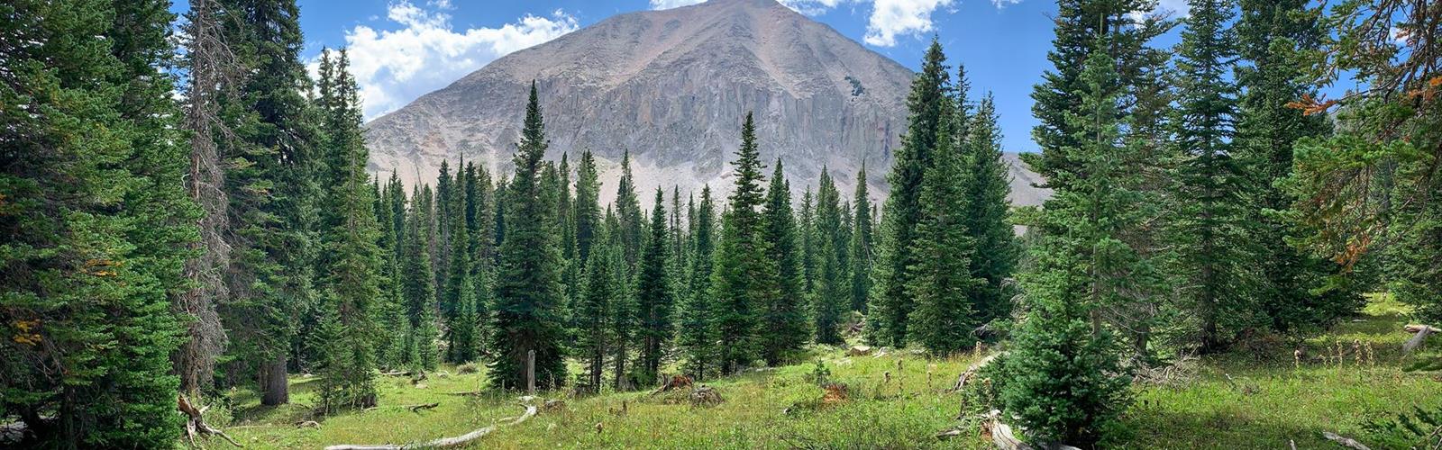
Mount Peale is the highest summit in the La Sal Mountains, rising above the red rock desert of southeastern Utah in a way that feels almost surreal. While the canyon country below bakes under the sun, this peak pushes into alpine territory — a world of rocky ridgelines, open tundra, and sweeping views that stretch across an enormous stretch of the Colorado Plateau. If you're looking for a serious mountain objective in this part of Utah, Mount Peale is the one that earns its reputation.
The La Sal Mountains
The La Sal Mountains are a laccolith range — formed when magma pushed upward through sedimentary rock without breaking the surface, creating a dome-like cluster of peaks. The result is a compact group of high summits that rise dramatically from the surrounding desert. Mount Peale sits at the heart of this range, and reaching it means transitioning through multiple distinct environments as you gain elevation. The contrast between the desert floor and the alpine zone above is one of the most striking things about hiking in this area.
The range sits just east of Moab, and on clear days the views from the upper slopes of Mount Peale take in iconic canyon country landmarks — the canyons of the Colorado and Dolores Rivers, the Canyonlands basin, Dead Horse Point, and the broader Colorado Plateau. That visual payoff is a big part of why hikers make the effort to get up here.
The Route and Terrain
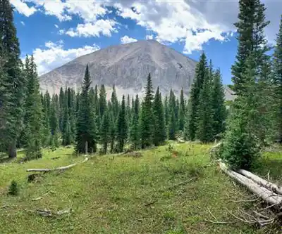
The standard approach to Mount Peale involves gaining significant elevation through varied terrain. Lower sections of the route pass through aspen groves and conifer forest — spruce, fir, and pine that give way to krummholz and then open alpine tundra as you push higher. The upper mountain is rocky and exposed, with loose scree and talus requiring careful footing. This is not a trail that holds your hand — route-finding skills and solid footwear matter here.
The summit itself is a broad, rocky high point with no shelter from wind or weather. Conditions can change quickly at this elevation, and afternoon thunderstorms are a genuine hazard during summer months. Early starts are strongly recommended — being on the summit before midday gives you a meaningful buffer against the electrical storms that build over the mountains on warm afternoons.
What to Expect on the Mountain
This is a physically demanding objective. The elevation gain is substantial, and the altitude itself adds to the challenge — your body works harder up here than it does at lower elevations, and hikers not acclimatized to high altitude may feel the effects. Take your time on the ascent, stay hydrated, and pay attention to how you're feeling.
The rocky upper terrain requires hands-on scrambling in places, though the route does not involve technical climbing. Sturdy hiking boots with good ankle support are the right footwear. Trekking poles are useful, especially on the descent when loose rock and tired legs are a combination that leads to slips.
Wildlife in the La Sal Mountains includes mule deer, elk, and a variety of raptors that ride thermals above the ridgelines. The alpine tundra supports hardy wildflowers during the short summer season, and the transition zones between forest and open terrain are worth slowing down to appreciate.
Access and Trailhead
Access to the Mount Peale trailhead runs through the La Sal Mountain Loop Road, a scenic route that climbs from the desert floor into the range. Road conditions can vary — portions of the access road may require a high-clearance vehicle depending on conditions and the specific route you take to the trailhead. Check current road conditions before heading out, particularly early and late in the season when snow and mud can affect access.
The La Sal Mountains fall within the Manti-La Sal National Forest, managed by the U.S. Forest Service. There are no entry fees for day hiking in this area. Dispersed camping is available in the national forest, subject to standard Leave No Trace guidelines and any specific restrictions posted by the Forest Service.
Season and Timing
The window for hiking Mount Peale is relatively short. Snow typically lingers on the upper mountain well into early summer, and the route can be buried under significant snowpack through June in heavy years. The prime hiking season runs roughly from mid-July through September. By October, early season snowstorms can close the upper mountain again.
Shoulder season visits — late spring or early fall — are possible but require avalanche awareness and winter mountaineering skills if snow is present. Don't underestimate the mountain in marginal conditions.
Practical Tips
- Start early. Afternoon thunderstorms are common and dangerous on exposed ridgelines and summits. Aim to be off the summit by early afternoon at the latest.
- Bring layers. Even on warm summer days, temperatures at the summit can be significantly colder than at the trailhead, and wind chill adds to that. A wind shell and an insulating layer are worth carrying.
- Carry enough water. Water sources on the upper mountain are limited and should be treated before drinking. Carry more than you think you'll need.
- Check the weather. Look at forecasts specific to mountain elevations, not just the Moab valley. Conditions differ significantly between the desert floor and the alpine zone.
- Know your limits. This is a serious mountain hike. If you're new to high-altitude hiking or alpine terrain, build up to it with easier objectives first.
- Leave No Trace. Alpine tundra is fragile and slow to recover from damage. Stay on established paths where they exist, and avoid trampling vegetation on the upper mountain.
Dogs and Other Users
Dogs are permitted in the Manti-La Sal National Forest but must be under control at all times. Given the rugged terrain on the upper mountain — loose talus, steep sections, and exposed ridgelines — consider carefully whether your dog is suited for this kind of terrain before bringing them along.
Mount Peale sees far less traffic than the heavily visited trails around Moab, which means you're likely to have a quieter, more solitary experience on the mountain — one of the genuine rewards of putting in the effort to get up here.
The Essential Hiking Checklist
Everything you need for your next hike. Bilingual, printable, 1 page.
Get your free hiking checklistRecommended gear for this trail
As an Amazon Associate I earn from qualifying purchases.


Ready to go?
Everything you need to know before you goWhen?
How much?
As an Amazon Associate I earn from qualifying purchases.
Affiliate links — LGPO may earn a commission at no extra cost to you.
- Hiking shoes Essential
- → Salomon Elixir Tour Mid WP · 203.38 $
- Layered clothing Essential
- Rain jacket Essential
- Trekking poles
- → Black Diamond Trail Ergo Cork · 69.99 $
- Headlamp
- → Petzl Actik Core 625 · 103.95 $
FAQ - Frequently asked questions
Everything you need to knowSimilar hikes nearby
Discover other trails you might enjoy
Boulder Top
Southern Utah
Lake Powell
Southern Utah
Under the Rim Trail
Southern Utah
Silver Reef
Southern Utah

Harris Wash
Southern Utah
White Rim Trail
Southern Utah
Hiking near Regina
4 trails to explore ~1383 km away
We work hard to provide the most up-to-date and error-free data possible. If something seems incorrect, let us know! Your contribution helps the whole community.
Hikers' opinions
Be the first to review!
No hiker has shared their experience yet. Share your impressions and help other hikers!