

Ready to explore Boulder Top? Here's everything you need to know before you go!
Discover the trail
Trail description
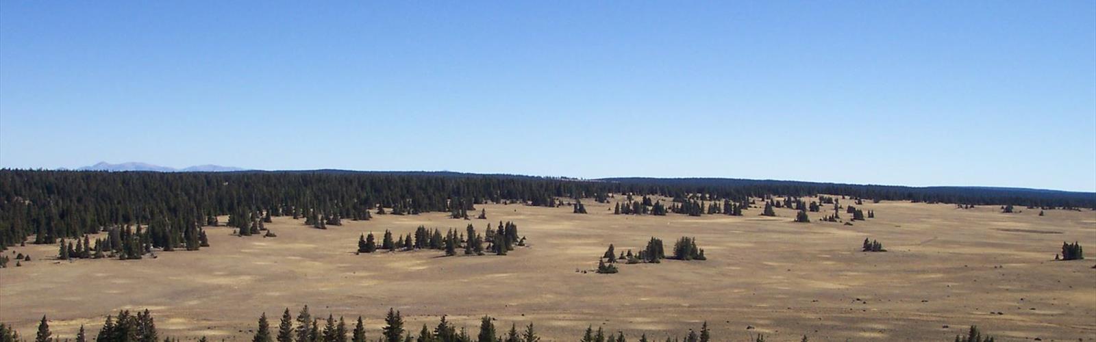
Boulder Top is one of those places that stops you in your tracks the moment you arrive. Sitting high above the surrounding canyon country of central Utah, this broad, elevated plateau offers a hiking experience that feels genuinely different from anything else in the region. The scale is hard to wrap your head around until you're actually standing on it — a vast, open tableland stretching in every direction, with the kind of sky that makes you feel small in the best possible way.
What Is Boulder Top?
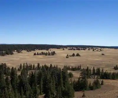
Boulder Top is a high-elevation plateau located in central Utah, part of the Dixie National Forest and closely associated with the Aquarius Plateau — one of the highest timbered plateaus in North America. The landscape up here is a striking mix of open meadows, dense conifer forest, and scattered lakes and ponds that dot the terrain across the plateau. It's the kind of place where the terrain keeps surprising you as you move through it.
The name fits. The plateau is littered with boulders — glacially deposited rocks that give the landscape a rugged, almost lunar quality in certain spots, especially as you move away from the treeline into the more exposed sections. The contrast between the boulder fields and the lush meadows nearby is one of the defining visual features of the area.
The Terrain and What to Expect
Hiking on Boulder Top is largely cross-country travel. There are established routes and some trails, but a big part of what draws people here is the freedom to move across open terrain without being locked into a single corridor. The plateau is wide enough that you can spend a full day out here and still feel like you've only scratched the surface.
The ground varies considerably depending on where you are. Some sections are grassy and relatively easy underfoot, while others involve navigating through boulder fields or pushing through dense stands of spruce and fir. Navigation skills matter here — the openness of the plateau can be disorienting in low visibility, and the landscape doesn't always offer obvious landmarks to orient yourself by.
The lakes scattered across Boulder Top are a major draw. Many of them hold fish, and the combination of high-altitude water, open sky, and surrounding forest makes them excellent spots to stop, eat lunch, and take in the surroundings. The stillness up here on a calm day is something else entirely.
Wildlife and Natural Features
The plateau supports a healthy range of wildlife. Mule deer are commonly spotted, particularly in the meadow areas. Elk move through the area as well, especially during seasonal migrations. Birdlife is active across the plateau, with raptors frequently visible riding thermals above the open sections.
The forest on Boulder Top is predominantly subalpine — spruce, fir, and aspen make up most of the tree cover. The aspen groves are particularly striking in fall, when the plateau lights up with color before the season closes in. Wildflowers are abundant through the summer months, filling the meadows with color during the warmer weeks.
The lakes and ponds are ecologically significant features of the plateau. They range from small, shallow ponds to larger bodies of water, and their presence shapes the character of the surrounding terrain. Wetland vegetation grows along the margins of many of them, adding another layer of habitat diversity to the area.
Access and Logistics
Getting to Boulder Top requires some planning. Access roads lead up onto the plateau, but road conditions can vary significantly depending on the season and recent weather. A high-clearance vehicle is strongly recommended, and in some conditions four-wheel drive is necessary. The roads that access the plateau are not maintained for year-round use, and snow can linger well into spring at this elevation.
The plateau sits at high elevation, which means the hiking season is compressed compared to lower-elevation destinations in Utah. Summer and early fall are the primary windows when conditions are reliably good for travel on the plateau. Afternoon thunderstorms are common during the summer months — a standard feature of high-elevation terrain in this part of the West — so early starts are a smart habit.
There are dispersed camping opportunities in the area, consistent with Dixie National Forest regulations. This makes Boulder Top a solid destination for an overnight or multi-day trip, giving you time to explore more of the plateau than a single day allows. Check current forest regulations and any fire restrictions before heading out, as these can change based on conditions.
Who This Place Is For
Boulder Top rewards hikers who are comfortable with open-country travel and self-navigation. If you're looking for a well-signed, heavily trafficked trail with clear waypoints, this isn't the right fit. But if you're drawn to wide-open terrain, the freedom to pick your own line, and a landscape that feels genuinely remote even when it's not technically far from civilization — this plateau delivers.
The elevation means you should be acclimatized before pushing hard up here, especially if you're coming from lower elevations. Take your time on the first day, drink plenty of water, and pay attention to how you're feeling. The rewards for doing it right are substantial.
- Terrain type: High-elevation plateau with open meadows, boulder fields, conifer forest, and scattered lakes
- Navigation: Cross-country travel is common; map and compass or GPS recommended
- Vehicle access: High-clearance vehicle recommended; 4WD may be required depending on conditions
- Season: Summer through early fall; snow can persist into late spring
- Camping: Dispersed camping available under Dixie National Forest regulations
- Wildlife: Mule deer, elk, raptors, and diverse birdlife
- Weather: Afternoon thunderstorms common in summer; early starts recommended
Why Boulder Top Stands Out
Central Utah has no shortage of dramatic landscapes, but Boulder Top occupies a specific niche that's hard to replicate elsewhere in the region. The combination of high-elevation openness, lake-dotted terrain, and genuine cross-country freedom puts it in a category of its own. It's the kind of destination that experienced hikers come back to repeatedly, finding new corners of the plateau each time and appreciating the consistency of what makes it special — the space, the quiet, and the sense that you're moving through a landscape that hasn't been over-managed or over-visited.
The Essential Hiking Checklist
Everything you need for your next hike. Bilingual, printable, 1 page.
Get your free hiking checklistRecommended gear for this trail
As an Amazon Associate I earn from qualifying purchases.


Ready to go?
Everything you need to know before you goWhen?
How much?
As an Amazon Associate I earn from qualifying purchases.
Affiliate links — LGPO may earn a commission at no extra cost to you.
- Hiking shoes Essential
- → Salomon Elixir Tour Mid WP · 203.38 $
- Layered clothing Essential
- Rain jacket Essential
- Trekking poles
- → Black Diamond Trail Ergo Cork · 69.99 $
- Headlamp
- → Petzl Actik Core 625 · 103.95 $
FAQ - Frequently asked questions
Everything you need to knowSimilar hikes nearby
Discover other trails you might enjoy
Mount Peale
Southern Utah
Lake Powell
Southern Utah
Under the Rim Trail
Southern Utah
Silver Reef
Southern Utah

Harris Wash
Southern Utah
White Rim Trail
Southern Utah
Hiking near Sydney
22 trails to explore ~7609 km away
We work hard to provide the most up-to-date and error-free data possible. If something seems incorrect, let us know! Your contribution helps the whole community.
Hikers' opinions
Be the first to review!
No hiker has shared their experience yet. Share your impressions and help other hikers!