


Ready to explore Farmington River? Here's everything you need to know before you go!
Discover the trail
Oh no! We don't have any photos 😢
This trail hasn't been captured yet. Be the first to share your adventure!Trail description
The Farmington River corridor offers some of Connecticut's most accessible and scenic hiking opportunities, winding through a landscape where New England's industrial heritage meets pristine natural beauty. This waterway has carved out a diverse ecosystem that supports both wildlife and outdoor recreation, making it a favorite destination for hikers seeking variety in their trail experiences.
Trail Network and Terrain
The hiking trails along the Farmington River traverse a mix of terrain that showcases the region's geological diversity. You'll find yourself walking through riverside floodplains where the soil is rich and dark, supporting towering sycamores and cottonwoods that create natural canopies overhead. The terrain shifts as you move away from the water, climbing gentle slopes into mixed hardwood forests dominated by oak, maple, and hickory.
Many of the trails follow old railroad grades and towpaths, creating relatively flat walking surfaces that make the area accessible to hikers of various skill levels. These historic corridors provide long sight lines along the river and through the forest, offering glimpses of wildlife and changing seasonal displays. The footing is generally solid, though some sections near the water can become muddy during spring snowmelt or after heavy rains.
River Environment and Wildlife
The Farmington River serves as the backbone of this hiking area, and its presence influences everything from the plant communities you'll encounter to the wildlife you might spot. The river maintains excellent water quality, supporting populations of wild trout that attract both anglers and the birds that feed on them. Great blue herons are common sights along the quieter stretches, standing motionless in the shallows before striking at unwary fish.
The riparian zone creates a unique microclimate that supports species not typically found in the surrounding upland forests. Look for belted kingfishers diving for fish, and listen for the distinctive call of red-winged blackbirds in the marshy areas where tributaries meet the main river. Deer tracks are abundant in the soft soil near the water's edge, and you might catch sight of these animals coming to drink, especially during early morning or evening hikes.
Seasonal Hiking Experience
Each season brings distinct advantages to hiking along the Farmington River. Spring arrives early near the water, with skunk cabbage and marsh marigolds emerging from wet areas while snow might still linger in the surrounding hills. The river runs high and fast during this time, creating a soundtrack of rushing water that accompanies your hike.
Summer transforms the corridor into a green tunnel, with full canopy providing welcome shade during hot Connecticut days. The river runs lower and clearer, revealing the rocky bottom and creating perfect conditions for spotting fish and aquatic insects. This is prime time for combining hiking with other activities like fishing or simply cooling your feet in the water.
Fall brings spectacular color to the mixed forests, with the river reflecting the reds and golds of the changing leaves. The lower water levels of late summer and early fall make it easier to explore areas that might be inaccessible during higher water periods. Winter hiking reveals the river's structure more clearly, with ice formations creating temporary sculptures along the banks and snow highlighting the patterns of animal tracks.
Historical Context
The Farmington River valley carries deep historical significance that adds layers of interest to your hiking experience. The river powered mills and factories during Connecticut's industrial boom, and remnants of this heritage appear along many trails. Stone foundations, old dam structures, and abandoned mill races tell the story of a time when this waterway drove the region's economy.
Native American groups used these river corridors as travel routes long before European settlement, and some trails follow paths that have been in use for centuries. The combination of natural transportation corridor and reliable water source made this area attractive to successive waves of inhabitants, each leaving their mark on the landscape.
Trail Access and Navigation
Multiple access points along the Farmington River provide flexibility in planning your hiking experience. Some trailheads offer formal parking areas with trail maps and information kiosks, while others provide more informal access through local parks or conservation areas. The interconnected nature of many trails means you can create loops of varying lengths or plan point-to-point hikes using multiple access points.
Trail marking varies depending on which organization maintains specific sections, but most routes are well-established and easy to follow. The river itself serves as an excellent navigation aid, and the relatively developed nature of the surrounding area means you're never far from civilization if you need to cut a hike short.
What Makes This Area Special
The Farmington River hiking area stands out in Connecticut's outdoor recreation landscape for its combination of accessibility and natural beauty. Unlike more remote wilderness areas that require significant travel time, these trails offer genuine nature experiences within reach of major population centers. The river provides a constant focal point that prevents the monotony sometimes associated with forest-only hiking.
The area also offers excellent opportunities for multi-activity outings. Many hikers combine trail time with fishing, photography, or simply relaxing by the water. The relatively gentle terrain makes it ideal for introducing newcomers to hiking while still providing enough variety to keep experienced hikers engaged. The changing character of the river and surrounding landscape means that familiar trails can offer new experiences with each visit.
The Essential Hiking Checklist
Everything you need for your next hike. Bilingual, printable, 1 page.
Get your free hiking checklistRecommended gear for this trail
As an Amazon Associate I earn from qualifying purchases.


Ready to go?
Everything you need to know before you goWhen?
How much?
As an Amazon Associate I earn from qualifying purchases.
Affiliate links — LGPO may earn a commission at no extra cost to you.
- Hiking shoes Essential
- → Salomon Elixir Tour Mid WP · 203.38 $
- Layered clothing Essential
- Rain jacket Essential
- Trekking poles
- → Black Diamond Trail Ergo Cork · 69.99 $
- Headlamp
- → Petzl Actik Core 625 · 103.95 $
FAQ - Frequently asked questions
Everything you need to knowSimilar hikes nearby
Discover other trails you might enjoy
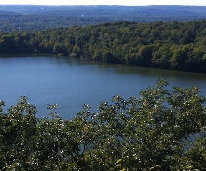

Hiking near Hartford
0 trails to explore ~16 km away
We work hard to provide the most up-to-date and error-free data possible. If something seems incorrect, let us know! Your contribution helps the whole community.
Hikers' opinions
Be the first to review!
No hiker has shared their experience yet. Share your impressions and help other hikers!