

Ready to explore Black Mountain-Northeast High Peak, Kentucky_Virginia? Here's everything you need to know before you go!
Discover the trail
Oh no! We don't have any photos 😢
This trail hasn't been captured yet. Be the first to share your adventure!Trail description
Black Mountain Northeast High Peak represents Kentucky's highest point, standing as a remarkable destination where the Bluegrass State meets Virginia along the Appalachian ridge. This summit offers hikers the unique opportunity to reach Kentucky's geographic pinnacle while experiencing the rugged beauty of the Cumberland Mountains.
Location and Access
The peak sits directly on the Kentucky-Virginia border, making it a distinctive hiking destination that literally straddles two states. The mountain forms part of the larger Black Mountain range, which extends across southeastern Kentucky and into Virginia. Access typically involves navigating rural mountain roads that wind through coal country, where small communities dot the landscape between forested ridges.
The approach to the trailhead requires careful navigation, as the area features a network of logging roads and mining access routes. Local knowledge proves invaluable here, and hikers should come prepared with detailed maps and GPS coordinates to locate the correct starting point.
Trail Experience
The hike to Kentucky's highest point challenges visitors with steep terrain and dense forest cover typical of the Appalachian region. The trail winds through mixed hardwood forests where oak, maple, and hickory trees create a canopy that shifts dramatically with the seasons. During spring, wildflowers carpet the forest floor, while autumn brings spectacular color displays across the mountainsides.
The path itself varies from well-defined sections to areas where route-finding skills become essential. Hikers encounter rocky outcrops, fallen logs, and stream crossings that add technical interest to the journey. The terrain reflects the mountain's coal-bearing geology, with exposed rock faces and occasional remnants of past mining activity visible along certain sections.
Summit Features
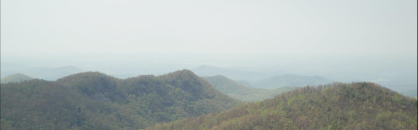
Reaching the Northeast High Peak provides a sense of accomplishment that goes beyond the physical challenge. Standing at Kentucky's highest elevation offers panoramic views across the Cumberland Mountains, with ridgelines extending into Virginia and beyond. On clear days, the vista encompasses multiple mountain ranges, showcasing the extensive Appalachian landscape.
The summit area itself features rocky outcrops and sparse vegetation adapted to the exposed conditions. Wind patterns at this elevation create a noticeably different microclimate compared to the protected valleys below. The border location adds geographic significance, allowing hikers to literally stand in two states simultaneously.
Natural Environment
The ecosystem around Black Mountain Northeast High Peak reflects the biodiversity of the southern Appalachians. The elevation gradient supports different plant communities, from rich cove forests in the valleys to more specialized high-elevation species near the summit. Wildlife includes typical mountain species such as white-tailed deer, black bears, and various bird species that inhabit the dense forest cover.
The area's geology tells the story of ancient mountain-building processes, with exposed rock formations revealing the region's coal-bearing strata. Springs and small streams originate from these heights, eventually feeding into larger waterways that drain both Kentucky and Virginia watersheds.
Seasonal Considerations
Each season brings distinct characteristics to the Black Mountain experience. Spring offers mild temperatures and emerging vegetation, though mud and wet conditions can make trail navigation more challenging. Summer provides the most stable weather but also brings heat and humidity that can make the climb more strenuous.
Fall stands out as perhaps the premier season for visiting, with comfortable temperatures and spectacular foliage displays. The mixed hardwood forests create a tapestry of colors that extends across the mountain landscape. Winter hiking becomes more technical, with potential for ice and snow conditions that require appropriate gear and experience.
Historical Context
The Black Mountain region carries significant historical importance in Kentucky's development. Coal mining shaped much of the area's modern history, with communities rising and falling based on mining operations. Evidence of this industrial heritage appears throughout the region, from abandoned mining equipment to reclaimed sites where nature slowly reclaims former extraction areas.
The mountain also holds cultural significance for local communities, representing both the challenges and beauty of Appalachian life. Traditional uses of the land included hunting, gathering, and small-scale agriculture on suitable slopes and valleys.
Planning Your Visit
Success on Black Mountain Northeast High Peak requires thorough preparation and realistic expectations. The combination of challenging terrain, navigation requirements, and remote location demands that hikers come equipped with proper gear, including sturdy boots, navigation tools, and emergency supplies.
Weather can change rapidly at elevation, making layered clothing essential regardless of season. Water sources may be limited along certain route options, so carrying adequate hydration becomes critical. The remote nature of the area also means that cell phone coverage cannot be relied upon for emergency communication.
Local conditions can vary significantly based on recent weather, seasonal factors, and ongoing land management activities. Checking current conditions and access restrictions before departure helps ensure a safe and successful adventure to Kentucky's highest point.
The Essential Hiking Checklist
Everything you need for your next hike. Bilingual, printable, 1 page.
Get your free hiking checklistRecommended gear for this trail
As an Amazon Associate I earn from qualifying purchases.


Ready to go?
Everything you need to know before you goWhen?
How much?
As an Amazon Associate I earn from qualifying purchases.
Affiliate links — LGPO may earn a commission at no extra cost to you.
- Hiking shoes Essential
- → Salomon Elixir Tour Mid WP · 203.38 $
- Layered clothing Essential
- Rain jacket Essential
- Trekking poles
- → Black Diamond Trail Ergo Cork · 69.99 $
- Headlamp
- → Petzl Actik Core 625 · 103.95 $
FAQ - Frequently asked questions
Everything you need to knowSimilar hikes nearby
Discover other trails you might enjoy

Hiking near Pittsburgh
0 trails to explore ~446 km away
We work hard to provide the most up-to-date and error-free data possible. If something seems incorrect, let us know! Your contribution helps the whole community.
Hikers' opinions
Be the first to review!
No hiker has shared their experience yet. Share your impressions and help other hikers!