


Ready to explore Mount Waldo? Here's everything you need to know before you go!
Discover the trail
Oh no! We don't have any photos 😢
This trail hasn't been captured yet. Be the first to share your adventure!Trail description
Mount Waldo is a small mountain about 1,060 feet (320 m) high in Waldo County, Maine. It is located in the town of Frankfort.
Mt. Waldo granite was once the stock in trade of a thriving industry. The Mount Waldo Granite has a coarse-grained texture which gives it a more patchy, mottled look than the finer-grained granites. Although granite is no longer quarried here, it can still be seen in buildings in many eastern cities, such as New York, Washington, D.C., and Philadelphia.
The combination of bare rock ledges and proximity to tidewater made this granite amenable to quarrying in the early 19th century. The two significant quarries in the Mount Waldo Granite in the 19th century were on the northeast flank of Mount Waldo itself, and near the top of Mosquito Mountain. According to a description of the operations from the early 20th century, the quarried stone was taken over graded tracks, operated by gravity, to cutting sheds and wharfs on Marsh River. From there it was taken on the Penobscot River and distributed to eastern ports in Massachusetts, New York, and Philadelphia, and to "western" cities of Chicago, Milwaukee, and Cleveland. The granite from Mt. Waldo was used for structures such as the Washington Monument, the U.S. Senate Office Building, the Tomb of the Unknown Soldier, the United Nations Building, the Philadelphia Mint, the Empire State Building, and several piers that support the Brooklyn Bridge
The quarry was on the north spur of Mount Waldo, 660 feet (200 m) above sea level, one-third mile southwest of the town of Frankfort. The operator of the quarry was the Mount Waldo Granite Works of Frankfort. Granite from the quarry was reportedly a medium gray color. Transport of the granite was by two graded tracks, each 1,200 feet (370 m) long, operated by gravity from the quarry part way down the hill to the power house, thence by a cable road (Roebling engine) 1¼ miles to the wharf, which is accessible to schooners at 15 feet (4.6 m) draft. The quarry located at Mt. Waldo has been unused since 1914. The surviving elements of the quarry works were listed on the National Register of Historic Places in 1974.
Free
1 pages
The Essential Hiking Checklist
Everything you need for your next hike. Bilingual, printable, 1 page.
Get your free hiking checklistRecommended gear for this trail
As an Amazon Associate I earn from qualifying purchases.
LGPO Pick

Salomon
Elixir Tour Mid WP
Waterproof mid-height boot ideal for rocky terrain
203.38 $


Affiliate links — LGPO may earn a commission at no extra cost to you.
Ready to go?
Everything you need to know before you goWhen?
Opening hours
No information
Varies by season
Best season
Fall
Spectacular colors
Best time
Early morning
Less crowded
Weather (next days)
Loading
How much?
Entry fees
Adult
Not available
Child
—
What to bring?
As an Amazon Associate I earn from qualifying purchases.
Affiliate links — LGPO may earn a commission at no extra cost to you.
Gear
- Hiking shoes Essential
- → Salomon Elixir Tour Mid WP · 203.38 $
- Layered clothing Essential
- Rain jacket Essential
- Trekking poles
- → Black Diamond Trail Ergo Cork · 69.99 $
- Headlamp
- → Petzl Actik Core 625 · 103.95 $
Water & food
2L minimum
No water point on the trail
Bring energy snacks for a 4h+ hike
Good to know
Safety
Download the GPX before you go
Limited cellular coverage on the trail
Slippery after rain
Be careful on rocky sections
In an emergency
Emergency
911
Parking GPS
44.614, -68.895868
Center
Not available
FAQ - Frequently asked questions
Everything you need to knowNo, Mount Waldo has no visitor centre on site.
Didn't find your answer?
Similar hikes nearby
Discover other trails you might enjoy
South Peak
Aroostook County
2 KM
1h25
330 m
Intermediate
Allagash Mountain
Aroostook County
3.2 km
1h30
213 m
Intermediate
Penobscot River Trails
Aroostook County
8 km
2h30
104 m
Beginner

Fish River
Aroostook County
14.5 km
4h10
300 m
Intermediate
🐕
Dog allowed
Deboullie Public Reserved Land
Aroostook County
15 km
4h30
414 m
Intermediate
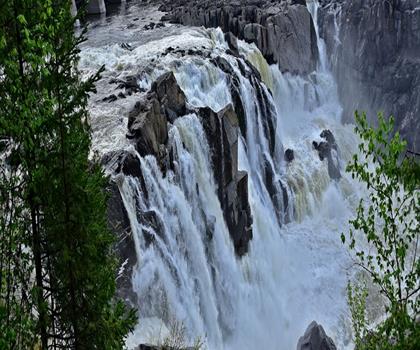
Grand Falls
Aroostook County
11.5 KM
4h15
600 m
Intermediate
Top 10 best hiking in Aroostook County
Our ranking based on hiker reviews
Hiking near Bangor
0 trails to explore ~23 km away
Did you spot an error?
We work hard to provide the most up-to-date and error-free data possible. If something seems incorrect, let us know! Your contribution helps the whole community.
Hikers' opinions
Be the first to review!
No hiker has shared their experience yet. Share your impressions and help other hikers!