


Ready to explore The Sands? Here's everything you need to know before you go!
Discover the trail
Oh no! We don't have any photos 😢
This trail hasn't been captured yet. Be the first to share your adventure!Trail description
The Sands is a hiking destination located in Aroostook County, Maine — a part of the state that doesn't always make it onto the average hiker's radar, but absolutely should. Aroostook County is Maine's largest county by far, covering more land than some entire states, and it holds a quieter, more rugged version of the Maine outdoor experience that you won't find further south along the coast. The Sands fits right into that character.
The Setting
Aroostook County is defined by wide open spaces, working forests, agricultural land, and a genuine sense of remoteness. This isn't the crowded trailhead scene you'd find near Acadia or the Appalachian Trail corridor. Out here, you're more likely to share the trail with a white-tailed deer than another hiker. The Sands takes advantage of this landscape, offering an experience that feels unhurried and genuinely off the beaten path.
The name itself — The Sands — hints at the terrain underfoot. Sandy soils are a notable feature of certain pockets of Aroostook County, a legacy of glacial activity that shaped this entire region thousands of years ago. As glaciers retreated, they left behind deposits of sand, gravel, and outwash material that created distinct microhabitats unlike the rocky, root-tangled trails more commonly associated with Maine hiking.
What the Terrain Is Like
Hiking at The Sands means walking through a landscape shaped by both geological history and the natural ecology of northern Maine. Sandy, well-drained soils support a different plant community than you'd find on a typical Maine hillside — expect open, airy sections where the forest canopy thins out, allowing more light to reach the ground and encouraging a ground-level flora that can surprise you if you're used to the dense, mossy understory of coastal or mountain Maine.
The footing tends to be softer and more forgiving than rocky Maine trails, which makes The Sands a reasonable option for hikers who want to explore the region without tackling technical terrain. That said, sandy trails can shift and feel loose in spots, so solid footwear is still a good call.
Northern Maine's forests are predominantly boreal in character — spruce, fir, and birch are common players — and the transition zones where sandy openings meet denser forest create interesting edges worth paying attention to. These edge habitats are often productive spots for wildlife observation, particularly birds.
Wildlife and Nature
Aroostook County is serious wildlife country. Moose are present throughout the region and sightings, while never guaranteed, are a real possibility — especially in wetter areas near the trail. White-tailed deer, snowshoe hare, and a wide range of bird species are regular inhabitants of this type of mixed boreal and transitional habitat.
Birdwatchers will find northern Maine rewarding in general. Species that are harder to find further south — certain warblers, sparrows, and boreal specialists — are more accessible up here. The open sandy areas and forest edges at The Sands can be particularly good spots to slow down and listen.
Getting There
Aroostook County is a long drive from most of Maine's population centers, and that's part of the deal. If you're coming from Bangor, you're looking at a significant drive north. The county seat of Presque Isle and the city of Caribou are the main service hubs in the region, offering fuel, food, and accommodations before you head out to more remote areas. Planning ahead matters up here — services thin out quickly once you leave the main corridors.
As with many trails in rural northern Maine, cell service can be limited or nonexistent in the area. Download offline maps before you leave, let someone know your plans, and carry what you need with you. Self-sufficiency is part of the culture out here, and it's a good mindset to bring along.
Best Times to Visit
Maine's north country has a compressed outdoor season compared to the rest of New England. Winters are long and genuinely cold — Aroostook County regularly sees some of the coldest temperatures in the state. Snow can linger well into spring, and the shoulder seasons bring mud that can make sandy trails feel unpredictable.
Summer and early fall are the prime windows for hiking in this region. July and August bring long days and relatively stable weather, though bugs — particularly black flies in early summer — are a real factor and worth preparing for. September and October offer cooler temperatures, fewer insects, and the added bonus of fall foliage, which in northern Maine tends to peak earlier than in the southern part of the state. The combination of birch and mixed forest in Aroostook County makes for a solid fall color show.
Practical Notes
- Location: The Sands is situated in Aroostook County, Maine — plan your route accordingly and confirm access details before heading out.
- Footwear: Trail runners or hiking boots with good grip are recommended; sandy terrain can be loose in sections.
- Navigation: Download offline maps ahead of time. Cell coverage in rural Aroostook County is unreliable.
- Bugs: Black flies are a significant presence in late spring and early summer. Bring insect repellent and consider a head net if you're sensitive to bugs.
- Wildlife awareness: Moose country — stay alert, especially near any wet or low-lying areas along the trail.
- Self-sufficiency: Services are limited in the area. Carry water, snacks, a first aid kit, and a charged battery pack.
Why It's Worth the Trip
The Sands represents something that's increasingly rare in the northeastern United States — a place where you can genuinely feel like you have the landscape to yourself. Aroostook County doesn't draw the crowds that southern Maine does, and that's exactly the point. If you're the kind of hiker who values quiet, space, and a landscape that feels authentically wild rather than managed for tourism, northern Maine delivers, and The Sands is a solid reason to make the drive north.
The Essential Hiking Checklist
Everything you need for your next hike. Bilingual, printable, 1 page.
Get your free hiking checklistRecommended gear for this trail
As an Amazon Associate I earn from qualifying purchases.


Ready to go?
Everything you need to know before you goWhen?
How much?
As an Amazon Associate I earn from qualifying purchases.
Affiliate links — LGPO may earn a commission at no extra cost to you.
- Hiking shoes Essential
- → Salomon Elixir Tour Mid WP · 203.38 $
- Layered clothing Essential
- Rain jacket Essential
- Trekking poles
- → Black Diamond Trail Ergo Cork · 69.99 $
- Headlamp
- → Petzl Actik Core 625 · 103.95 $
FAQ - Frequently asked questions
Everything you need to knowSimilar hikes nearby
Discover other trails you might enjoy
South Peak
Aroostook County
Allagash Mountain
Aroostook County
Penobscot River Trails
Aroostook County

Fish River
Aroostook County
Deboullie Public Reserved Land
Aroostook County
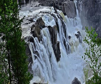
Grand Falls
Aroostook County
Hiking near Sydney
22 trails to explore ~7544 km away
We work hard to provide the most up-to-date and error-free data possible. If something seems incorrect, let us know! Your contribution helps the whole community.
Hikers' opinions
Be the first to review!
No hiker has shared their experience yet. Share your impressions and help other hikers!