

Ready to explore Cedar Lake Trail? Here's everything you need to know before you go!
Discover the trail
Oh no! We don't have any photos 😢
This trail hasn't been captured yet. Be the first to share your adventure!Trail description
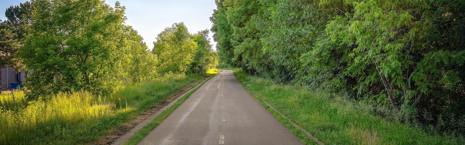
The Cedar Lake Regional Trail is America's first bicycle freeway. It is a rail trail that runs about 4.3 miles (6.9 km) from downtown Minneapolis, Minnesota (44°59′11″N 93°16′01″W) west to Minnesota State Highway 100 in the neighboring suburb of St. Louis Park(44°57′43″N 93°20′36″W). The trail was inaugurated on February 17, 1995. At the trail's west end, pavement continues for another 4.2 miles (6.8 km) as the Hutchinson Spur Trail through St. Louis Park to Hopkins. In 2009, the "Hutch Spur" was renamed "North Cedar Lake Trail." The two trails are paved for their entire lengths.
One reason the trail has been called a "bicycle freeway" is that it has three lanes for most of its length within Minneapolis: separate one-way lanes for bike traffic (like a divided highway) and third parallel lane for two-way pedestrian traffic. The Cedar Lake Regional Trail follows a BNSF Railway line (the railroad's Wayzata Subdivision) west out of downtown Minneapolis. The North Cedar Lake (Hutch Spur) Trail continues to follow that line until just west of Louisiana Avenue in St. Louis Park, where it begins turning southwest.
The Cedar Lake Regional Trail connects with other Minneapolis trails as follows:
A bridge over the BNSF tracks connects to Bryn Mawr park and a section of the Luce Line Trail along Bassett Creek
A short spur leads to Parade Stadium and provides a connection to Kenwood Parkway
A longer spur, the Kenilworth Trail, follows the old Chicago and North Western Railway branch along the east side of Cedar Lake. This provides a connection to the Midtown Greenway Trail, the Southwest LRT Trail, and the trails around Lake Calhoun.
Another spur follows the west shore of Cedar Lake. This trail is also part of the Grand Rounds National Byway.
The Hutch Spur Trail also connects with several short trails within St. Louis Park, most significantly a trail along 33rd Street at Aquila Park. At its west end, the Hutch Spur Trail meets the Southwest LRT Trail at the intersection of U.S. Highway 169 and Excelsior Boulevard, near the Hopkins Depot, in Hopkins.
The Cedar Lake Regional Trail, North Cedar Lake Trail, Cedar Lake LRT Trail, Midtown Greenway (for about a block) and the Kenilworth Trail together form a 12.5 mile loop that the Cedar Lake Park Association (see below) has dubbed, not surprisingly, the Cedar Lake Loop.
Phase III of the Cedar Lake Regional Trail, which extends the east end of the trail about 1 mile (1.6 km) under Target Field and past the Target Field train station to reach West River Parkway along the Mississippi River, began construction in the summer of 2010. It was expected to be completed in November 2010. Unfortunately the cold weather in October and November delayed completion of the trail to the river. This final trail segment officially opened with a ribbon-cutting ceremony on June 14, 2011.
The planned Southwest Corridor light rail line will parallel the Cedar Lake Trail from near Royalston Avenue southwest to just past Interstate 394, a distance of about 1.5 miles (2.4 km). At that point, the light rail line will diverge to the southwest parallel to the Kenilworth Trail. The line is currently expected to open in 2016. The Cedar Lake Park Association (CLPA), a grass-roots citizens group that spearheaded the campaign to buy the land and built the trail in the 1990s, noted in their Fall 2010 Update that an at-grade crossing of Cedar Lake Regional Trail and the Southwest LRT would pose several problems, including severe traffic flow restrictions for bicycles and pedestrians, as well as safety concerns. CLPA is advocating a grade-separated crossing.
The trail is located in areas that were formerly railroad yards for the Great Northern Railway and the Minneapolis and St. Louis Railway. When Burlington Northern Railroad (the successor to Great Northern) consolidated its facilities elsewhere, and the Chicago and North Western (the successor to Minneapolis and St. Louis) dismantled the M&ST.L facilities, the land became available for use as parkland. It was at that time, starting in 1989, that the Cedar Lake Park Association rallied thousands of citizens and spearheaded (raising over $500,000) the campaign to purchase the land from the railroad and create Cedar Lake Park. Then in 1995, CLPA, along with the Minneapolis Park & Recreation Board and Minneapolis Public Works, lead the effort to create the Cedar Lake Regional Trail. An additional $500,000 in funding for the trail came from CLPA members, the rest came from federal and state agencies, totaling $1.6 million. This amount funded the first two segments of the trail, from Hwy 100 in the west, to Royalston Ave near downtown Minneapolis, which were constructed in 1995.
The third and final segment of the trail, shadowing the Burlington Northern Santa Fe (BNSF) mainline through the heart of a dense urban infrastructure, cost $9.2 million, according to Minneapolis Public Works Project Manager Jack Yuzna. The final segment took over 11 years to plan and construct as alignments changed and entities such as the Minnesota Ballpark Authority sought to locate the new Twins stadium in the warehouse district. Eventually Target Field was built cantilevered out over the space for the trail and the BNSF moved its tracks to accommodate both the trail and the Ballpark Authority. During all of this time, indeed, since the first envisioning of a trail from Hwy 100 to the Mississippi River by Theodore Wirth III in his Cedar Lake Park & Trail Feasibility Study (1989), the Cedar Lake Park Association, a volunteer citizens-activist organization, has led the way. As Mayor R. T. Rybak noted in his speech at the ribbon-cutting ceremony, "Citizens groups like the Cedar Lake Park Association hold [public official's] feet to the fire to make sure projects like this get done."
The Cedar Lake Regional Trail was the first federally funded bicycle commuter trail in the nation.
Free
1 pages
The Essential Hiking Checklist
Everything you need for your next hike. Bilingual, printable, 1 page.
Get your free hiking checklistRecommended gear for this trail
As an Amazon Associate I earn from qualifying purchases.
LGPO Pick

Salomon
Elixir Tour Mid WP
Waterproof mid-height boot ideal for rocky terrain
203.38 $


Affiliate links — LGPO may earn a commission at no extra cost to you.
Ready to go?
Everything you need to know before you goWhen?
Opening hours
No information
Varies by season
Best season
Fall
Spectacular colors
Best time
Early morning
Less crowded
Weather (next days)
Loading
How much?
Entry fees
Adult
Not available
Child
—
What to bring?
As an Amazon Associate I earn from qualifying purchases.
Affiliate links — LGPO may earn a commission at no extra cost to you.
Gear
- Hiking shoes Essential
- → Salomon Elixir Tour Mid WP · 203.38 $
- Layered clothing Essential
- Rain jacket Essential
- Trekking poles
- → Black Diamond Trail Ergo Cork · 69.99 $
- Headlamp
- → Petzl Actik Core 625 · 103.95 $
Water & food
2L minimum
No water point on the trail
Bring energy snacks for a 4h+ hike
Good to know
Safety
Download the GPX before you go
Limited cellular coverage on the trail
Slippery after rain
Be careful on rocky sections
In an emergency
Emergency
911
Parking GPS
44.986389, -93.266944
Center
Not available
FAQ - Frequently asked questions
Everything you need to knowNo, Cedar Lake Trail has no visitor centre on site.
Didn't find your answer?
Similar hikes nearby
Discover other trails you might enjoy

Top 10 best hiking in Minneapolis-St. Paul Metro
Our ranking based on hiker reviews
Hiking near Winnipeg
17 trails to explore ~619 km away
Did you spot an error?
We work hard to provide the most up-to-date and error-free data possible. If something seems incorrect, let us know! Your contribution helps the whole community.
Hikers' opinions
Be the first to review!
No hiker has shared their experience yet. Share your impressions and help other hikers!