

Ready to explore Mount Washington? Here's everything you need to know before you go!
Discover the trail
Available trails
| Trails | Distance | Elevation | Duration | Difficulty | GPX |
|---|---|---|---|---|---|
| 13.2 km | 1157 m | 5h | Advanced | GPX | |
| 15.4 km | 1418 m | 5h30 | Advanced | ||
| 16.7 km | 1372 m | 6h | Advanced | GPX | |
| 7.6 km | 564 m | 2h30 | Advanced | GPX | |
| 6.4 km | 1300 m | 3h30 | Advanced | GPX | |
| 8.3 km | 1220 m | 4h | Advanced | GPX | |
| 12.4 km | 1292 m | 5h | Advanced | GPX |
Trail description
Description
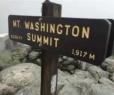
Mount Washington is the highest peak in the northeastern United States, rising to 1,917 meters (6,288 feet) above sea level in the heart of the White Mountains of New Hampshire. It's one of the most iconic and demanding hikes in the entire country — and for good reason. The mountain has a well-earned reputation for extreme and unpredictable weather, with some of the highest wind speeds ever recorded on Earth's surface. That said, thousands of hikers make the summit every year, and the experience is unlike anything else in the Northeast.
The Hike
The most popular route to the summit is the Tuckerman Ravine Trail, which starts at the Pinkham Notch Visitor Center on Route 16. This route covers approximately 14.5 km round trip with an elevation gain of 1,281 meters, and most hikers should plan for around 6 hours 30 minutes to complete it. The trail is rated Hard — this isn't a casual day hike, and it demands solid physical fitness, proper footwear, and careful planning.
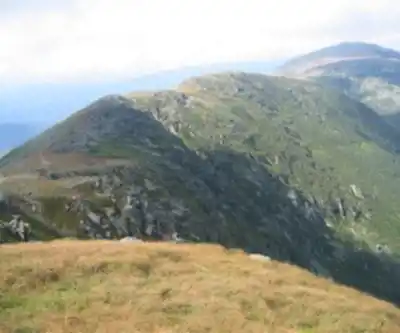
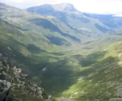
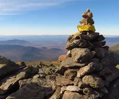
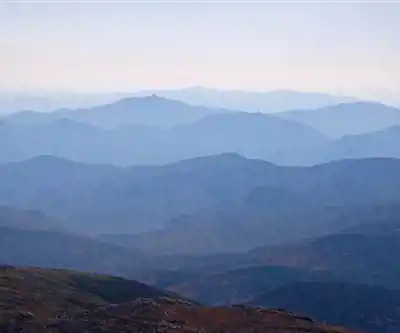
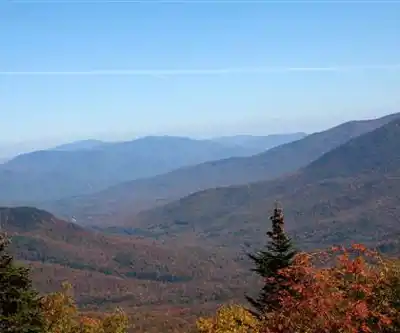
The lower section of the trail follows a well-maintained path through dense boreal forest, crossing several streams and gradually gaining elevation. As you climb higher, the trees shrink and thin out, and by the time you reach Tuckerman Ravine — a glacially carved bowl on the mountain's southeast face — the terrain opens up dramatically. The ravine itself is a striking geological feature, with steep headwalls that hold snow well into spring and sometimes early summer.
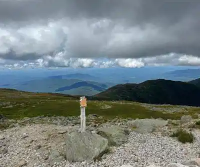
Above the ravine, the trail becomes significantly more rugged. You're scrambling over large boulders and exposed rock, and the grade steepens considerably. Above treeline, the alpine zone takes over completely — low-growing vegetation, lichen-covered rocks, and sweeping views in every direction. This section is also where the weather can turn fast, so it's worth checking the Mount Washington Observatory forecast before you head out.
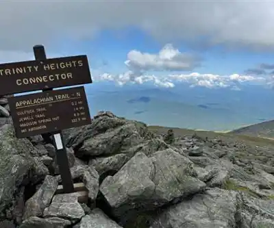
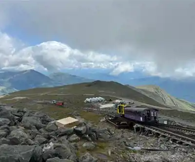
The Summit
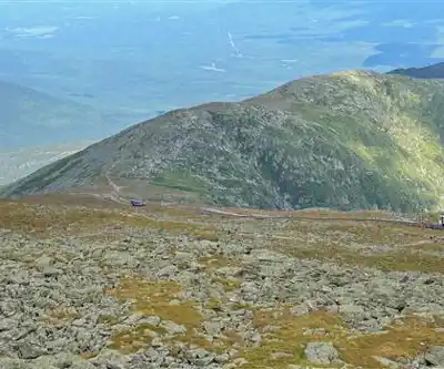
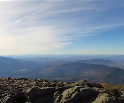
The summit of Mount Washington is unlike most mountain tops you'll encounter in the Northeast. There's a weather observatory, a visitor center, a small museum, and even a cafeteria up there — plus the upper terminal of the Mount Washington Cog Railway and the top of the Mount Washington Auto Road. It's a busy place on a clear summer day, which can feel a bit jarring after a hard climb, but the panoramic views across the White Mountains make it all worthwhile. On a clear day, you can see into several neighboring states.
The summit is above treeline and fully exposed, which means wind, cold, and rapidly changing conditions are always a real possibility — even in July and August. Temperatures at the top can be 10–15°C colder than at the trailhead, and wind chill can make it feel far colder. Packing extra layers, rain gear, and enough food and water is non-negotiable on this hike.
Trail Conditions and Seasonality
Mount Washington is a four-season mountain, but the hiking season for most people runs from late spring through early fall. Snow can linger on the upper mountain well into May or even June, and early-season hikers should be prepared for icy conditions above the ravine. Fall brings stunning foliage in the lower elevations and cooler, more stable weather for summit attempts. Winter ascents are possible but require mountaineering experience and equipment — this is serious alpine terrain in winter.
The trail can be very busy on summer weekends. Starting early in the morning helps you avoid crowds and gives you a better chance of clear skies before afternoon clouds build up.
Getting There
The Pinkham Notch Visitor Center, operated by the Appalachian Mountain Club (AMC), is located on Route 16 between Jackson and Gorham, New Hampshire. There is a parking lot at the trailhead, though it fills up quickly on weekends during peak season. The AMC visitor center offers trail information, gear, food, and lodging options including the Joe Dodge Lodge.
What to Know Before You Go
- Difficulty: Hard — suitable for experienced hikers with good fitness
- Distance: 14.5 km round trip
- Elevation gain: 1,281 m
- Estimated time: 6 hours 30 minutes
- Weather: Always check the Mount Washington Observatory summit forecast before heading out — conditions can change rapidly and dramatically
- Gear: Sturdy hiking boots, trekking poles, extra layers, rain gear, and plenty of water and food are strongly recommended
- Leave No Trace: The alpine zone above treeline is extremely fragile — stay on marked trails and avoid stepping on vegetation
Mount Washington rewards the effort with some of the most dramatic scenery in the White Mountains, but it demands respect — go prepared, and it's an experience you won't forget.
Services and amenities
This information may vary by season.
Recommended gear for this trail


Ready to go?
Everything you need to know before you goStarting Point
To access the hiking trails, you can start at several trailheads:
Ammonoosuc Ravine Trailhead: Located at the end of Base Station Road, near the mount washington Cog Railway. The address is 3168 Base Station Rd, Bretton Woods, NH 03589.
Tuckerman Ravine Trailhead: Found at the Pinkham Notch Visitor Center. The address is 2888 NH-16, Gorham, NH 03581.
Jewell Trailhead: Also accessible from Base Station Road, with parking available near the Cog Railway.
Great Gulf Trailhead: Situated off Route 16 in Pinkham Notch. Look for signs directing to Great Gulf Wilderness Parking Area.
Ensure to check weather conditions and trail advisories before heading out.
When?
How much?
- Hiking shoes Essential
- → Salomon Elixir Tour Mid WP · 203.38 $
- Layered clothing Essential
- Rain jacket Essential
- Trekking poles
- → Black Diamond Trail Ergo Cork · 69.99 $
- Headlamp
- → Petzl Actik Core 625 · 103.95 $
FAQ - Frequently asked questions
Everything you need to knowThe Essential Hiking Checklist
Everything you need for your next hike. Bilingual, printable, 1 page.
Download the free checklistSimilar hikes nearby
Discover other trails you might enjoy

Crawford
White Mountains
White Mountain National Forest
White Mountains
Presidential Range Rail Trail
White Mountains
Welch-Dickey Trailhead
White Mountains
Sabbaday Falls
White Mountains
Swift River
White Mountains
Hiking near North Conway
0 trails to explore ~28 km away
We work hard to provide the most up-to-date and error-free data possible. If something seems incorrect, let us know! Your contribution helps the whole community.
Hikers' opinions