


Ready to explore Sitting Bull Falls & The Ridge Road Sitting Bull Falls to Guadalupe Ridge? Here's everything you need to know before you go!
Discover the trail
Oh no! We don't have any photos 😢
This trail hasn't been captured yet. Be the first to share your adventure!Trail description
Sitting Bull Falls and the Ridge Road represents one of New Mexico's most spectacular desert oasis experiences, combining the rare sight of a year-round waterfall in the Chihuahuan Desert with access to the dramatic Guadalupe Ridge. This unique destination offers hikers the chance to explore both lush riparian environments and rugged desert highlands in a single adventure.
The Falls Experience
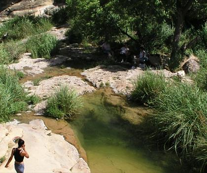
Sitting Bull Falls serves as the centerpiece of this hiking destination, where spring-fed waters cascade down limestone cliffs to create a series of pools and smaller waterfalls. The contrast is striking – emerald pools surrounded by desert vegetation and towering canyon walls. The falls flow year-round, fed by underground springs that maintain consistent water levels even during dry periods.
The immediate area around the falls features developed facilities including picnic areas, restrooms, and established trails. A paved path leads to the base of the falls, making the lower sections accessible to visitors of varying abilities. For those seeking more adventure, informal trails lead to upper pools and viewpoints that require scrambling over rocks and navigating steeper terrain.
Ridge Road Access and Terrain
The Ridge Road component of this destination provides access to the Guadalupe Ridge system, offering hikers expansive views across the Chihuahuan Desert and into the Lincoln National Forest. This high-elevation route contrasts sharply with the falls environment, transitioning from desert oasis to exposed ridgeline terrain.
The road itself serves as both access route and hiking corridor, with numerous pull-offs and informal trail connections leading to viewpoints and ridge walks. The terrain here is characterized by exposed limestone, scattered juniper and oak, and dramatic drop-offs that provide sweeping vistas of the surrounding desert landscape.
Flora and Wildlife
The diverse elevation range and water availability create distinct ecological zones throughout this area. Around the falls, you'll encounter riparian vegetation including cottonwoods, willows, and various ferns that thrive in the moist microclimate. Desert species like ocotillo, lechuguilla, and various cacti dominate the drier areas.
Wildlife viewing opportunities include desert bighorn sheep, mule deer, and numerous bird species. The permanent water source at the falls attracts wildlife year-round, making it an excellent spot for patient observers. Hawks and other raptors frequently soar along the ridge systems, taking advantage of thermal updrafts.
Hiking Opportunities
The area offers hiking experiences ranging from easy walks to challenging backcountry exploration. The main falls trail provides a relatively gentle introduction, while ridge access opens up opportunities for more demanding adventures. Hikers can combine waterfall exploration with ridge walking for a full day of diverse terrain.
Navigation along the ridge requires attention to landmarks and basic route-finding skills, as formal trail markers become sparse in the backcountry areas. The combination of established paths near the falls and more primitive routes along the ridge system accommodates different skill levels and adventure preferences.
Seasonal Considerations
Summer temperatures can be extreme, particularly along exposed ridge sections where shade is minimal. Early morning starts are essential during warmer months. Spring and fall offer the most comfortable hiking conditions, with moderate temperatures and generally clear skies providing excellent visibility for ridge walking.
Winter hiking is possible but requires preparation for potentially icy conditions, particularly around the falls where spray can create slippery surfaces. Ridge areas may experience strong winds and rapid weather changes during winter months.
Access and Logistics
The falls area includes developed parking and basic facilities, though space can be limited during peak visitation periods. Ridge Road access requires high-clearance vehicles for the best experience, as the route includes rough sections and steep grades. Standard passenger vehicles can access lower portions but may be limited in reaching prime ridge hiking areas.
Water is available at the falls, but ridge hiking requires carrying adequate supplies as no reliable water sources exist along the higher elevations. The combination of desert conditions and elevation changes makes proper hydration planning essential for extended ridge exploration.
What Makes This Special
The juxtaposition of desert waterfall and high ridge terrain creates a hiking experience unlike most other New Mexico destinations. Few places offer such dramatic environmental contrasts within a single outing – from swimming holes and lush vegetation to exposed limestone ridges with hundred-mile views.
The geological story here is particularly compelling, with the falls representing the surface expression of extensive underground water systems, while the ridges showcase the dramatic limestone formations characteristic of the greater Guadalupe Mountains region. This combination of water, stone, and elevation creates photography opportunities and natural experiences that capture the essence of the American Southwest's diverse landscapes.
The Essential Hiking Checklist
Everything you need for your next hike. Bilingual, printable, 1 page.
Get your free hiking checklistRecommended gear for this trail
As an Amazon Associate I earn from qualifying purchases.


Ready to go?
Everything you need to know before you goWhen?
How much?
As an Amazon Associate I earn from qualifying purchases.
Affiliate links — LGPO may earn a commission at no extra cost to you.
- Hiking shoes Essential
- → Salomon Elixir Tour Mid WP · 203.38 $
- Layered clothing Essential
- Rain jacket Essential
- Trekking poles
- → Black Diamond Trail Ergo Cork · 69.99 $
- Headlamp
- → Petzl Actik Core 625 · 103.95 $
FAQ - Frequently asked questions
Everything you need to knowSimilar hikes nearby
Discover other trails you might enjoy
Hiking near Brandon
5 trails to explore ~1994 km away
We work hard to provide the most up-to-date and error-free data possible. If something seems incorrect, let us know! Your contribution helps the whole community.
Hikers' opinions
Be the first to review!
No hiker has shared their experience yet. Share your impressions and help other hikers!