
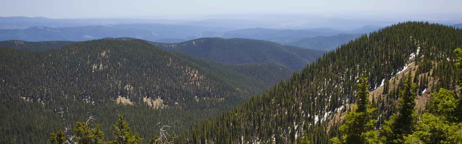

Ready to explore Tesuque Peak, New Mexico? Here's everything you need to know before you go!
Discover the trail
Oh no! We don't have any photos 😢
This trail hasn't been captured yet. Be the first to share your adventure!Trail description
Tesuque Peak is one of the most rewarding high-elevation hikes in the Santa Fe area, sitting near the top of the Sangre de Cristo Mountains in New Mexico. The trail takes you into the Santa Fe National Forest, climbing through dense conifer forest before opening up to sweeping alpine views that stretch across the high desert landscape below. If you're looking for a genuine mountain experience close to Santa Fe, this is one of the best options in the region.
The Terrain
The route to Tesuque Peak gains serious elevation as it works its way up through the upper reaches of the Sangre de Cristo range. The forest here is classic high-altitude New Mexico — spruce, fir, and aspen dominate the slopes, and the trail surface shifts between packed dirt, rocky sections, and exposed ridgeline as you climb higher. The upper portion of the hike moves above treeline, where the terrain opens up and the wind picks up noticeably. Footing can be uneven near the summit, so trekking poles are a smart call.
The peak itself sits at high elevation, and the altitude is something you'll feel, especially if you're coming from lower ground. Give yourself time to acclimatize before pushing hard on the ascent. The views from the top are expansive — on a clear day you can see far across the Rio Grande valley and into the surrounding mountain ranges.
What Makes This Hike Stand Out
What sets Tesuque Peak apart from other hikes in the Santa Fe area is the combination of accessibility and genuine alpine character. You're not just walking through forest — you're reaching a true high-country summit with the kind of panoramic payoff that takes real effort to earn. The transition from dense subalpine forest to open rocky summit is dramatic and satisfying.
The Sangre de Cristo Mountains are one of the southernmost ranges of the Rocky Mountains, and Tesuque Peak sits near the top of that chain in New Mexico. That geographic position gives the hike a distinct feel — you're in the Rockies, but surrounded by the high desert context of the Southwest. It's a combination you don't find many places.
Wildlife and Nature
The upper elevations around Tesuque Peak support a range of wildlife typical of New Mexico's high mountain zones. Mule deer and elk move through the forested slopes, and smaller mammals like pikas and marmots are often spotted near the rocky summit area. Raptors, including hawks and eagles, are commonly seen riding thermals above the ridgeline. The subalpine forest is also good habitat for a variety of mountain bird species.
Wildflowers bloom across the open slopes during summer, adding color to the rocky terrain above treeline. The aspen groves lower on the mountain turn brilliant gold in fall, making autumn one of the most popular times to hike here.
Practical Information
The trailhead for Tesuque Peak is accessed via the Santa Fe Ski Basin area, which sits at the end of Hyde Park Road (NM-475) northeast of Santa Fe. The road is paved and well-maintained for most of the year, though winter conditions can affect access — check road conditions before heading out in the colder months.
Parking is available at the ski basin area. The Santa Fe National Forest manages this land, and it's worth checking with the Española Ranger District or the Santa Fe National Forest office for any current trail conditions, closures, or permit requirements before your visit.
- Access: Via Hyde Park Road (NM-475) to the Santa Fe Ski Basin
- Managed by: Santa Fe National Forest
- Parking: Available at the ski basin trailhead area
- Altitude: High-elevation hike — expect thinner air, especially if arriving from lower elevations
What to Bring
Afternoon thunderstorms are a real concern in New Mexico's mountains during summer, particularly from July through early September. Plan to be off exposed ridgelines and the summit well before early afternoon. Start early, watch the sky, and don't push your luck if clouds are building.
Layers are essential regardless of the season. Even on warm summer days, temperatures at the summit can be significantly cooler than in Santa Fe, and wind chill adds to that. Pack a rain jacket, extra insulation, and plenty of water. The dry mountain air at altitude means you'll dehydrate faster than you expect.
- Start early to avoid afternoon lightning storms
- Bring layers — summit temperatures drop quickly
- Carry more water than you think you need
- Trekking poles help on the rocky upper sections
- Sunscreen is a must at high elevation in New Mexico
- Check current trail and road conditions before heading out
Best Seasons
Summer and early fall are the prime seasons for hiking Tesuque Peak. The trail is typically snow-free from late spring through October, though conditions vary year to year. Fall brings cooler temperatures and the added bonus of aspen color on the lower slopes. Winter access depends heavily on snowpack and road conditions — the upper sections of the route can hold snow well into spring.
Spring hiking is possible but expect lingering snow and potentially muddy conditions on the trail. The shoulder seasons reward those willing to deal with variable conditions with fewer crowds and a quieter mountain experience.
Who This Hike Is For
Tesuque Peak is best suited for hikers who are comfortable with sustained elevation gain and high-altitude conditions. The altitude alone makes this a more demanding outing than the trail length might suggest on paper. Hikers who are fit and have some mountain experience will find this a genuinely satisfying summit hike. Those new to high-elevation hiking should take the acclimatization piece seriously and be willing to turn around if they're not feeling well.
Dogs are commonly seen on trails in the Santa Fe National Forest — check current regulations for leash requirements before bringing your dog along on this route.
The Essential Hiking Checklist
Everything you need for your next hike. Bilingual, printable, 1 page.
Get your free hiking checklistRecommended gear for this trail
As an Amazon Associate I earn from qualifying purchases.


Ready to go?
Everything you need to know before you goWhen?
How much?
As an Amazon Associate I earn from qualifying purchases.
Affiliate links — LGPO may earn a commission at no extra cost to you.
- Hiking shoes Essential
- → Salomon Elixir Tour Mid WP · 203.38 $
- Layered clothing Essential
- Rain jacket Essential
- Trekking poles
- → Black Diamond Trail Ergo Cork · 69.99 $
- Headlamp
- → Petzl Actik Core 625 · 103.95 $
FAQ - Frequently asked questions
Everything you need to knowSimilar hikes nearby
Discover other trails you might enjoy
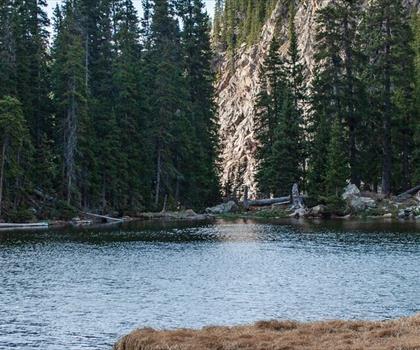
Lake Peak, New Mexico
North Central New Mexico
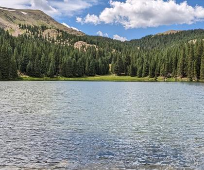
Venado Peak, New Mexico
North Central New Mexico

Truchas Peak, New Mexico
North Central New Mexico

Santa Fe Baldy
North Central New Mexico
Old Santa Fe Trail
North Central New Mexico
Santa Fe National Historic Trail
North Central New Mexico
Hiking near Regina
4 trails to explore ~1631 km away
We work hard to provide the most up-to-date and error-free data possible. If something seems incorrect, let us know! Your contribution helps the whole community.
Hikers' opinions
Be the first to review!
No hiker has shared their experience yet. Share your impressions and help other hikers!